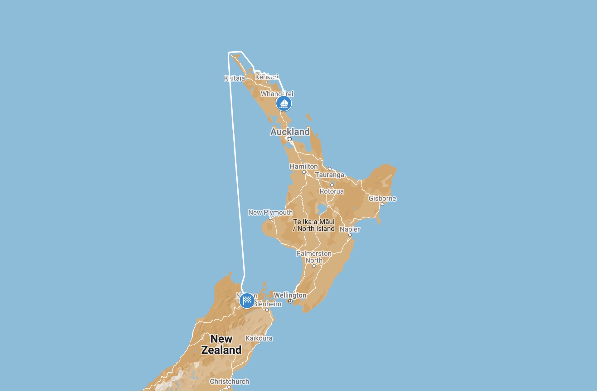
After almost a year, we’re sailing again. Via the Bay of Islands, we round the North Island and sail south in the wake of Dutch explorer Abel Tasman.
Whangarei –Nelson (NZL)
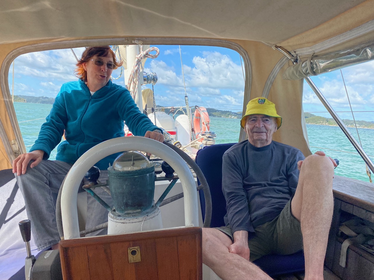
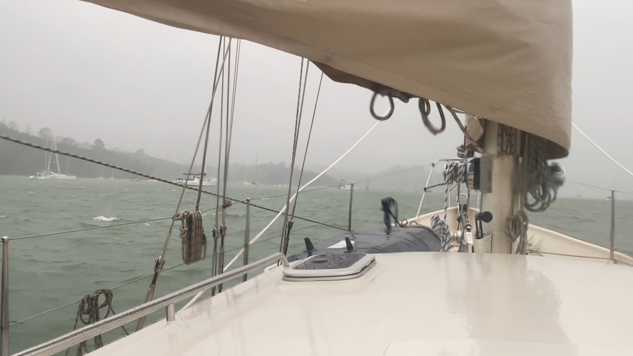
“How I’ve missed this”, Ivar says with a big smile on his face as he steers Luci out of Whangarei Harbour. We’re sailing again for the first time in 10 months. The weather is doing its utmost to make our first leg to the Bay of Islands a pleasant sea trial. With many borders around us still closed, we have decided to sail around Aotearoa New Zealand. From the very north (Cape Reinga) to the very south (Stewart Island), there is a lot of coastline to explore. We’re very excited to leave the shore life we led these past months behind and be guided by the wind again, just like our famous countryman Abel Tasman four centuries ago.
A Good Start
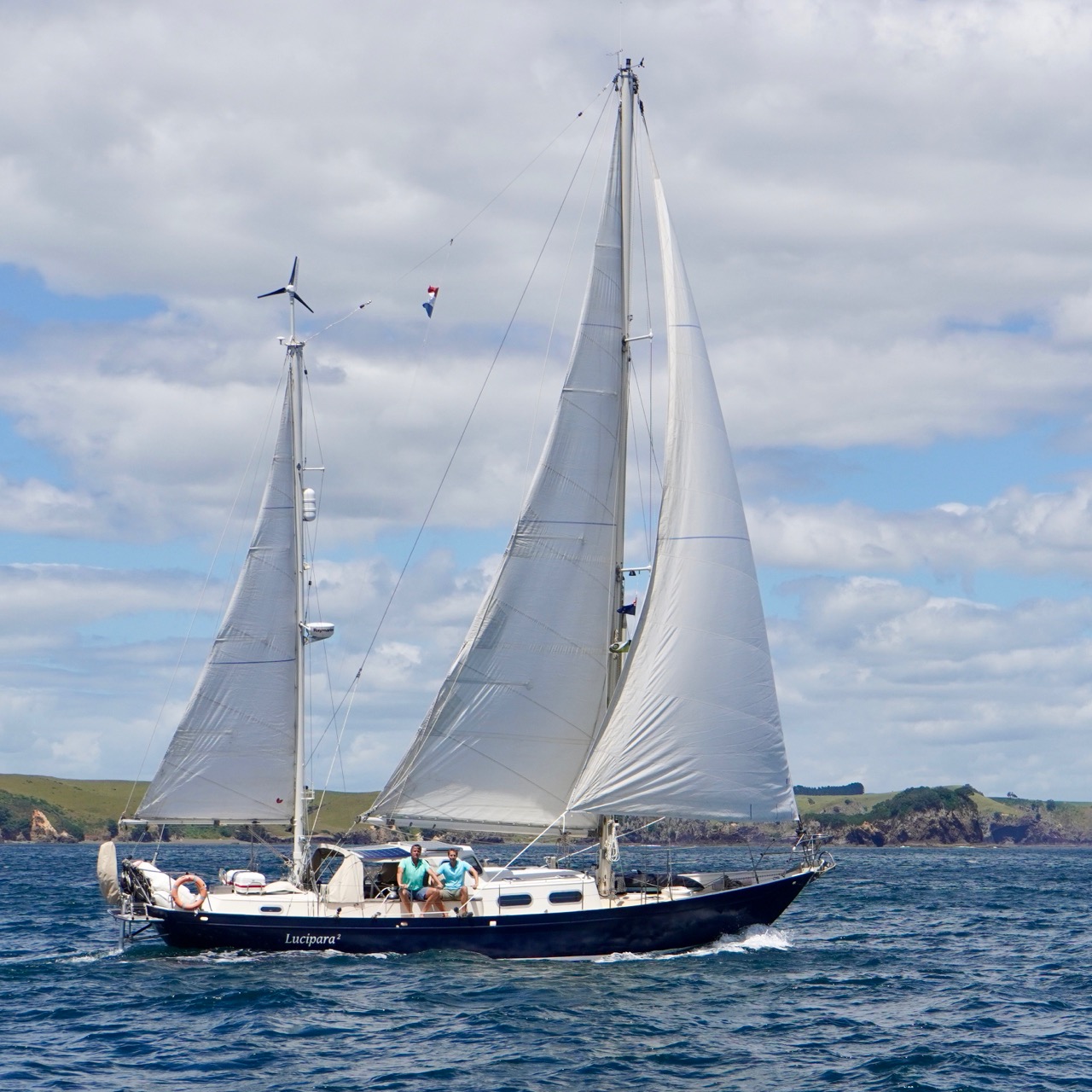
Luci is in her element again. She shows off her new paint, clean hull, and the features we have added in Whangarei, most notably the new electronic autopilot. It is keeping her firmly on course, so the crew can take a break from steering. The new hydraulic system proves to be quite energy efficient. So much so, that we give Herbie, our wind vane, the day off.
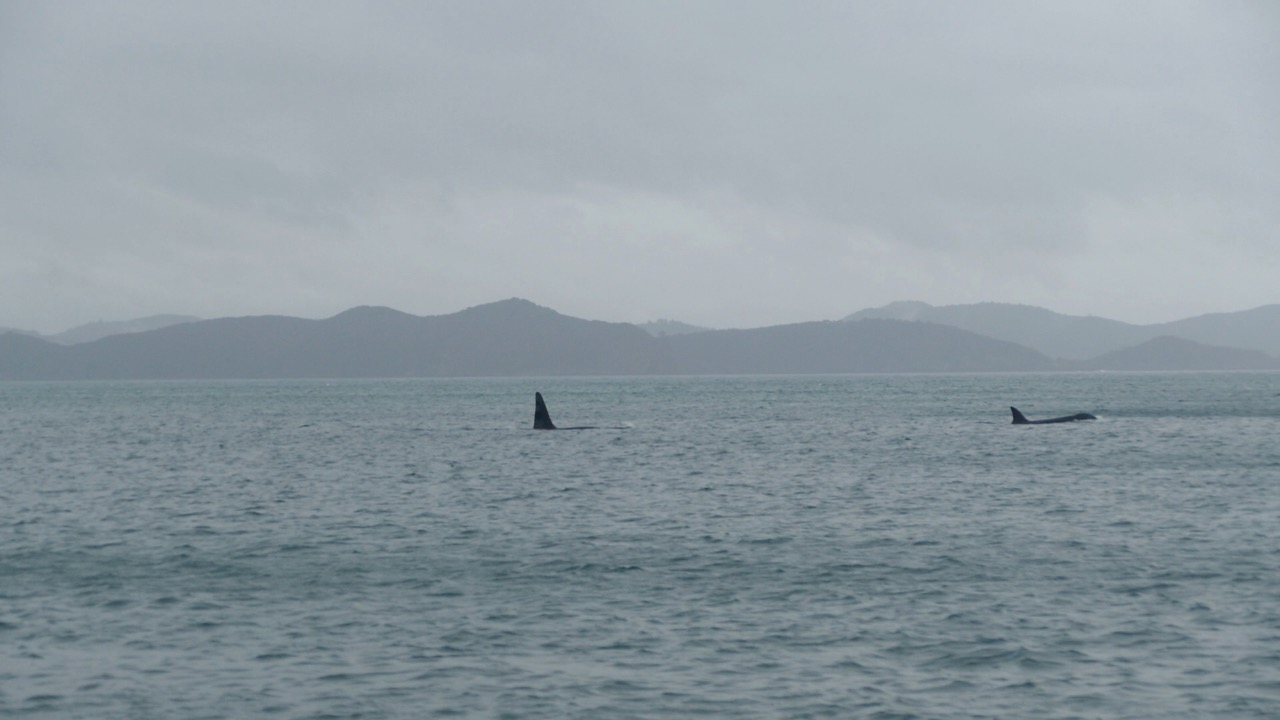
We reach the protected anchorage of Urupukapuka Island just in time before the weather turns nasty. Floris is in heaven when he handles the new anchor chain. No more rusty bits on deck, which was always the case with the old chain. The added length (100 meters) also takes away any worries about water depth. While the wind blows through Luci’s new rigging, we sleep like babies knowing we have more than enough chain out. The next morning, the sky is still grey and a drizzle dampens our moods. But that quickly changes when we spot a pod of orcas. How magical! We watch in awe as the pod – a male with a huge fin and about six females and youngsters – swim by. It’s the first time we see any during our trip, and we certainly didn’t expect to see them at an anchorage.
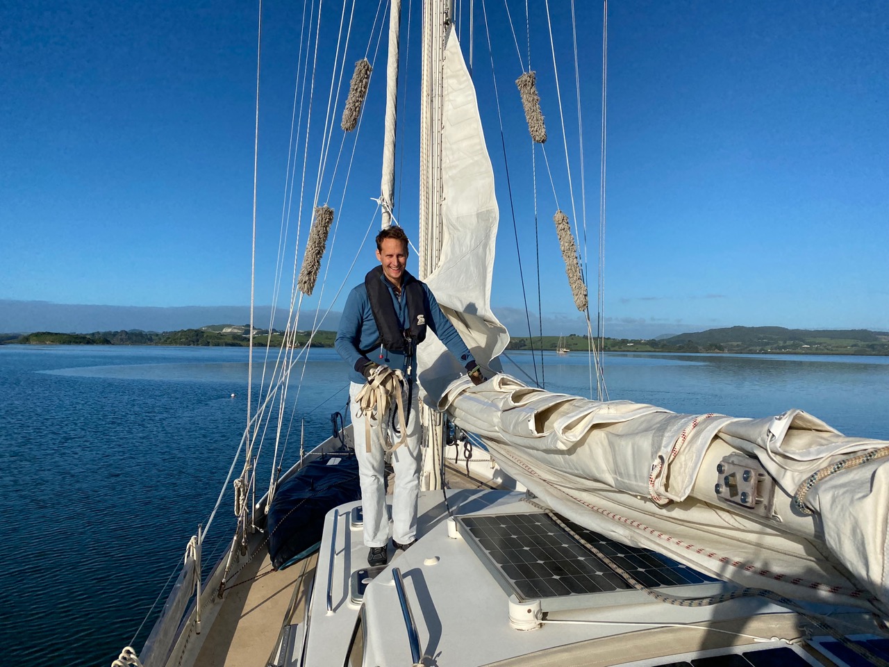
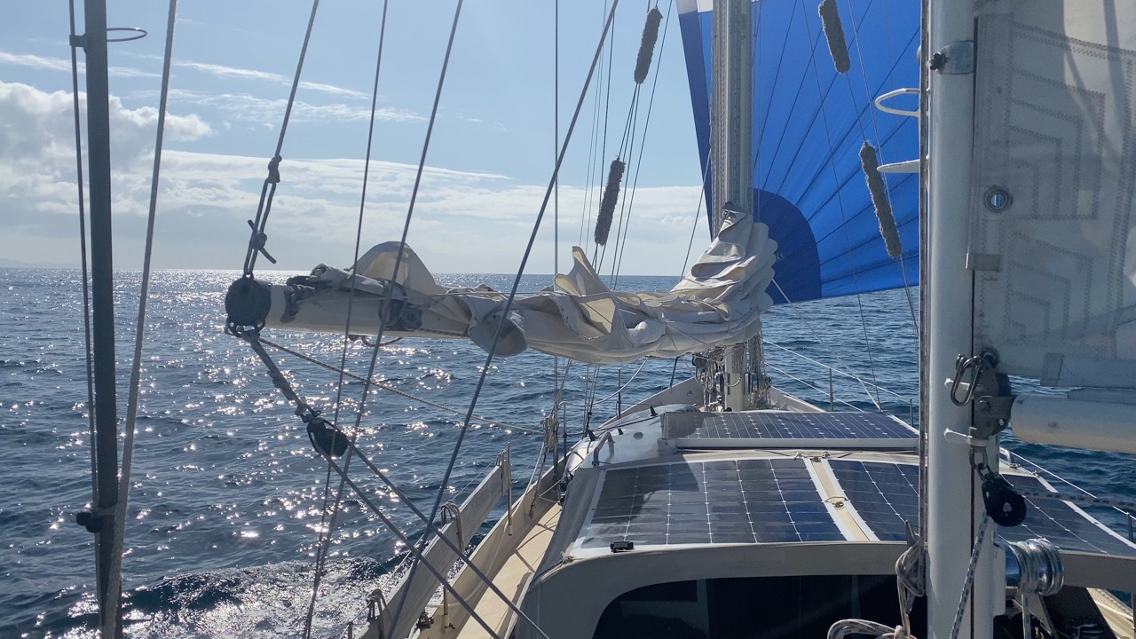
Does the sail remember how to be hoisted?
Sailing again!
Thank you Gaastra for supplying us with sustainable gear!
Orcas visiting our anchorage
Buchanan Blues
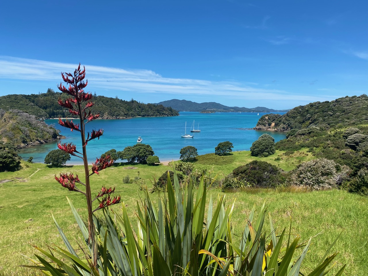
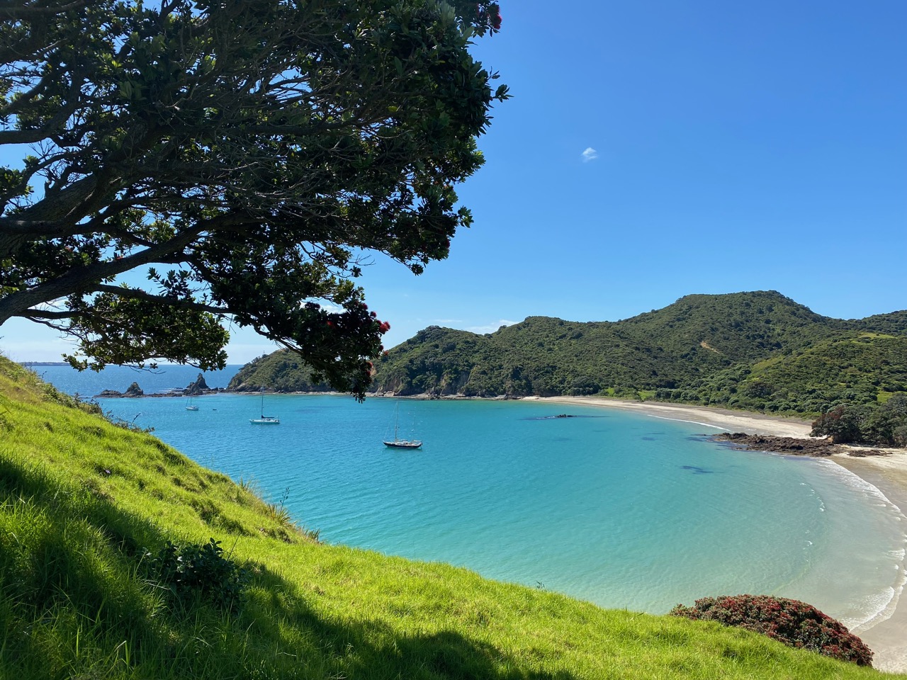
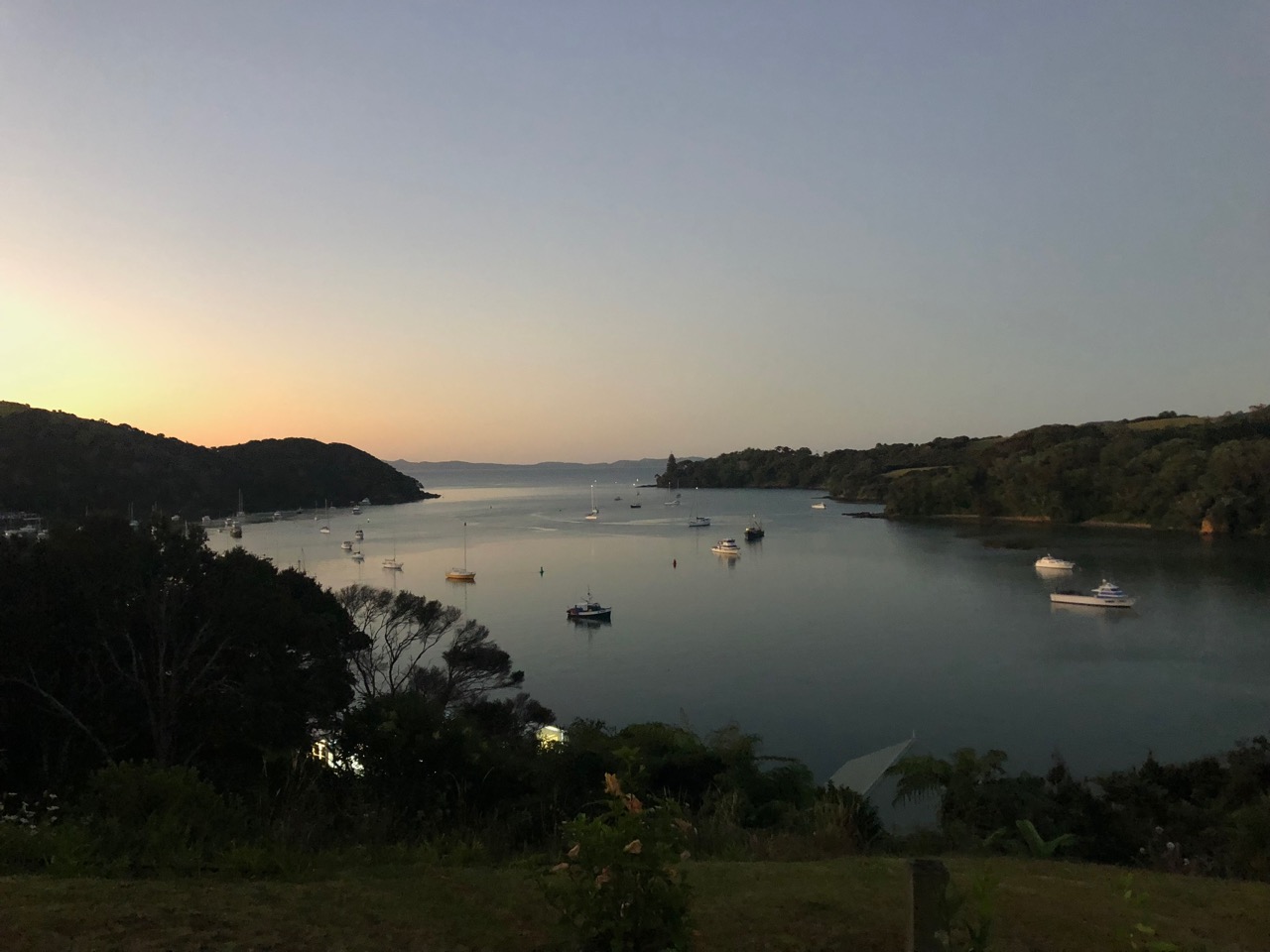
In the weeks that follow we take time to properly explore the Bay of Islands, something we didn’t do when we arrived here around a year ago. One of Aotearoa New Zealand’s most popular cruising grounds is quiet now, but despite the low season the weather feels summer-like. We visit different islands with stunning bays, attractive hiking opportunities, abundant wildlife, and magnificent views.
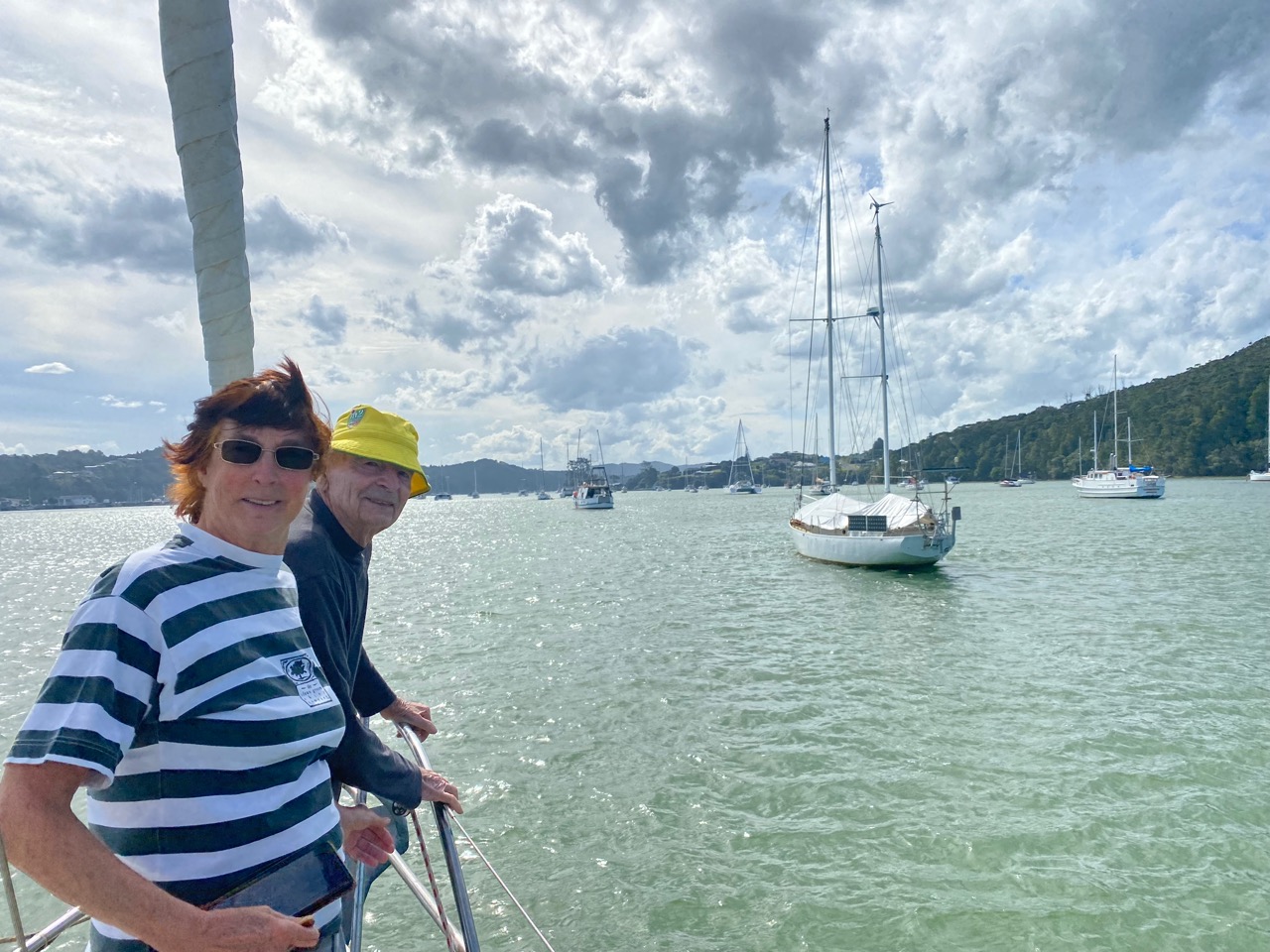
Our friends Saskia and John, who sailed to Aotearoa New Zealand in 1984 and decided to stay, join us on board for a day. Although their last time sailing was a while ago, they steer and help on the deck as if no time has passed. We even find their former boat, SY Cornelia, on a mooring in Opua. It’s also a steel ketch designed by Alan Buchanan, just like Luci. They sold her to Dutch adventurer Mark Slats, who made her famous by sailing her solo non-stop around the globe. Seeing their beloved boat again brings back great memories for Saskia and John.
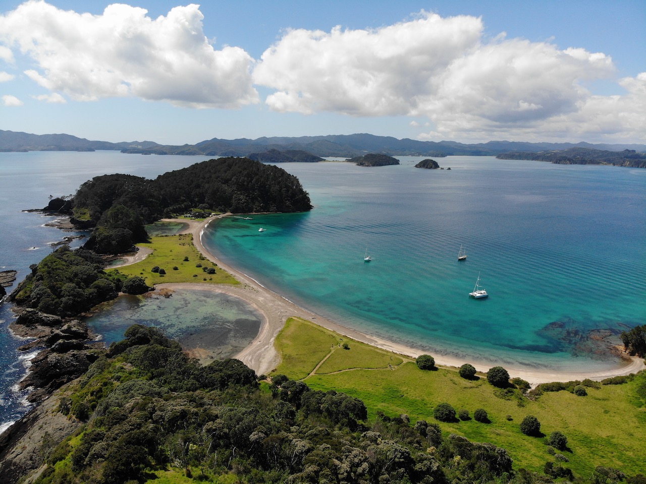
Anchored at Roberton Island – Bay of Islands
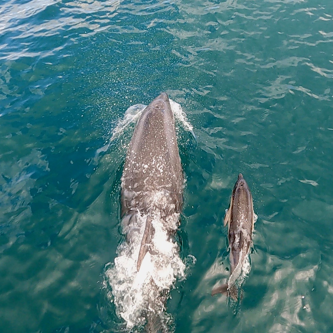
Baby dolphin learns to play with us
Saskia and John are thrilled to see their beloved Cornelia again
Saskia and John are back on a Buchanan boat
Ecological History
We also take some time to research things that are special about Aotearoa New Zealand, such as its history. About 80 million years ago, the archipelago became detached from the primordial continent of Gondwana. That’s 15 million years before a comet’s impact wiped out the dinosaurs and countless other species around the globe. Isolated, Aotearoa New Zealand formed an ecosystem of its own. New plant and tree species spread across the islands. Its fauna was also unique in the world: there were no mammals. Birds and insects dominated the land, meaning that they became the land’s main predators, rather than bears, wolves, or foxes. It was not until about a thousand years ago that the first humans, Polynesians, made the crossing and settled in this untouched land. The population grew and reached almost all the islands. But even though respect for nature was well-anchored in their culture, not everything ran smoothly. The newcomers, the Māori, were living in many different tribes and regularly fought among themselves. They also hunted down all the moas, large ostrich-like birds, until became they extinct.
Hundreds of years later, European explorers found the islands. In their wake the number of foreigners steadily grew, attracted by profitable products such as timber, whale oil, and flax. The original inhabitants were oppressed and their land was increasingly sold to colonists or taken by force. Soon, most of the forest had been cut or burned to make way for pastures and livestock. With so much original forest lost, native birds lost their habitat. Introduced pests such as rats, stoats, and possums further reduced their numbers.
This is Aotearoa New Zealand’s sad ecological history in a nutshell. It is flip side of increasing human wealth. We wonder in what state we will find the natural world on our circumnavigation of the country.
Powerful Counter-Movement
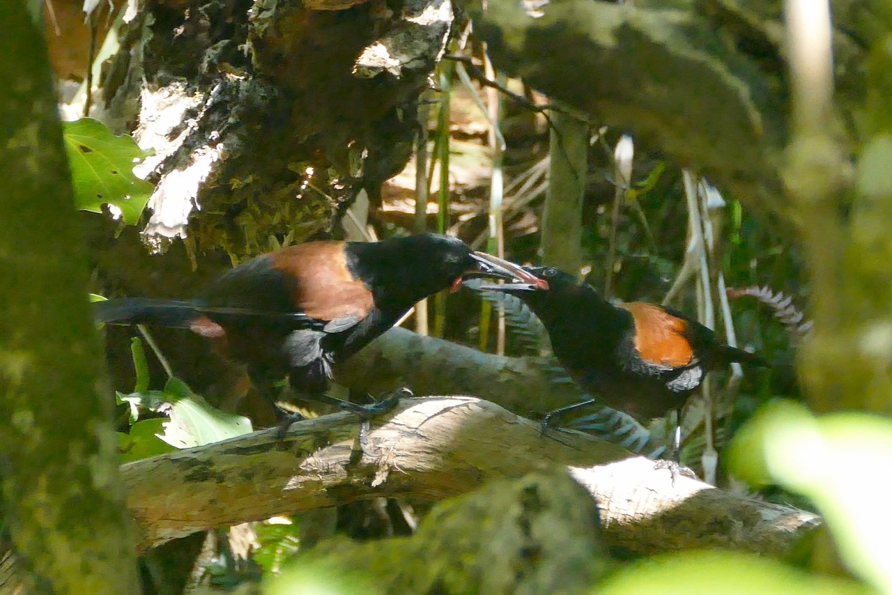
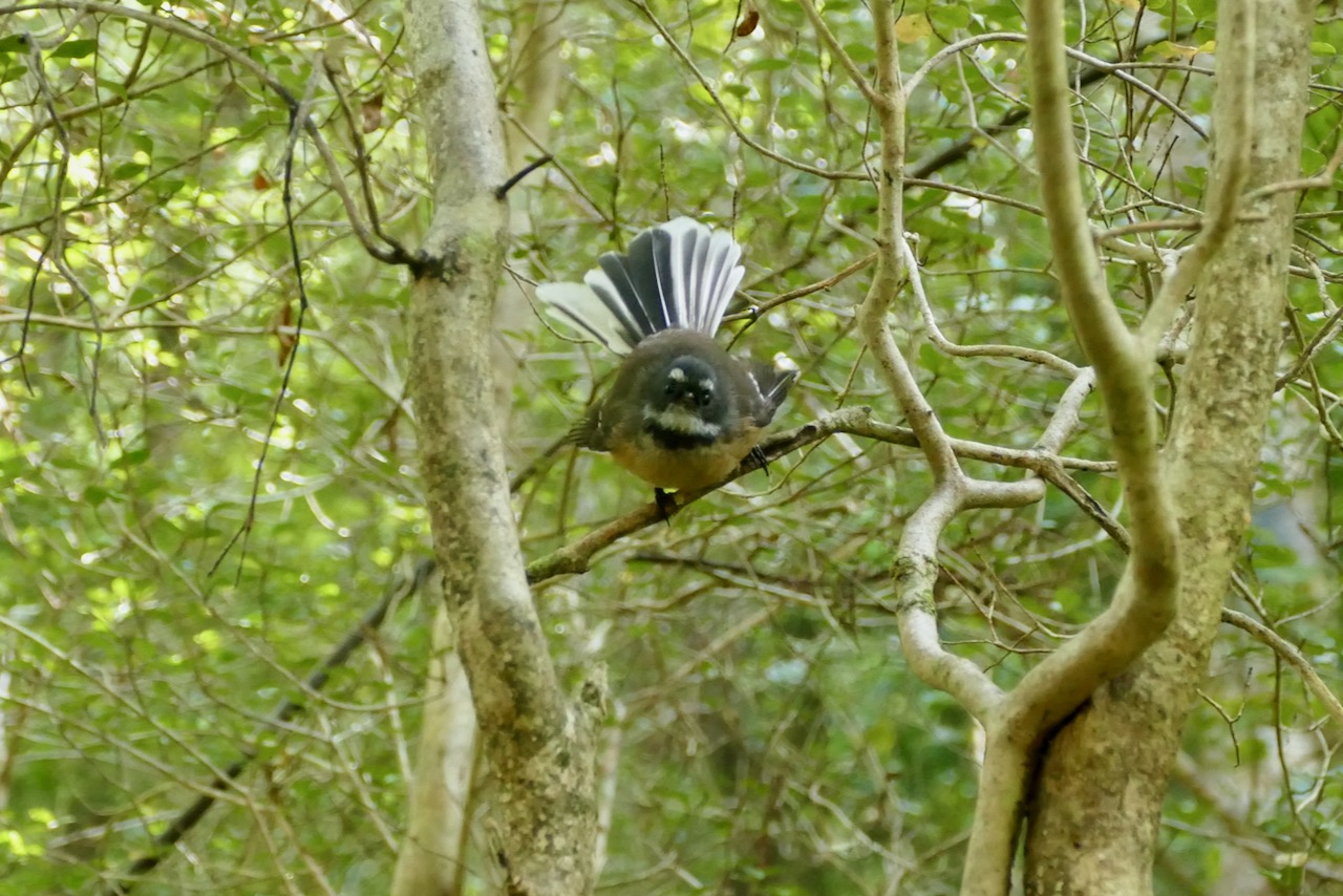
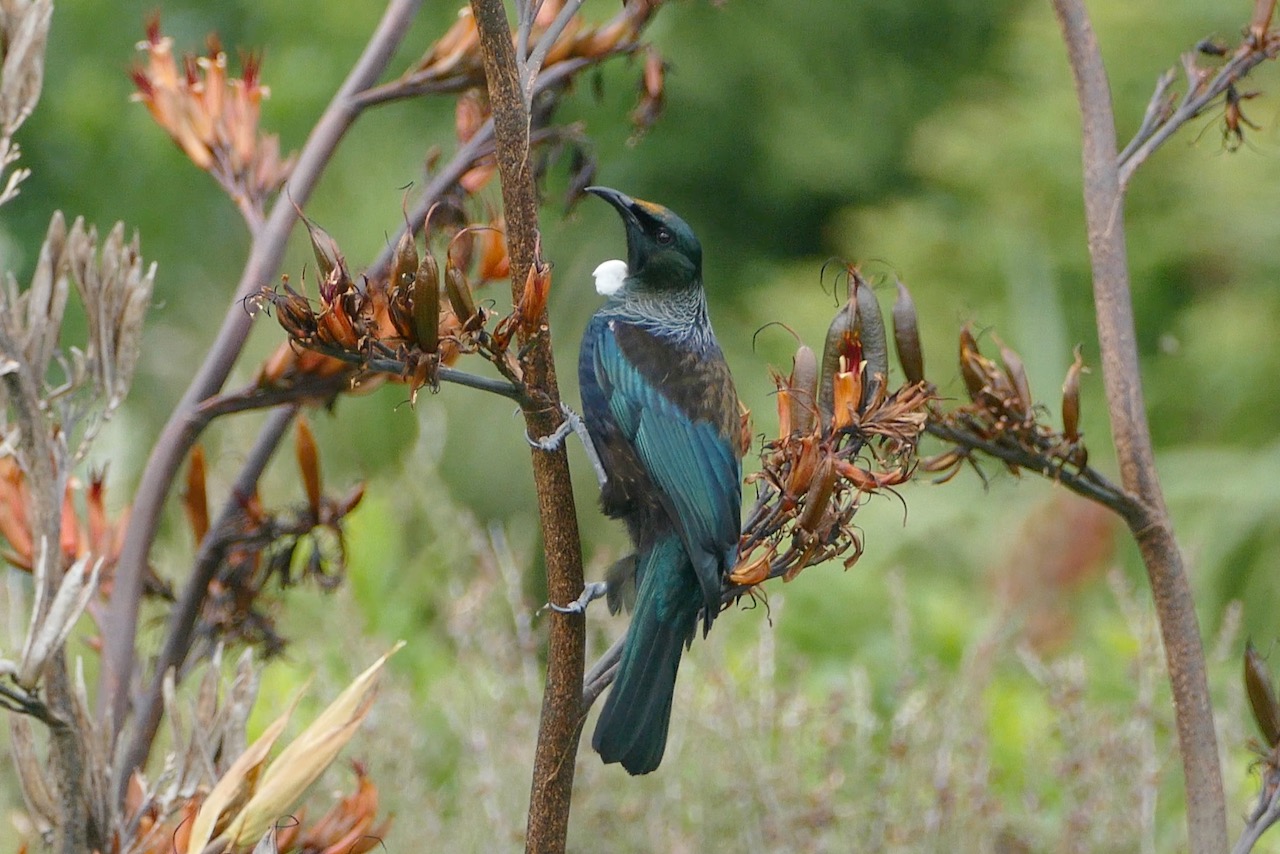
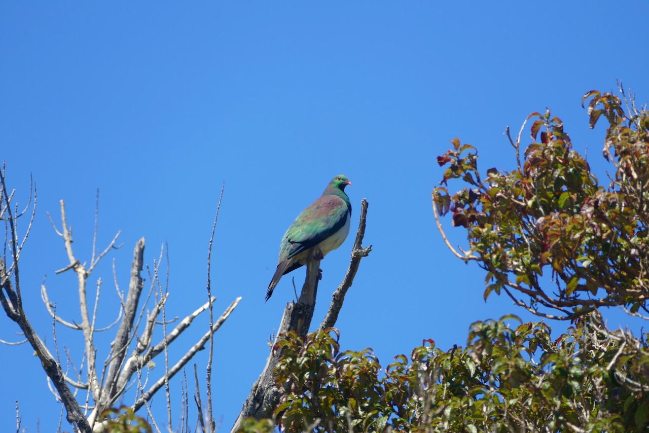
We know that there are pockets of original nature that have been preserved or restored. Nowadays, the Department of Conservation (DOC) manages several national parks across the country. Together with all other forms of conservation, about 32% of Aotearoa New Zealand is protected to some extent. The Māori also protect areas of nature: they see the land as a kind of ancestor, which we described earlier. Their wise approach also brings the birds back. In the pristine Te Urewera we saw an abundance native bird species such as the piwakawaka, tui and kereru. There, we got a glimpse of how overwhelmingly green and wild the whole country must have been once.
Everything is Interconnected
Biodiversity may be a somewhat abstract concept, but it is vital for all life on Earth. Research has shown time and again that a wide variety of species is extremely important for the balance within any ecosystem. All species have mutual relationships with each other. For example, seabirds fertilize the land with their droppings, which contain essential nutrients for plants and trees. The kereru and tui eat berries and disperse the seeds of native trees and plants. Other native birds like piwakawaka and saddlebacks mainly eat insects and thus keep the population in check. In complex ecosystems, everything is interconnected. One could compare disappearing species with pop rivets from the wing of an airplane: at first you hardly notice them, until the umpteenth broken rivet suddenly tears off the wing. Then everything collapses. That is why it is crucial to increase biodiversity. But how do you achieve that? We are happy to find an example in the Bay of Islands.
Project Island Song
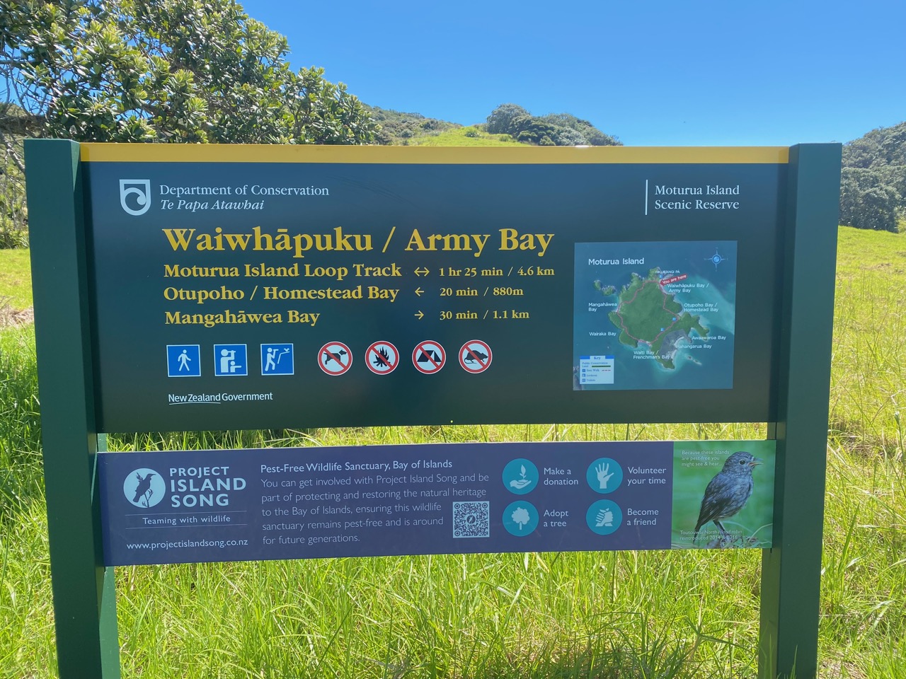
One of several ways the Kiwis take action is by rewilding places like Moturua Island in the Bay of Islands. The big benefit: it does not require a fence to keep pests away, as the water is an impregnable barrier. On our tour of the island, we spot many of the birds that have disappeared on the mainland. They have been brought back here as part of an initiative called Project Island Song, a collaboration between local communities and DOC. Thanks to their efforts, this island has become an oasis for native birds.
Pest-free before 2050
The example of Moturua shows that ecosystems can recover if biodiversity is increased. That doesn’t only help plants and animals. Ultimately, it increases the chances of human survival, as we too depend on nature that is healthy and productive. Think, for example, about our oxygen supply, water cycle, food production, climate regulation, and mental well-being.
The Aotearoa New Zealand government takes ecosystem restoration seriously and has set a national target for the entire country to be pest free by 2050. To achieve this, resources have been made available for DOC to work with local organizations to make the entire country pest free. We sincerely hope that the Kiwis will succeed!
Anchored at Moturua in de Bay of Islands
DOC works on rewilding
Saddlebacks with their typical brown backs
Piwakawaka shows its fantail
A Tui loves nectar from indigenous plants
Kereru – a large indigenous pigeon
Reunited with Pazzo
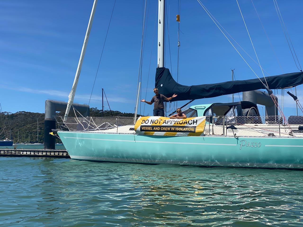
After extensive bird excursions on Moturua Island and visits to neighbouring islands, we sail back to Opua. Our American friends Willy, Cindy, and John from SY Pazzo have arrived from French Polynesia and are isolating on the Q (quarantine) pontoon. We last saw them in Gambier in February 2020 and can’t wait to reunite. Shortly after they are released, we visit them on board. We hug and catch up until it’s time to head back to Luci, as an ex-hurricane passes close to the North Island. It is causing gale-force winds and heavy rain at the anchorage and serves as a reminder that cyclone season is in full swing not too far north of us.
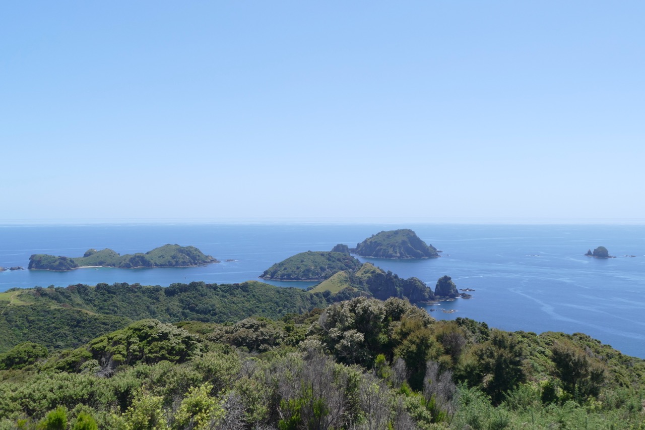
As soon as the weather improves, we sail together to a group of islands north of the Bay of Islands, the Cavalli Islands. Sunny skies bring out the colours of these beautiful islands. Crystal clear blue water, golden beaches, and green hills. On shore we hike to a viewpoint and are treated to breathtaking views.
Willy & Cindy at the Q pontoon
An ex-hurricane comes close to New Zealand
Riding out the storm in sheltered Opua
On our way to the Cavalli Islands – Picture SY Pazzo
Picturesque anchorage at the Cavalli Islands
Heaps of Cavalli Islands
Looking at the Rainbow
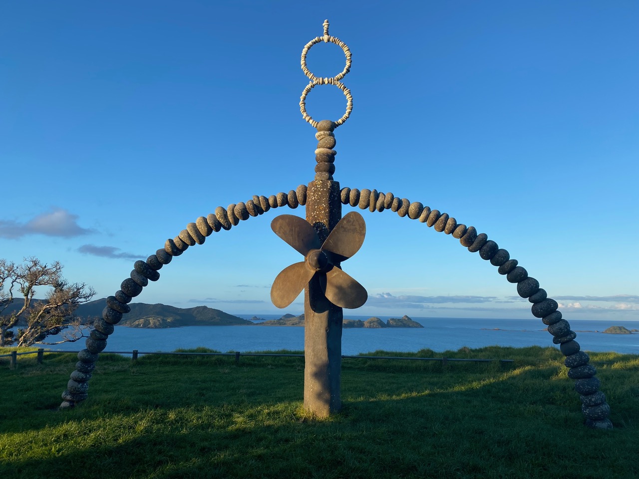
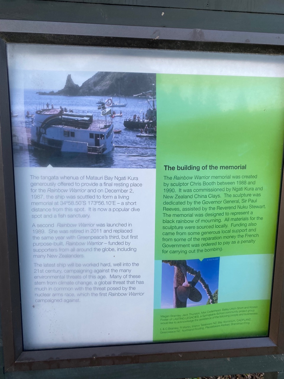
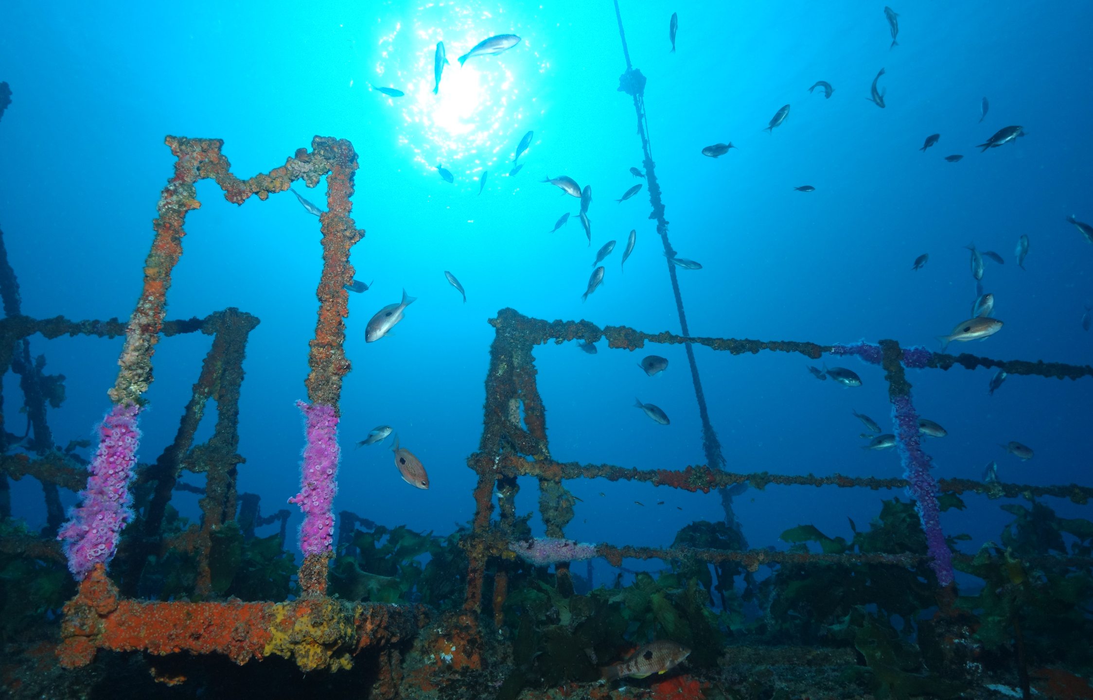
The Cavalli Islands are also the final resting place of the MV Rainbow Warrior. The ship was named after a North American Cree Indian prophesy: “When the world is sick and dying, the people will rise up like Warriors of the Rainbow…” The ship sank as a result of a bombing attack by the French secret service in Auckland Harbour in 1985 that killed one crew member. The French government wanted to prevent Greenpeace from protesting against the country’s nuclear tests on the Moruroa Atoll in French Polynesia.
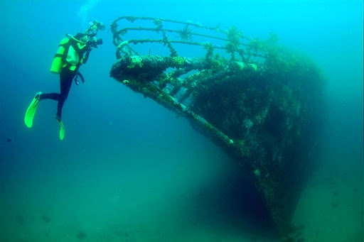
We visit the monument on land that was erected for this tragic event. The wreck of the Rainbow Warrior was transported here from Auckland and deliberately sunk as an artificial reef. Now, it’s teeming with marine life. Earlier we saw and documented how fast marine life can colonize and thrive in artificial structures when we visited Cape Verde and Brazil. “It’s a beautiful symbol of how evil destruction can be turned into something vibrant and life-giving”, Ivar remarks when we look at the sculpture.
The Rainbow Warrior memorial
Cavallis as the Rainbow Warrior’s final resting place
Rainbow Warrior is also a popular dive spot – Picture Marine Life Society of South Australia
Rainbow Warrior as artificial reef – Picture PADI
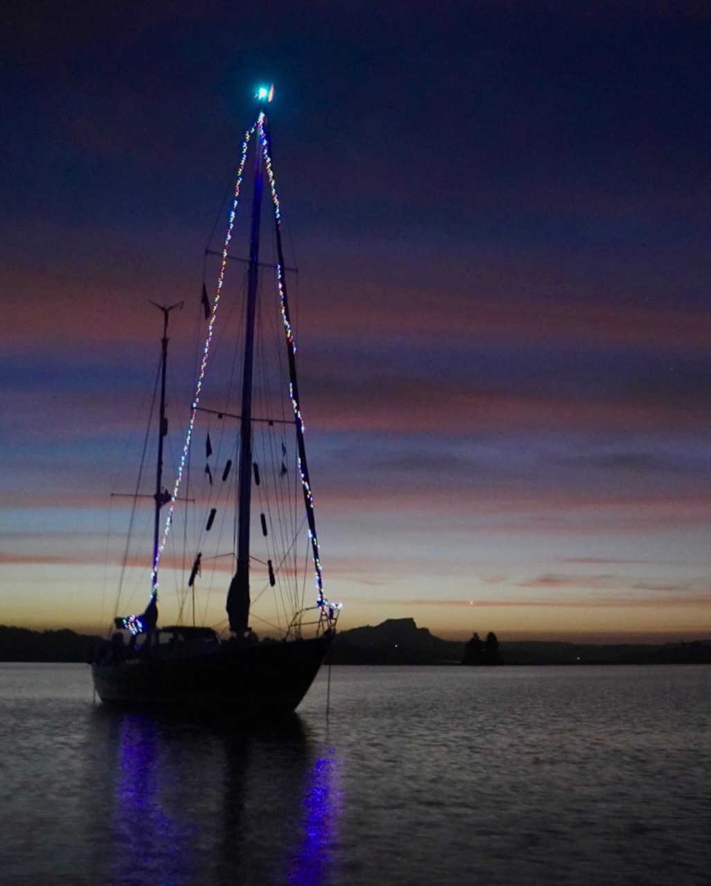
Christmas Tree Luci
We are anchored in the stunning bay of Whangaroa Harbour when Christmas arrives. While Willy and Cindy treat us to a delicious Christmas dinner at the local yacht club, Luci serves as the area’s largest Christmas tree. We have Ellen and Martin to thank for it, as they left us a long string of solar-powered lights that we hoisted into the mast.
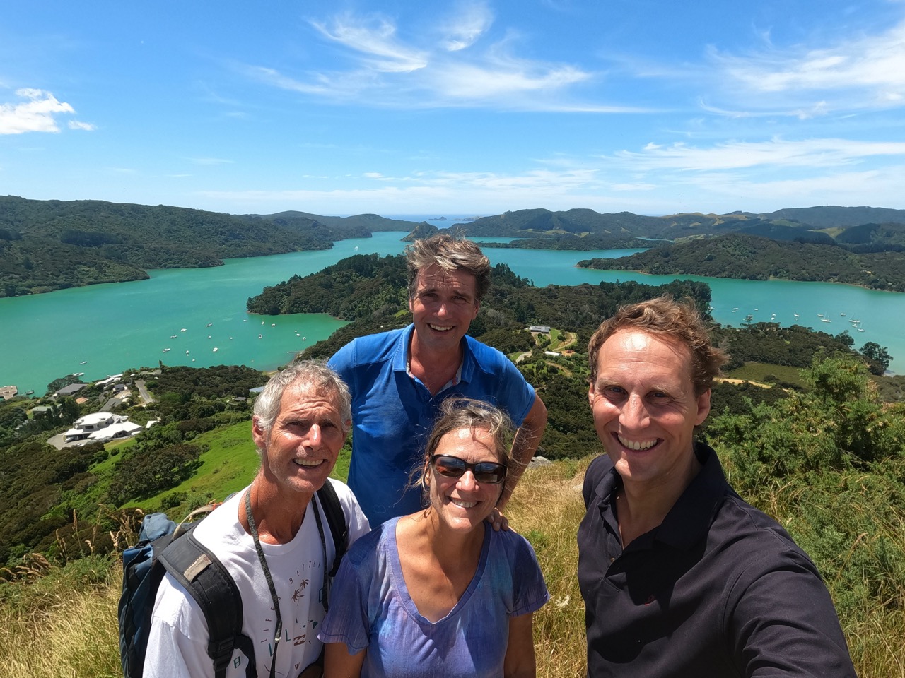
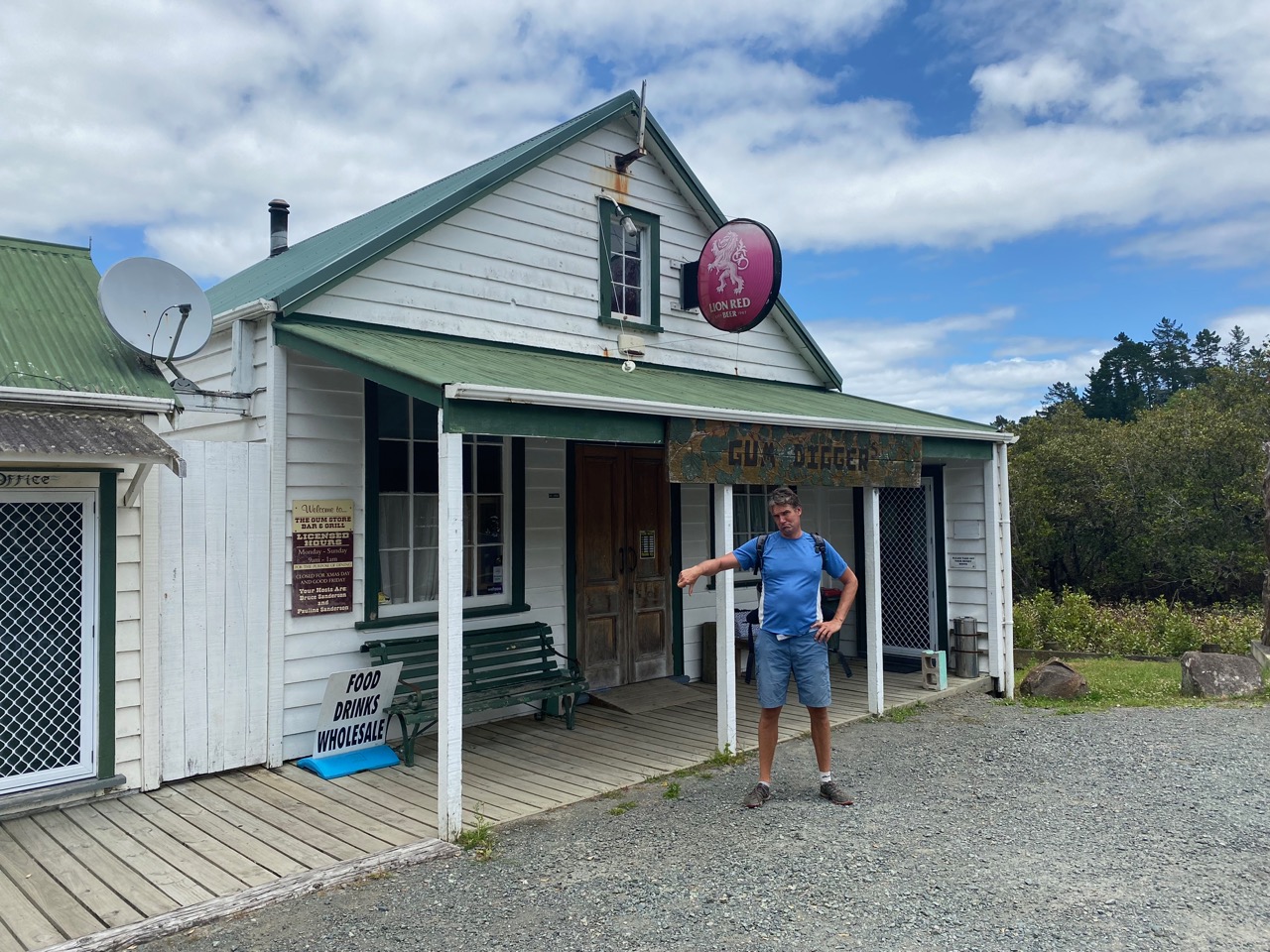
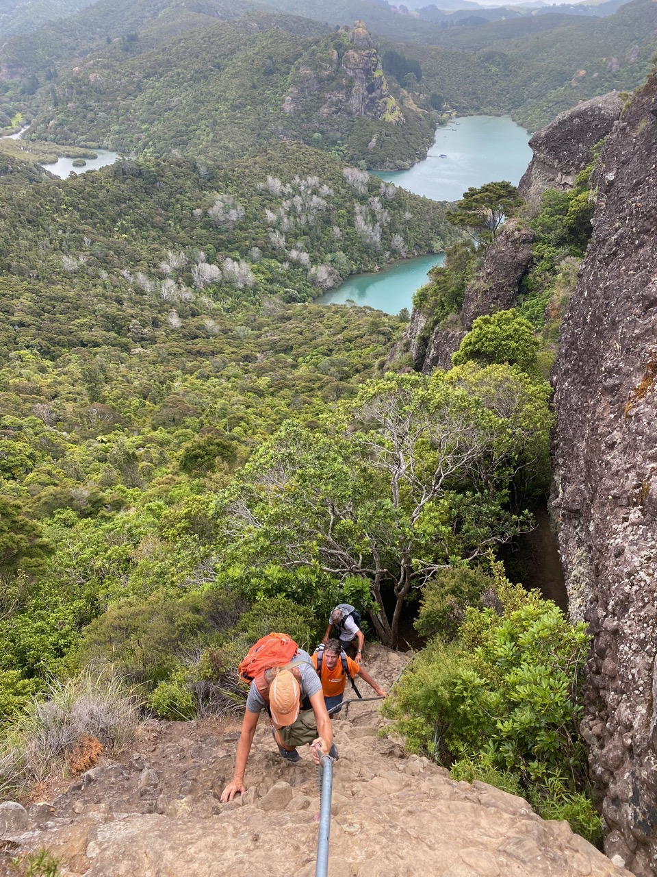
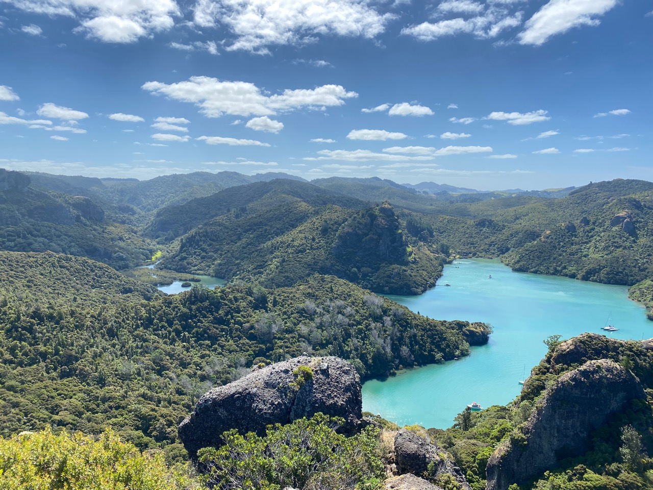
The following days we sport our hiking shoes and explore the stunning surroundings. A long trek through pristine forest leads to a local pub / store, but its owner happens to be ill. No lunch! We’re glad we packed some crackers. To get a good view of the surroundings, we climb to two local lookouts, Ohakiri St Pauls Rock and Kairara Dukes Nose Rock. The views are breathtaking!
Luci as Whangaroa’s largest Christmas tree
View on Whangaroa Harbour from St Paul’s Peak with Willy & Cindy
No pub food today
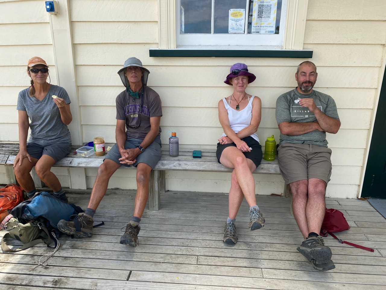
Fortunately we have crackers and peanutbutter
Climbing Duke’s Nose
Whangaroa Harbour as seen from the Duke’s Nose
Dutch Tradition in Mangonui
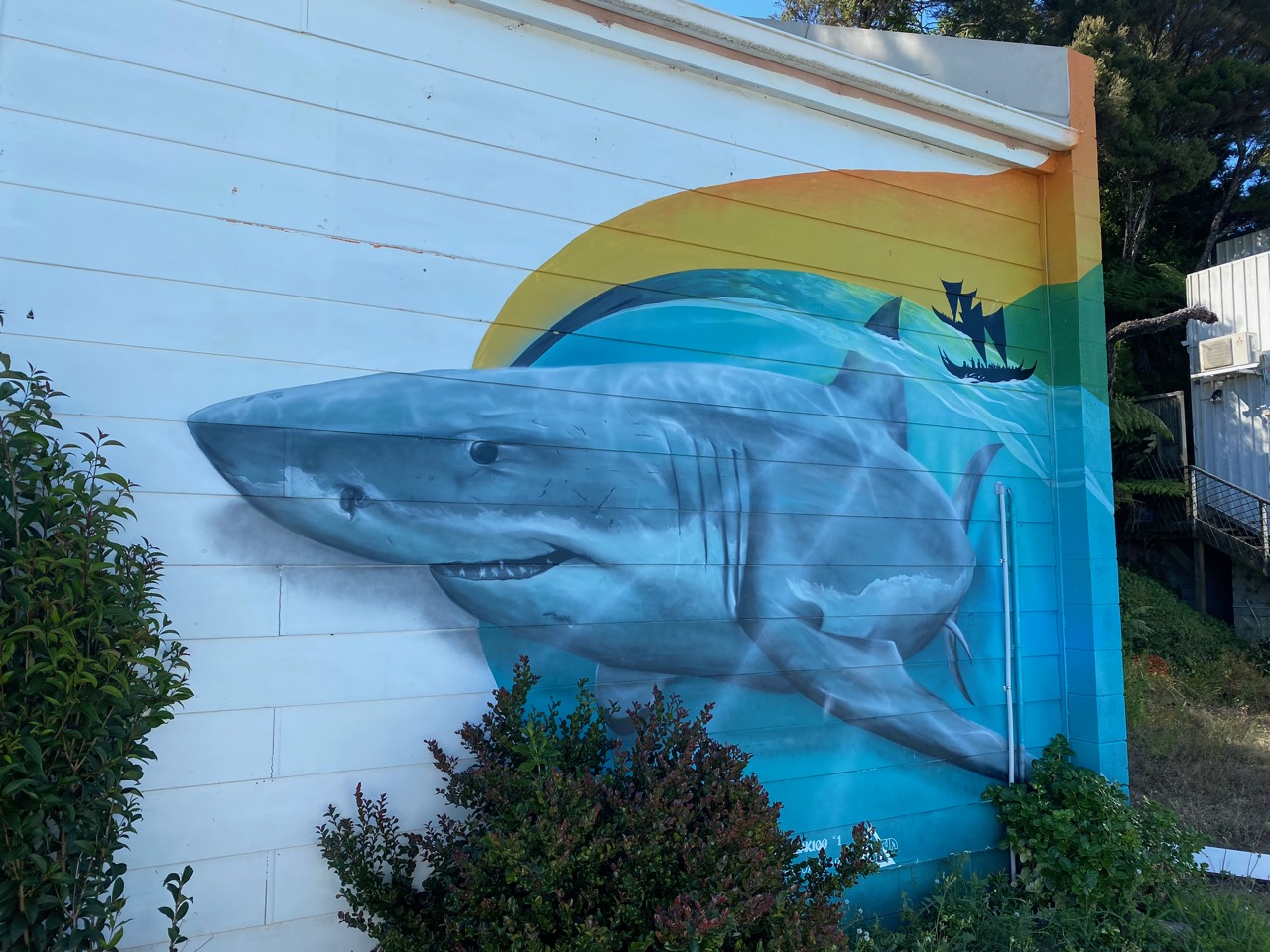
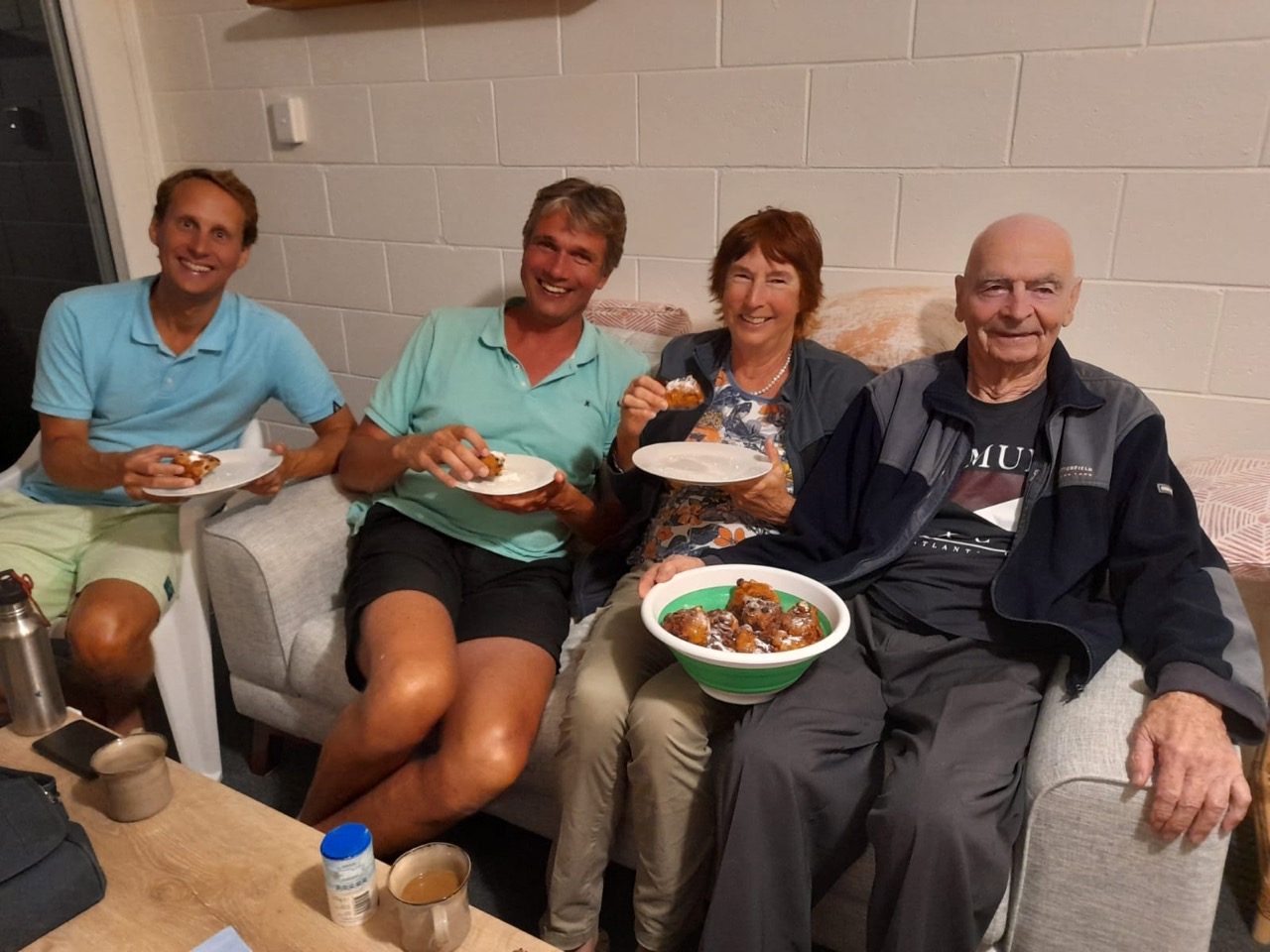
We sail further north to the small town of Mangonui, which means big shark in Māori. We don’t see any sharks but we do find the much-hyped fish & chips restaurant that overlooks the river. We indulge in the local delicacies with Cindy and Willy of SV Pazzo and Saskia and John, who have travelled here to see us again.
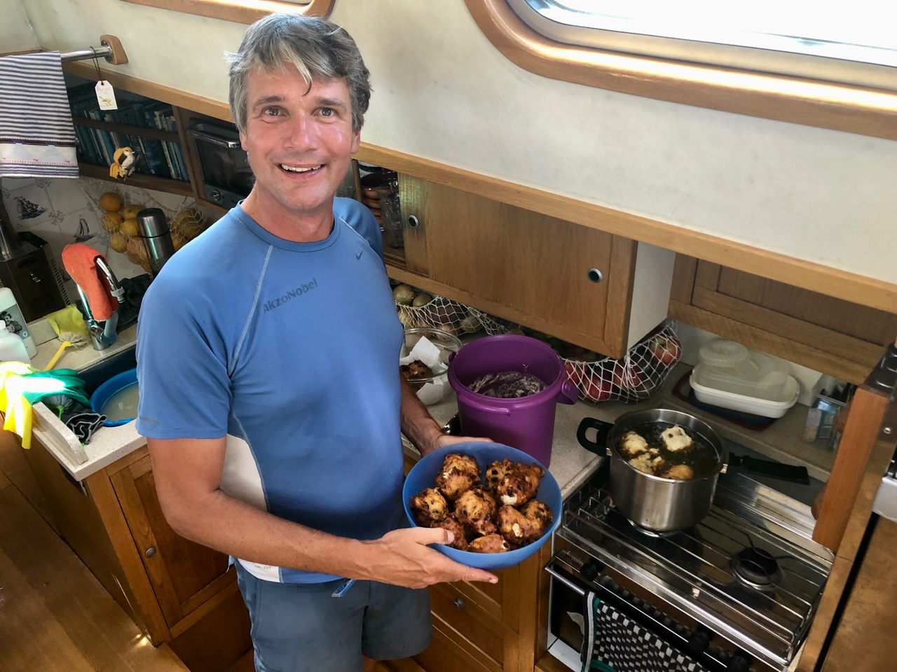
The next day is New Year’s Eve, which in the Netherlands is synonymous with oliebollen, deep-fried dough balls with raisins and candied fruit. Ivar delights Floris and our friends when he bakes two dozen of them. “These are the best oliebollen I have ever had!” Floris exclaims. When our neighbours at the anchorage invite us to a their New Year’s celebration party in town, Ivar’s oliebollen prove to be very popular with the Kiwis, too!
The only big shark we see in Mangonui
Ivar baking oliebollen
Mangonui on New Years eve
A good start to the New Year with Saskia and John
Waiting for a Window
For our planned passage to the South Island, we need fair weather for about four days, as there are hardly any stopover options on the west coast of the North Island. Our patience is being tested, but we have time. We are comfortably anchored in Mangonui and use the time to edit vlogs and write blogs. To take a break from the screens, we also venture on kayaking and hiking trips in the area.
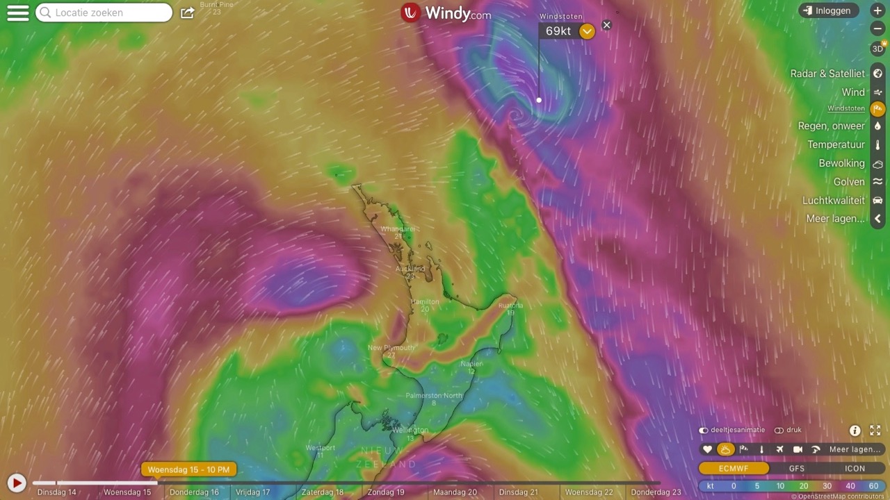
A week later, our patience is rewarded. A high-pressure area appears in the weather charts and promises to give us the winds we need to round Cape Reinga and sail south. That’s the weather window we need, let’s go!
Traces of Dutch History
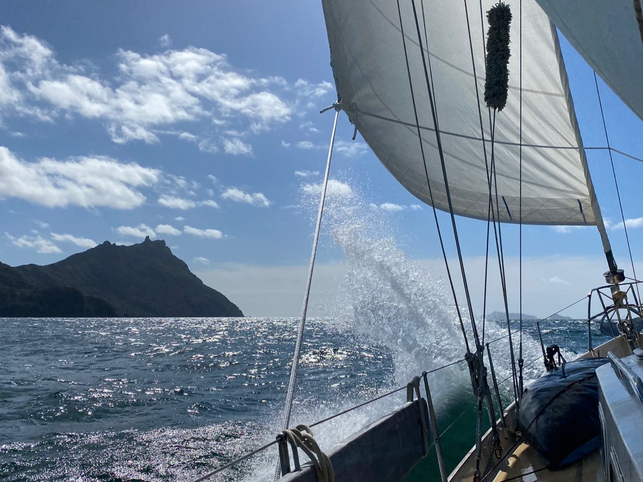
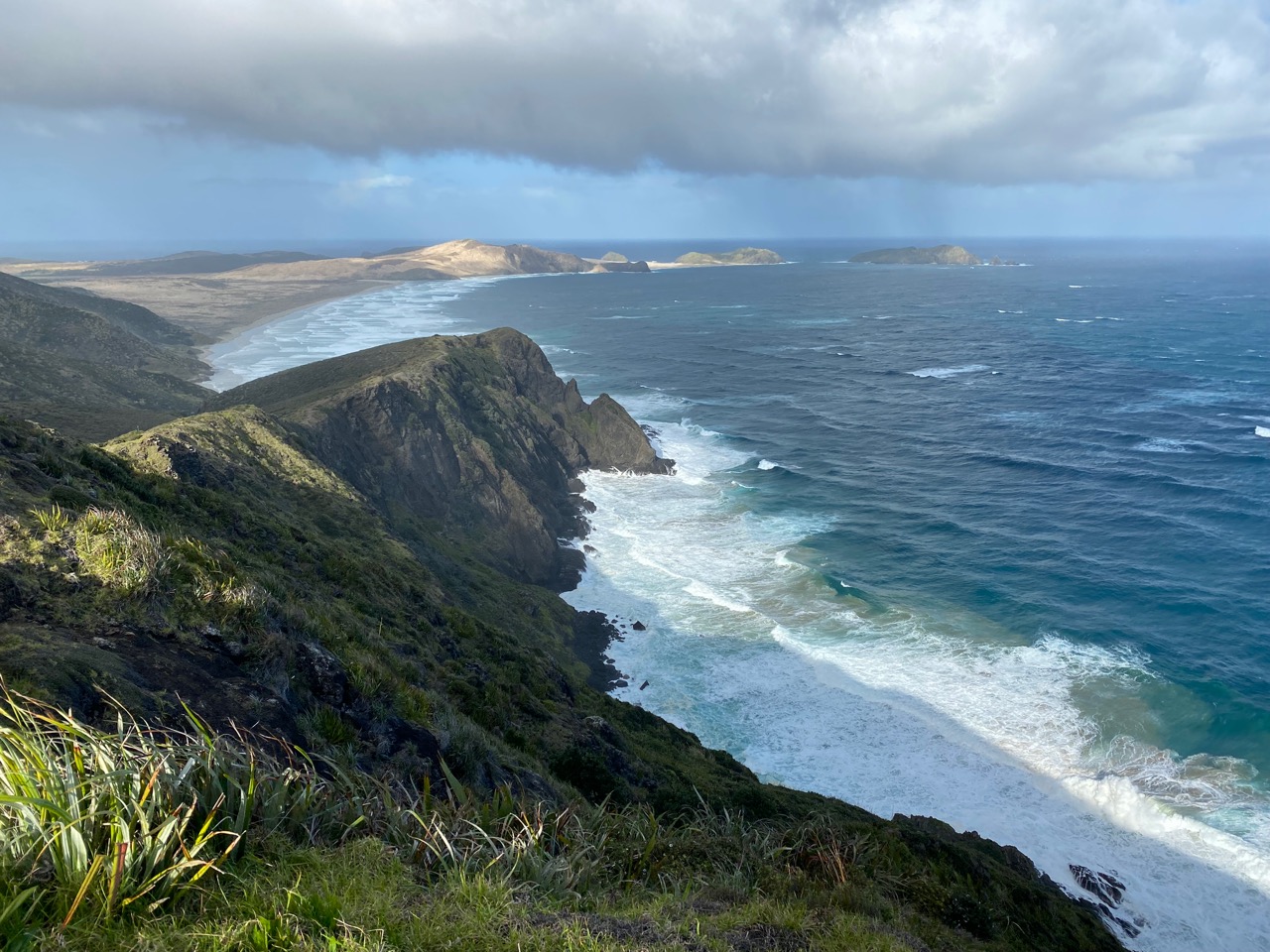
“There’s Cape Maria van Diemen!”, Floris points out. We are sailing around the northern-most tip of the North Island, keeping Luci at a safe distance from treacherous shallows. Shortly after rounding Cape Reinga, the country’s westernmost cape soon comes into view. Explorer Abel Tasman named it after the wife of his master: the governor-general of the Dutch East Indies, now Indonesia. It fascinates us that we find traces of our national history so far from home. Will we find more in these waters?
Wind and Water
We don’t have to wait long. Once we have rounded Cape Maria van Diemen, the Pacific Ocean gives way to the Tasman Sea. We change course southward and now sail in the explorer’s wake, albeit 379 years later and in the opposite direction. While his expedition here suffered from storms and a shortage of drinking water, we feel very lucky. Thanks to modern weather forecasts, we could to wait for a high-pressure area, which brings a perfect easterly wind. In the lee of the North Island we sail in great comfort. In addition, the beautiful weather provides so much solar energy that our batteries are full. We make use of that free energy and turn on the water-maker to get some extra drinking water in the tank. The contrast with the olden days could hardly be greater.
Cape Maria van Diemen as seen from land
Wind and sun in the lee of the North Island on the Tasman Sea
Southland
For centuries there had been the idea in Europe that – as counterbalance to the countries in the northern hemisphere – a large unknown country in the south would have to exist. Based on that theory, the Dutch East India Company (VOC) in 1642 decided to look for that land to expand its trading area. Governor-general Anthony van Diemen sent Abel Janszoon Tasman out to discover the ‘Southland’, and to investigate whether lucrative trade could be conducted with its inhabitants. Tasman was given two small ships for the expedition: his flagship Heemskerck and the armed transport vessel Zeehaen. They departed from the VOC’s base in Batavia, present-day Jakarta.
Murderers Bay
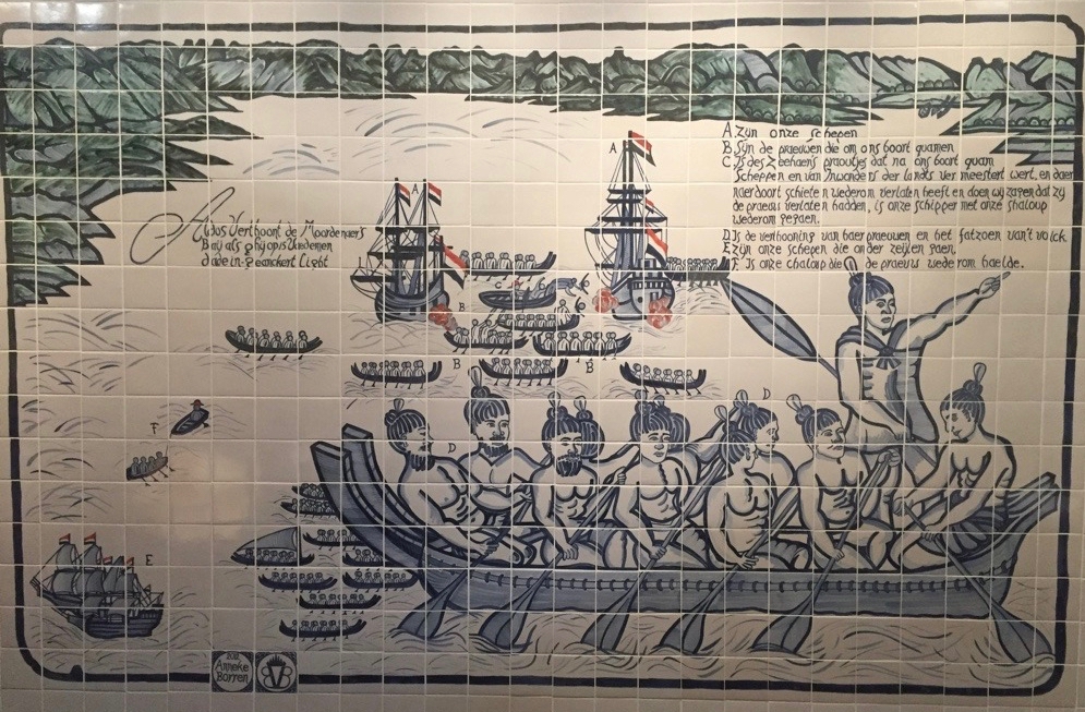
After Tasman explored a part of Australia and put present-day Tasmania on the map, a strong westerly wind forced him eastwards. As a result, he came across the west coast of the South Island. On 13 December 1642 he wrote in his logbook that the crew had sighted ‘a great high lofty land’. They were the first Europeans to see Aotearoa New Zealand. Tasman wanted to land, but the rugged coast forced him further north. He found an anchorage on the north coast of the South Island, but was unable to set foot on land. Hostile Māori in canoes attacked the Dutch, killing four of the sailors with clubs and paddles.
There is also another reading of this first encounter between the two worlds. The local Māori (Ngāti Tūmatakōkiri) would have been stunned to see the Dutch ships. In two wakas—canoes—they paddled to the invaders. They greeted them with ritual incantations and blew the pūtātara, a shell trumpet. Believing that they were the dreaded patupaiarehe, fair-skinned mythological figures, they tried to deter them. In response, the Dutch blew their own trumpets, filled with gunpowder and bullets. To the Māori this must have sounded like a challenge.
The next morning, they paddled with eleven wakas to the Dutch ships. Four Dutch sailors were killed after their boat was rammed by a waka. Tasman abandoned hopes of friendly relations and decided to leave. A man in a large waka held a white flag, possibly a peace sign. As they approached, Tasman’s men shot him dead. Whatever happened exactly, it is certain that Tasman named the anchorage ‘Moordenaersbaai‘, Murderers Bay in English.
A Century Later
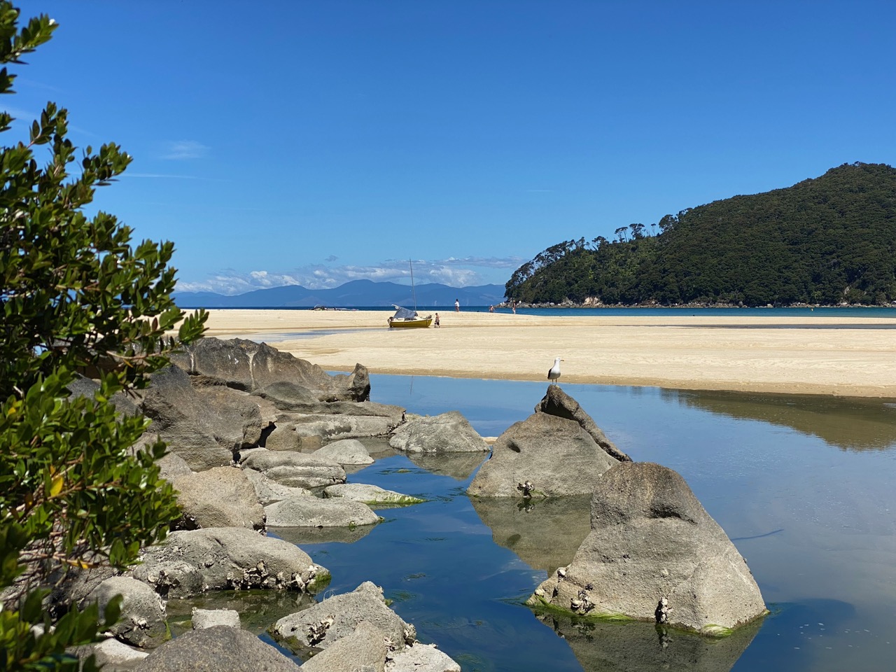
On our third day from Cape Maria van Diemen, we sail right past Golden Bay, as Murderers Bay is called today. Here too we realize how completely different our experience is from Tasman’s. Our anchor falls in the sand of a picturesque bay with bright blue water in a region called, yes, Tasman. Later, when we stretch our legs on the popular hiking trails of the national park of the same name, the locals are extremely friendly. They are at most surprised that we walk this great walk without heavy backpacks.
We read that Tasman determined that trade with the Māori was impossible. He sailed further along the west coast of the North Island, but the rough seas prevented him from landing there. He returned to the Netherlands with the message that the discovered coasts were not suitable for ‘exploitation’. The country did get a name: Staetenlandt. A cartographer later changed this in Nieuw Zeeland to honour Zeeland, the Dutch province from where many famous naval heroes originated. New Zealand, the English version of this name, has stuck to this day, alongside the version the Māori gave the land centuries before Tasman: Aotearoa – land of the long white cloud.
It took more than a century before Māori and Europeans met again, with the arrival of James Cook in 1769. He did not confine his visit to a short stop. Rather, he explored the whole country, with far-reaching consequences for the further course of Aotearoa New Zealand’s history.
Anchored
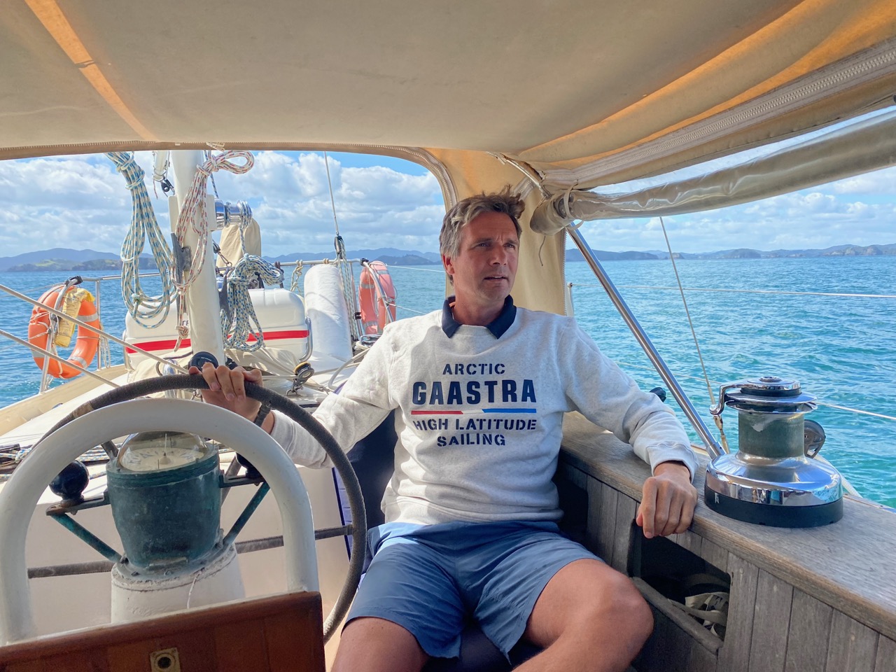
At the time, Tasman warned the VOC about the hostile Māori and the inhospitable coasts of New Zealand. We also receive an ominous message: “Abel, gale warning, easterly, 35 knots”, warns the Aotearoa New Zealand weather service via the VHF speaker. That’s our weather district! We move to a better-sheltered anchorage and hike another part of the beautiful Tasman track before the strong wind confine us on the boat.
An island south of Australia, a sea between Australia and New Zealand, a national park, a region and its own weather district. While we sail to Nelson in a relaxed day trip and check in its convenient marina to do the laundry and stock up on groceries, we realize the name Tasman is so firmly entrenched here that no one is likely to ever forget his wake.
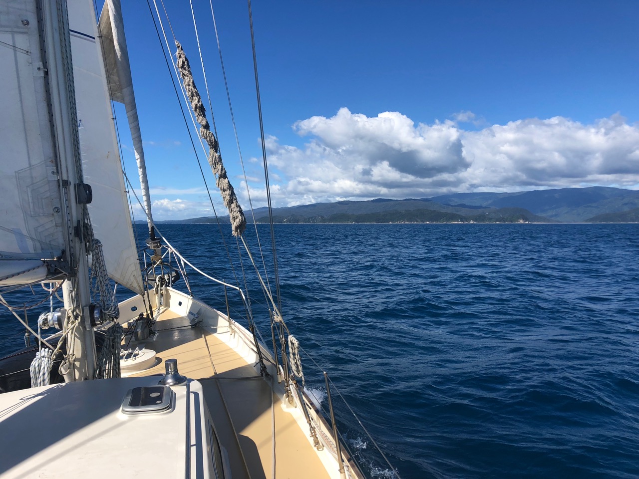
Sailing past Murderers Bay
The first encounter between the Dutch and Maori as pictured in the Dutch Museum in Foxton
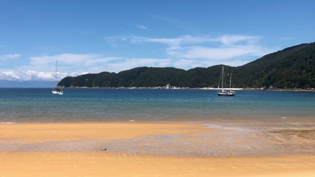
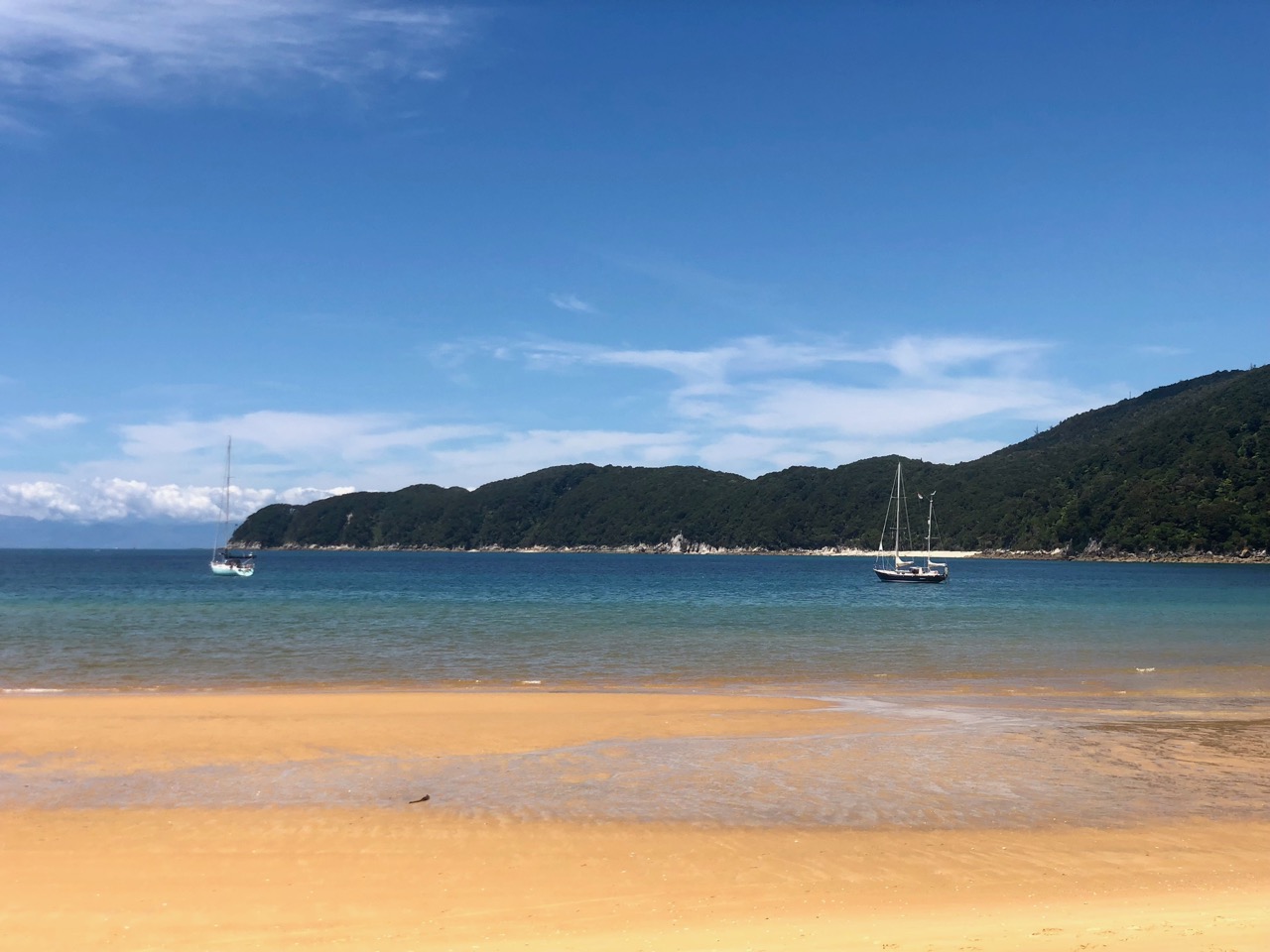
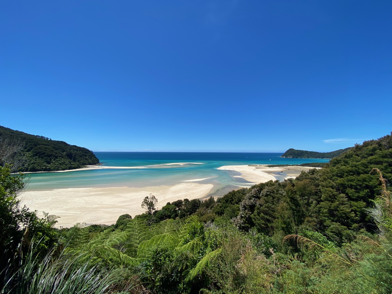
Anchored at Tonga Bay – Abel Tasman National Park
Nowadays Abel Tasman National Park’s stunning nature is well protected
Picturesque Abel Tasman National Park
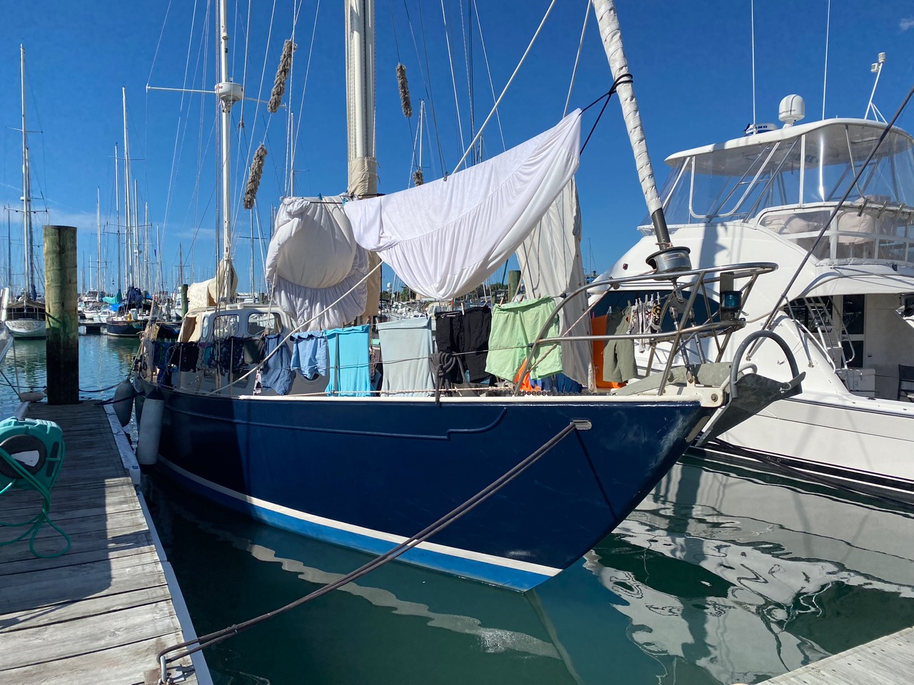
Sustainable dryer in Nelson
Our route from Whangarei to Nelson
Bestel ons boek - Order Our Book
Het boek uit over onze zeilreis van ruim acht jaar rond de wereld op zoek naar duurzame oplossingen: