We cross the Indian Ocean from Cocos (Keeling) Islands to South Africa. Can we avoid storms and the monster waves of the Agulhas current?
Cocos Keeling (AUS) – Richards Bay (ZAF)
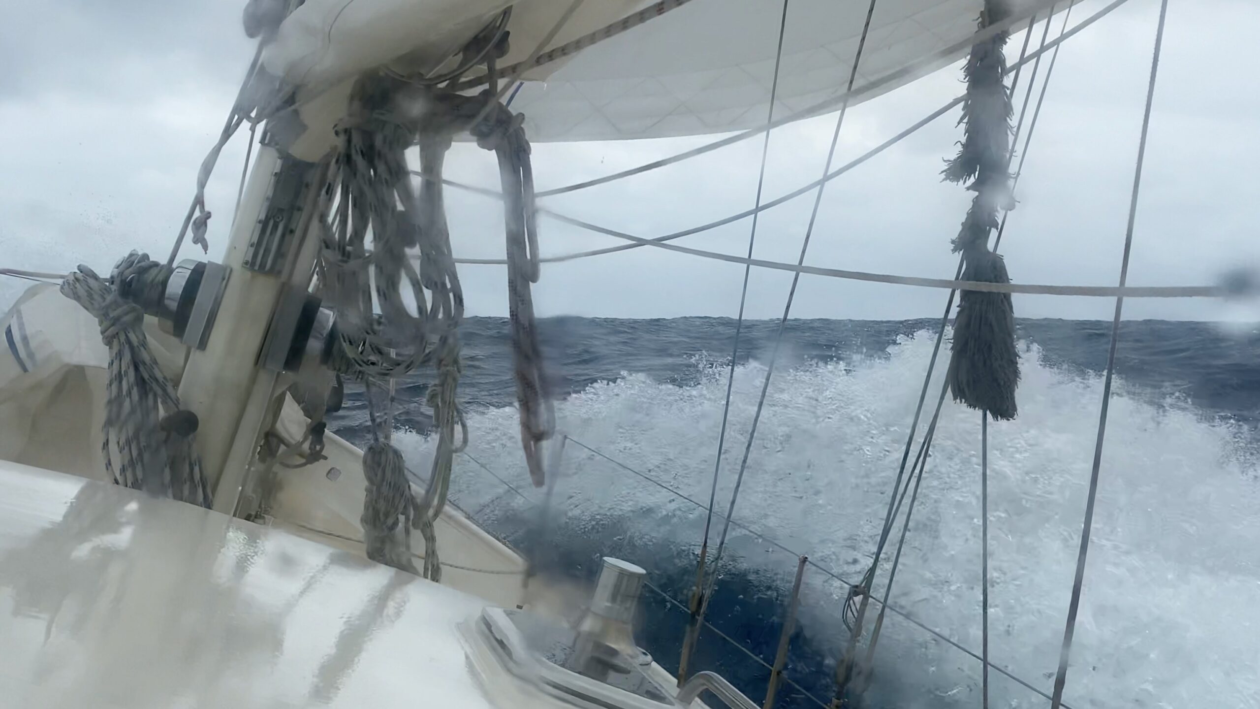
Heavy rain pours down as the seas climb over the sides of the boat, showering us from all directions. The wind is gusting up to 40 knots. It’s pitch-dark, except when bolts of lightning illuminate the sky, sending shivers down our spines and putting us on high alert. “We really need an extra reef in the mainsail”, Ivar shouts while Luci races at full speed. As soon as the squall has passed, we reef the mainsail as fast as we can. Not much later, the next squall hits us. Luci behaves somewhat calmer but still tosses us around erratically because of a persistent cross-swell. “What misery, crossing the Indian Ocean”, Floris sighs.
Only two days ago, we left the Cocos (Keeling) Islands. The trade winds blew 25 knots under bright sunshine and we had excellent weather forecast ahead of us. Now, that seemed like an eternity ago. A tropical depression north of us surfaced which was inconsistent with the forecasters’ models. Instead, it is heading our way.
We head south-southwest and keep up the pace so we can stay ahead of the worst weather. Our tactic works. The showers and wind gusts do not get any worse and after a few days, the sun emerges from behind the clouds. We are still making great speed. Yet still, the cross-swell remains. Storms far south of us generate waves that mix with the waves from the trade winds. The result: irregular lurches that make crossing the Indian Ocean uncomfortable and exhausting. When will this stop?
To Stop or Not to Stop?
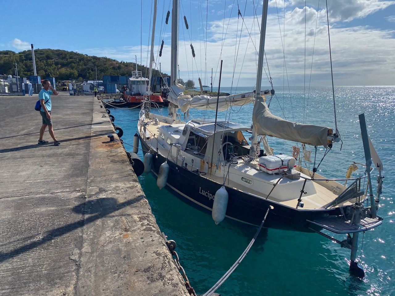
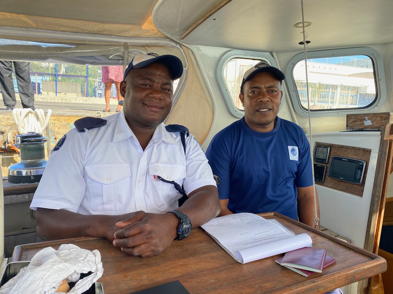
After more than 2,000 miles we approach the island of Rodrigues. “Yachts are not allowed to stop there!”, the authorities of Mauritius informed us when we set sail. But they are based on Mauritius’s main island, 500 miles away. Moreover, we learn that two other sailing boats are anchored in Rodrigues, so we take our chances and steer towards the island’s capital Port Mathurin, desperate for a break from crossing the Indian Ocean with its incessant storms and waves. The coastguard calls us on VHF and, fortunately, gives us permission to enter the port. Once moored at the concrete quay, one official after another boards Luci to clear us in. Everyone is very friendly and welcoming. They clearly don’t care much about the rules of their large neighbouring island. We just smile and, finally, relax.
Avoiding the worst of the depression
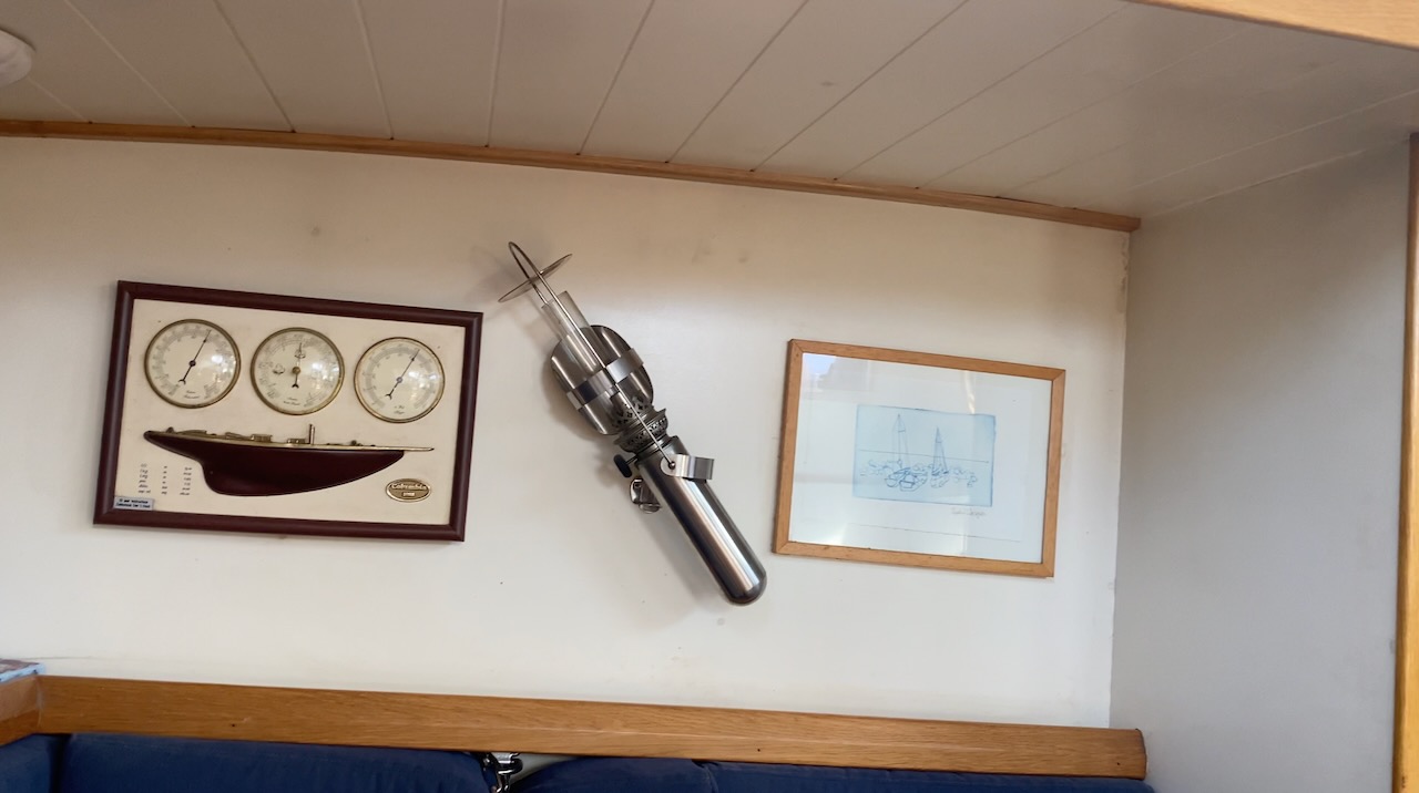
Oil lamp rolls stays upright when boat rolls
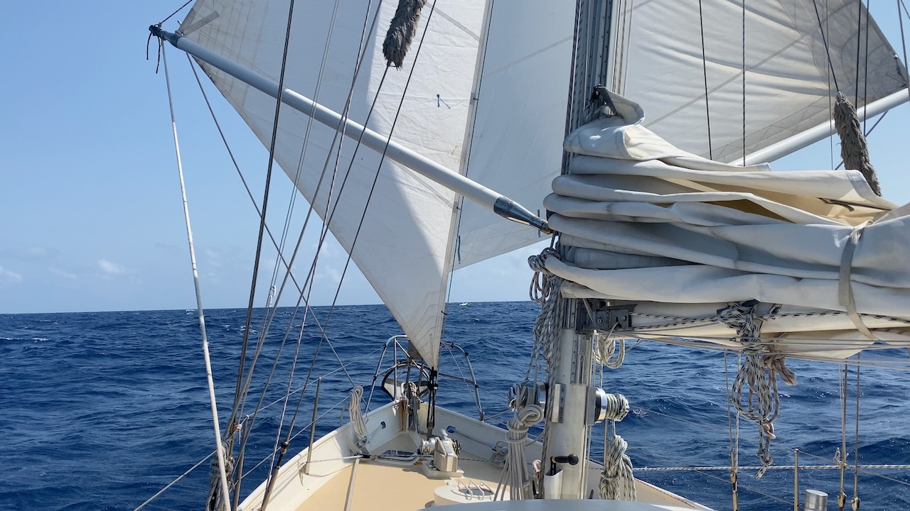
Just follow the trade winds
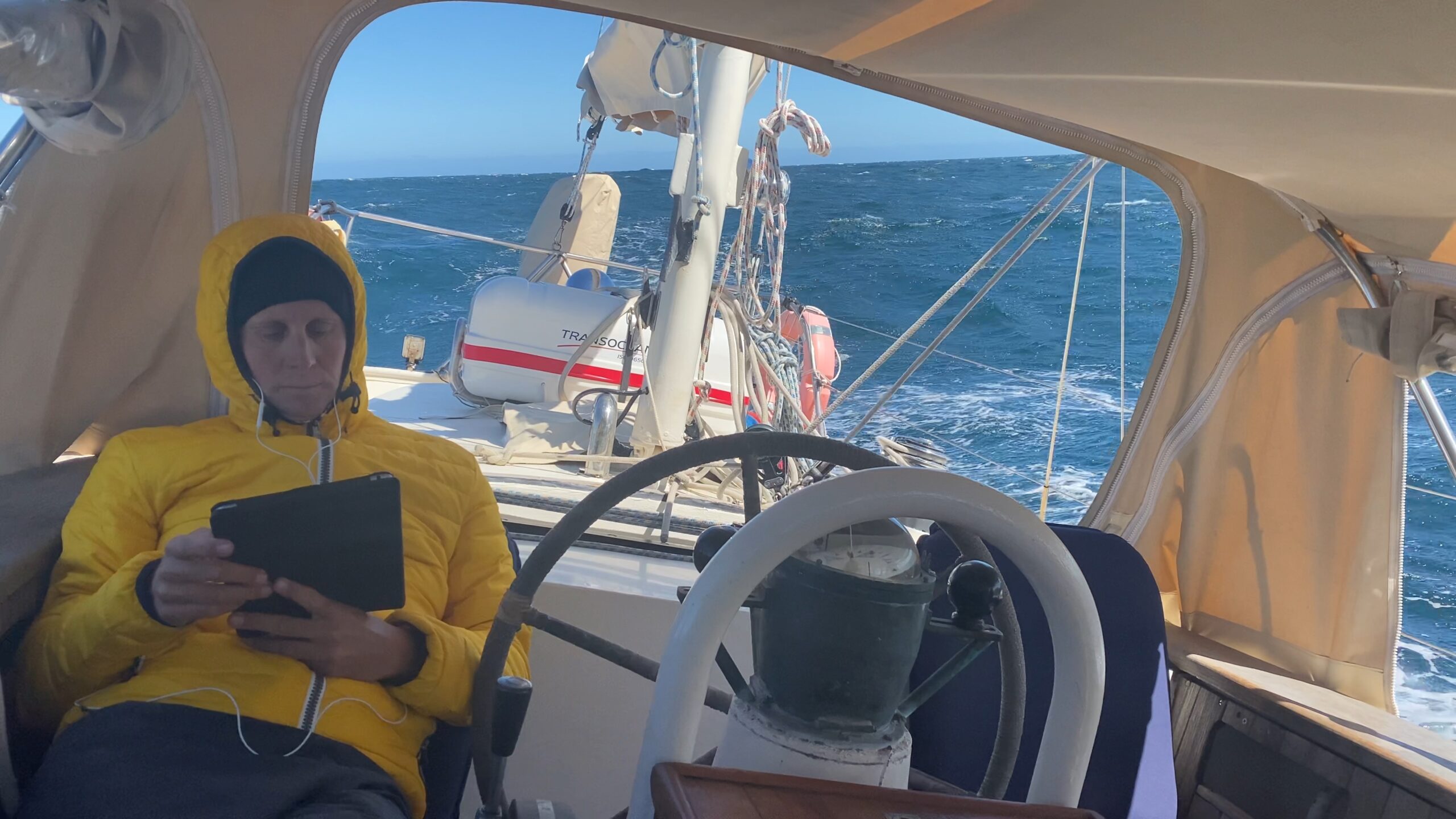
Floris reading on passage
At the quay in Port Mathurin
Friendly officials in Rodrigues
Time Travel
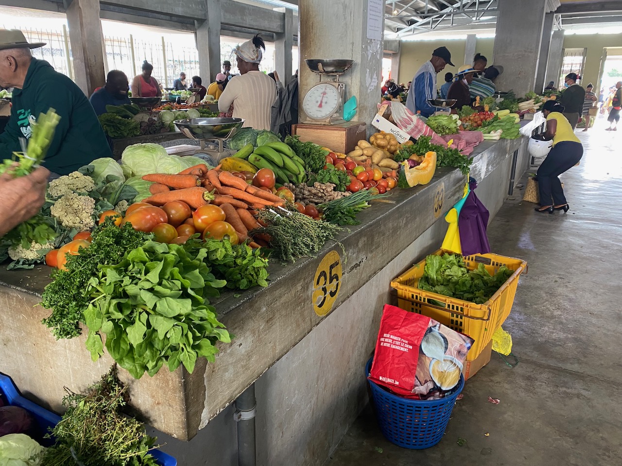
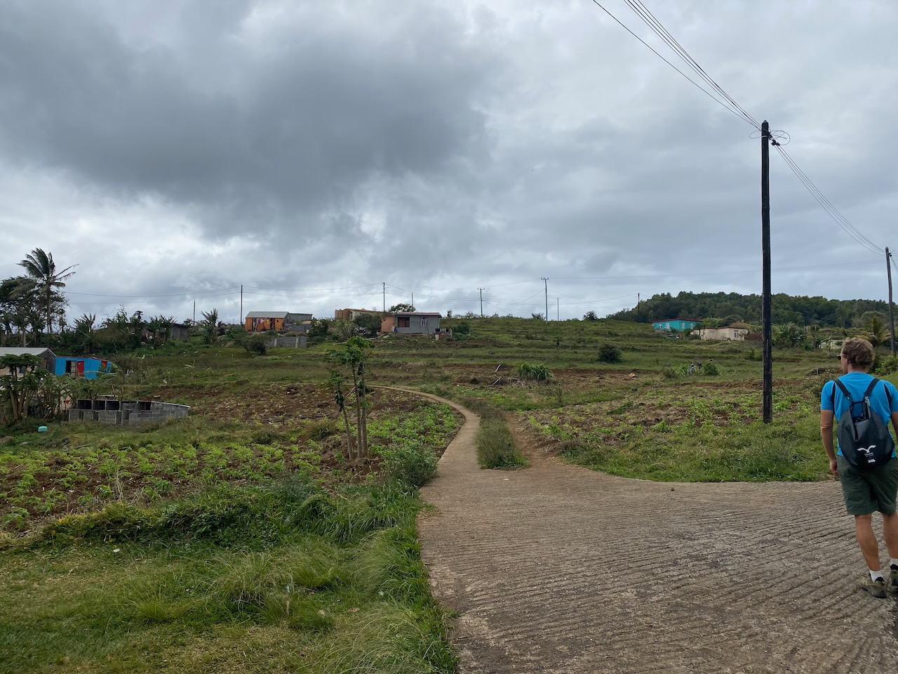
That same afternoon we leave the boat for the first time in 12 days to explore our new surroundings. The small town feels laid-back: nobody is in a hurry; people chat and patiently explain to us where we can get groceries and a SIM card. There are no big chains of shops, hotels, restaurants, only small, local businesses. The bus network is surprisingly extensive, which allows us to expand our radius and visit all corners of the island. On extensive hikes, we observe the residents managing their own affairs: from building their own houses to growing fruits and vegetables in the garden to raising chickens. The beaches are breath-taking. Brightly coloured, traditional sailboats traverse the azure blue lagoon. They make us feel like we have travelled a few centuries back in time.
Demolition and Reconstruction
On closer inspection, however, the island’s traumas come into focus. The population consists almost entirely of descendants of enslaved Africans, brought here by European colonial powers to work on plantations. The growing population and land-use has also affected biodiversity. A monument commemorates the solitaire, an imposing, flightless bird, which went extinct at the hands of hungry humans. The same fate befell the indigenous tortoise: killed for fresh meat until extinction by crews of ships crossing the Indian Ocean.
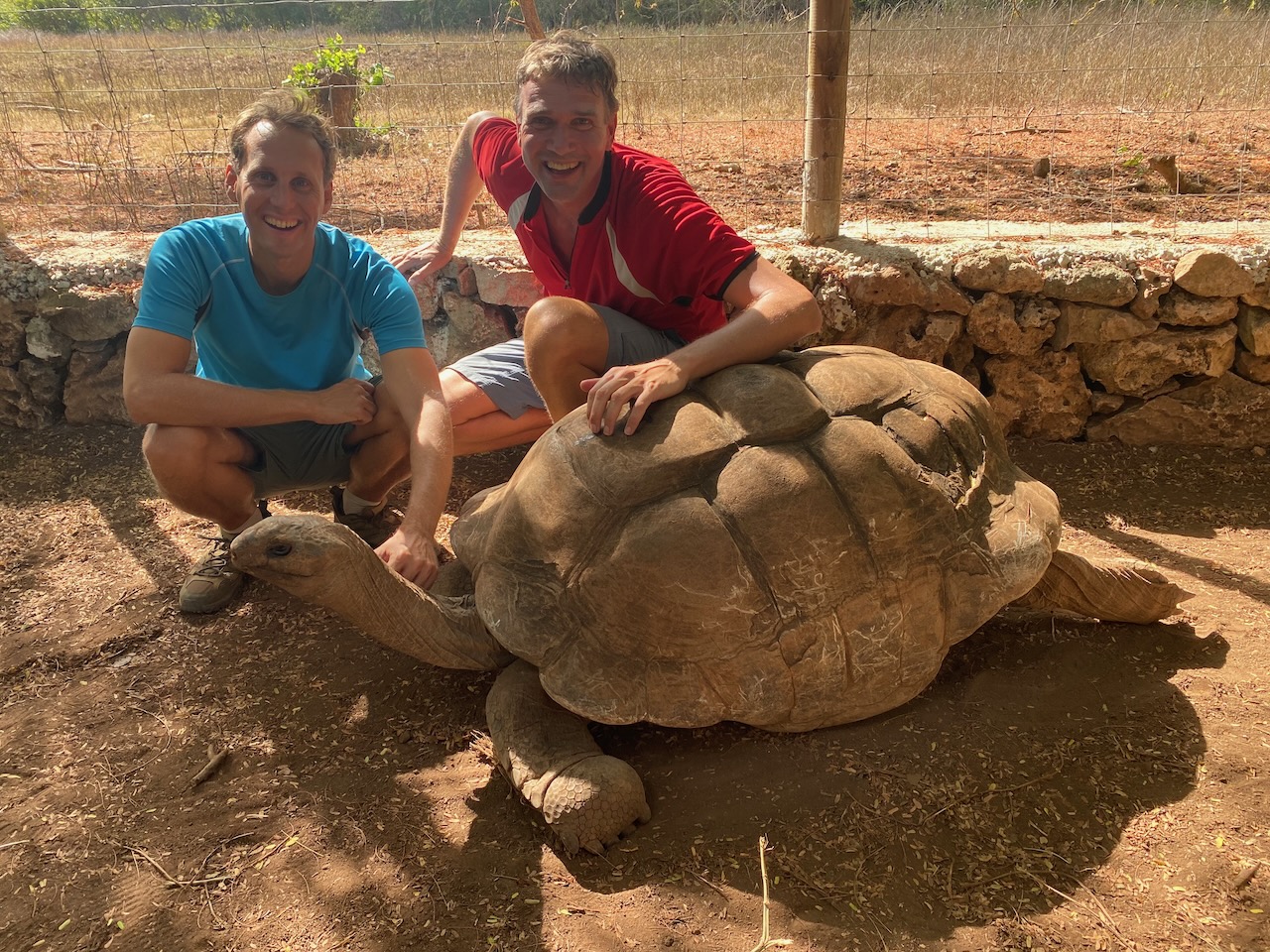
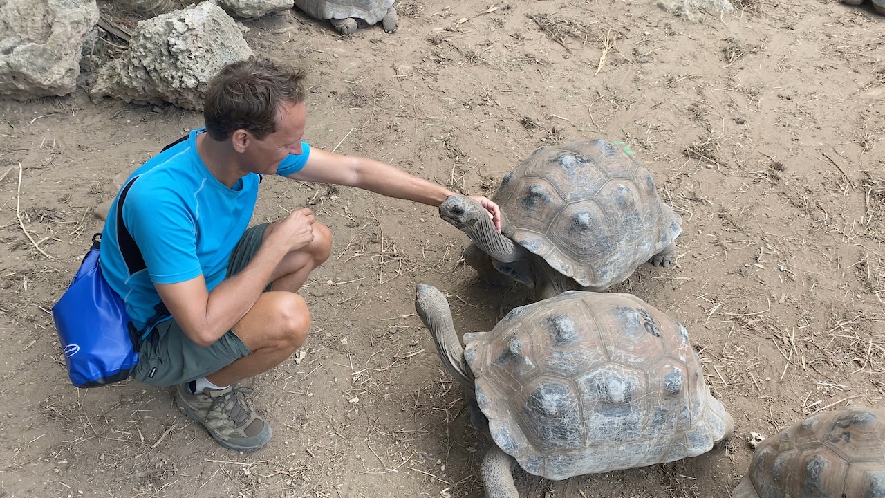
Some twenty years ago, nature lovers initiated a turnaround. In the Francois Leguat reserve, they started ‘rewilding’ Rodrigues. They restored flora and fauna to their original state as much as possible by planting native trees and shrubs and reintroducing species closely related to the extinct tortoises. Since then, the tortoise population has steadily grown to over three thousand, which we notice with our own eyes. We can even pet them. Like puppies on sleeping pills, as we reach down to touch their shells, they slowly respond to us and eventually compete for our attention. Thanks to the reserve, we can still see what the island must have looked like before its discovery.
Produce market in Port Mathurin
Self-sufficiency on Rodrigues
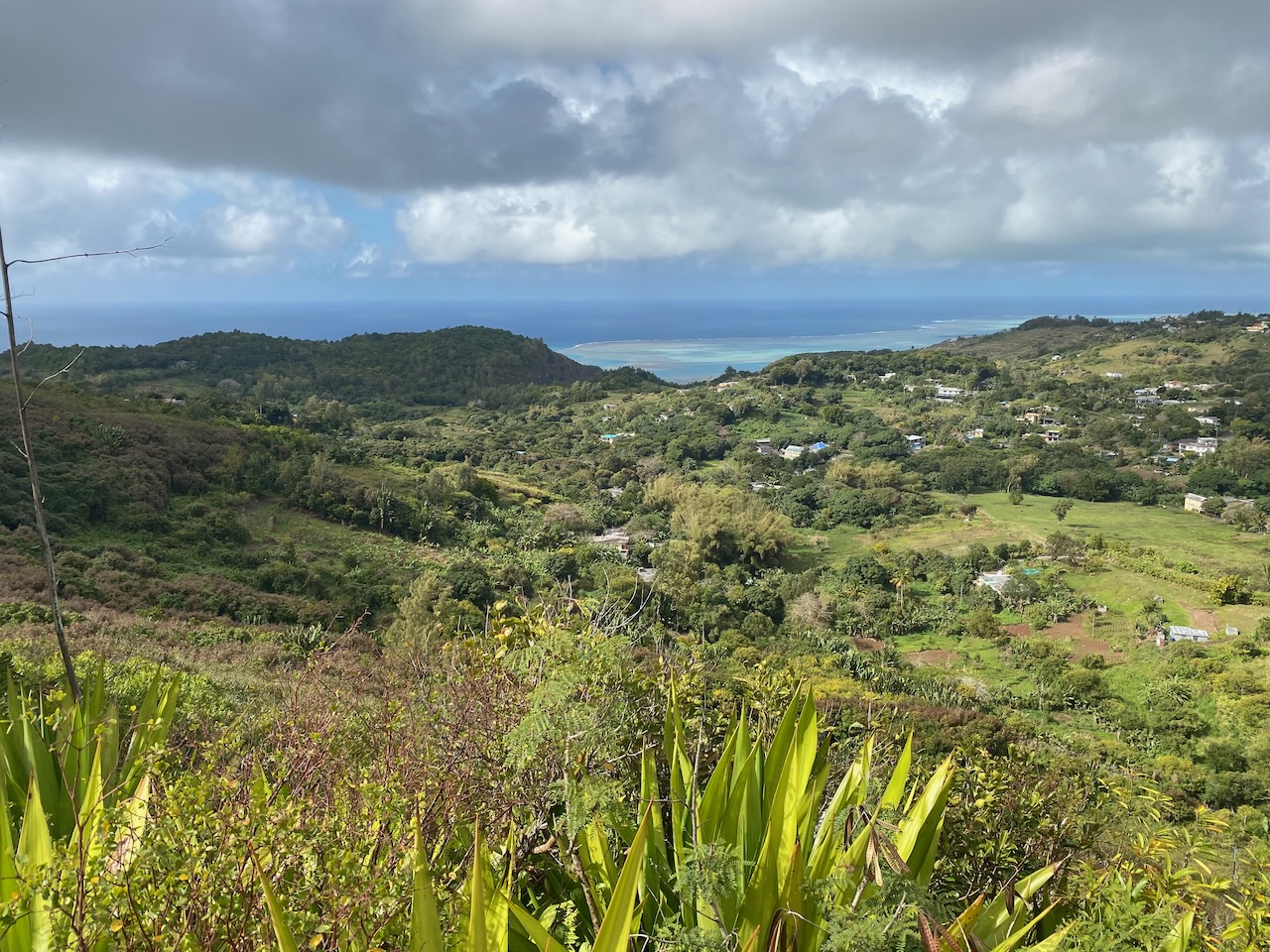
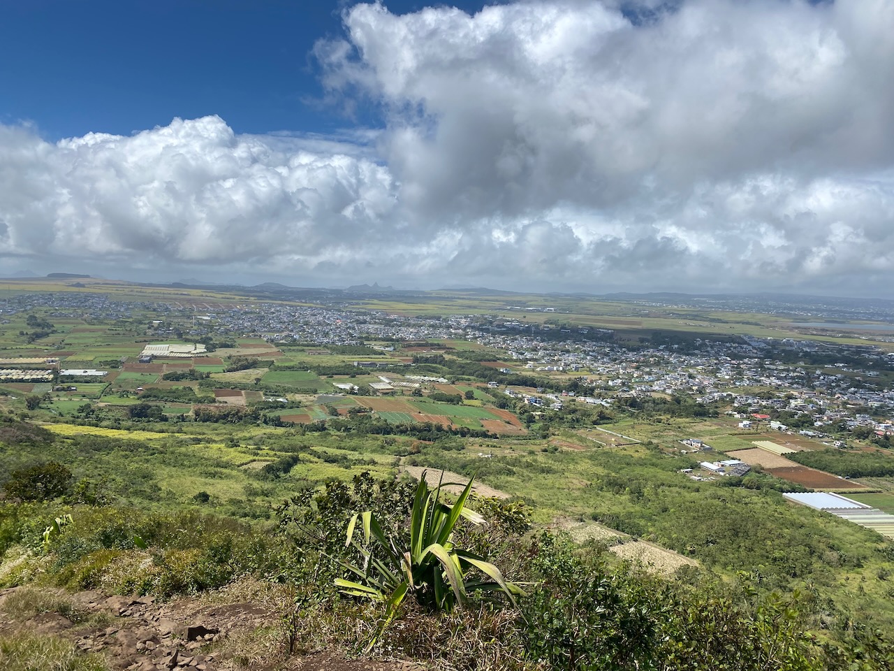
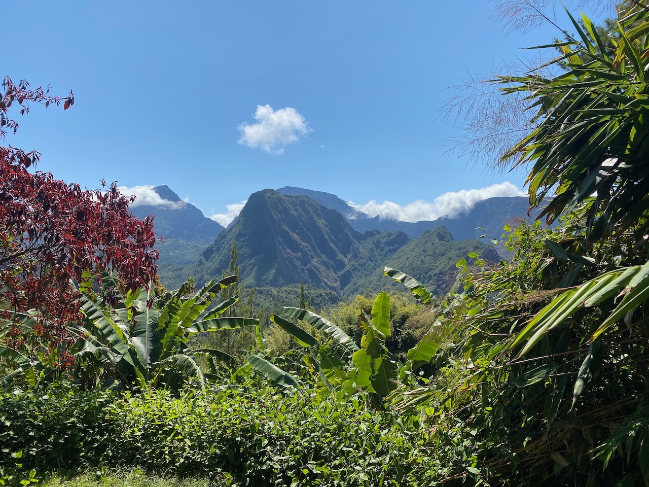
View on Rodrigues
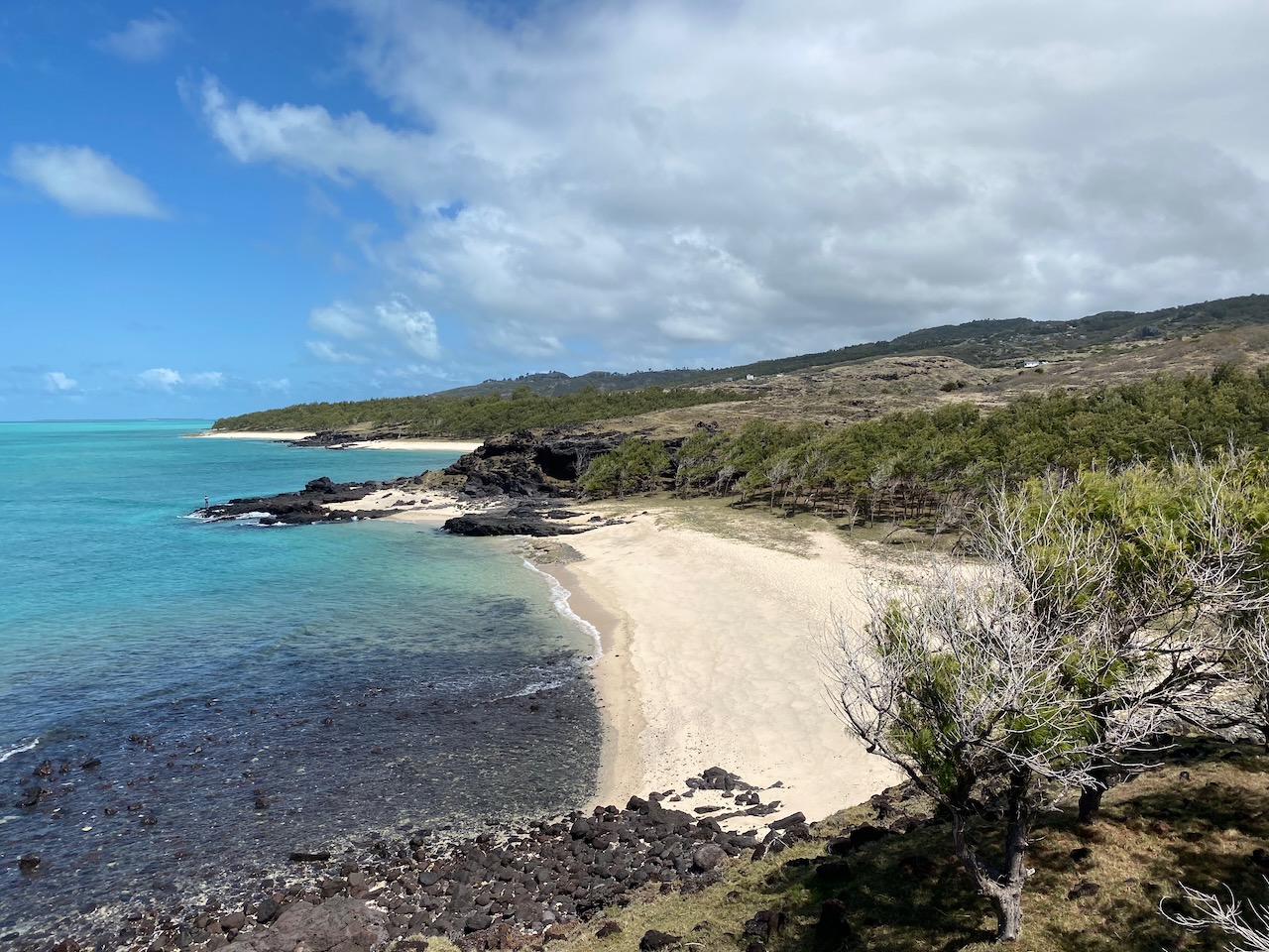
Stunning beaches on Rodrigues
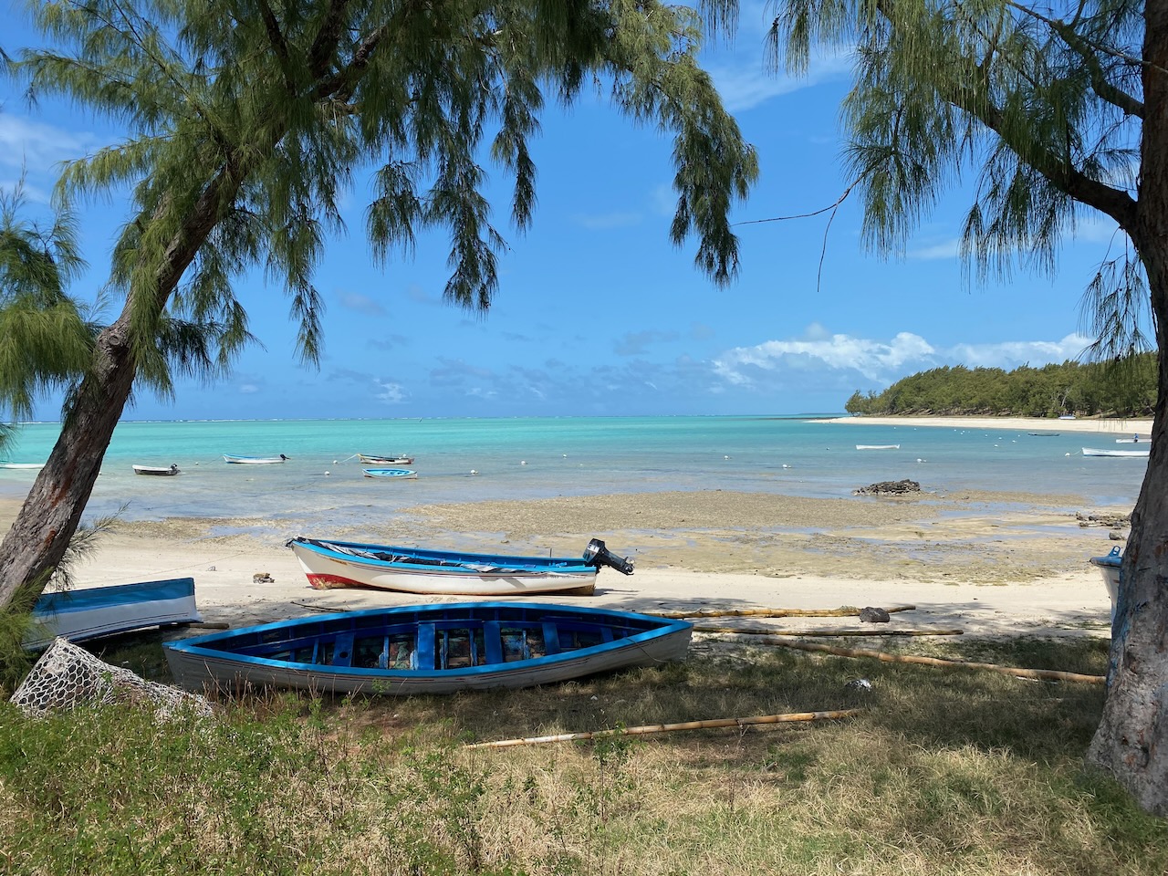
Traditional Rodrigues boats
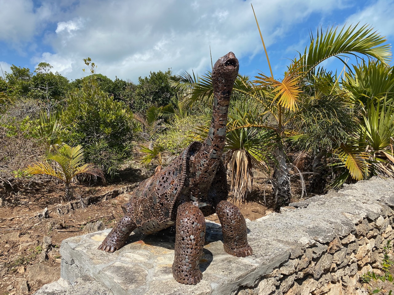
Tortoise that is no more
Ancestor of 3000 tortoises now living on Rodrigues
Tortoises competing for Floris’ attention
Rainbow Island
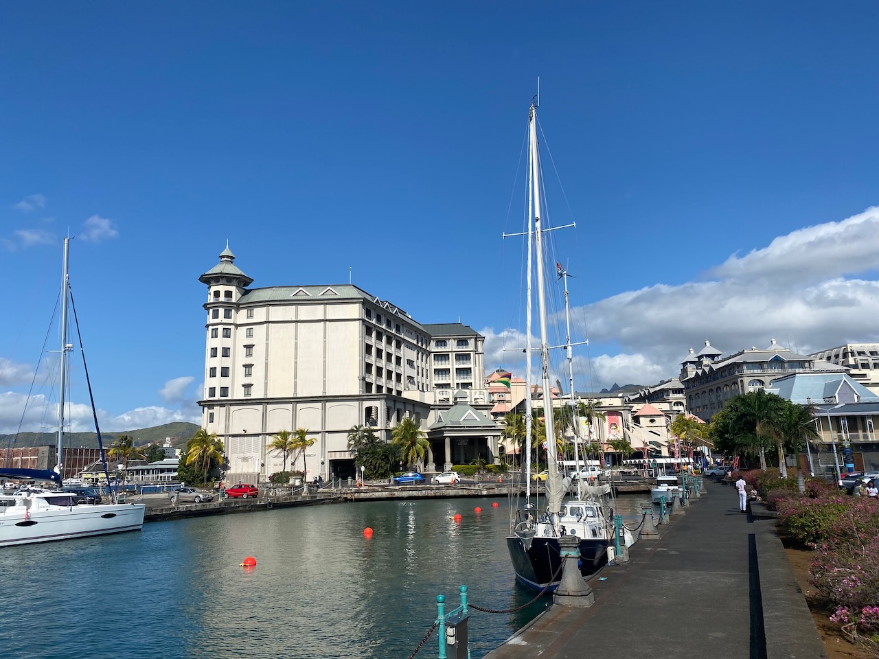
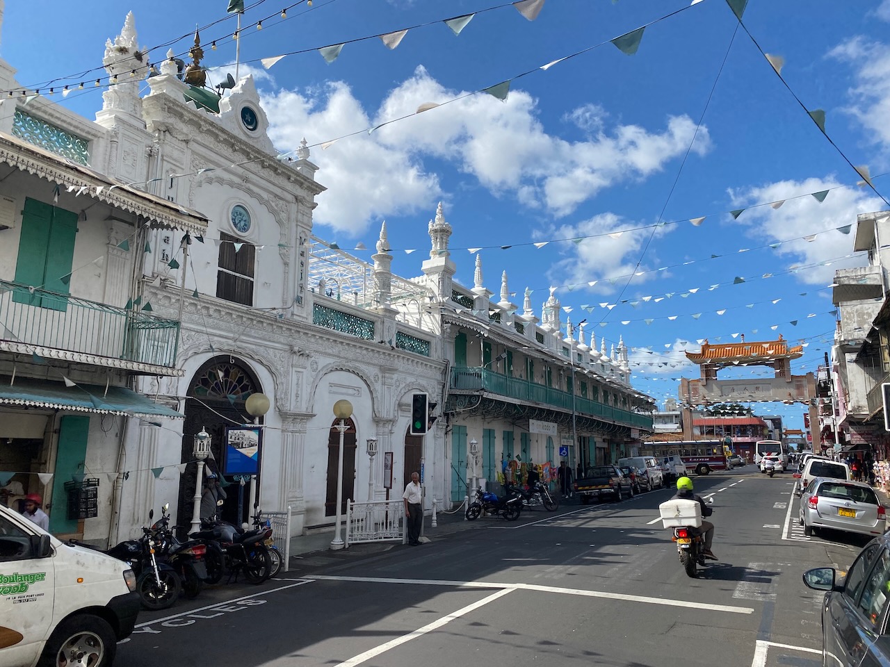
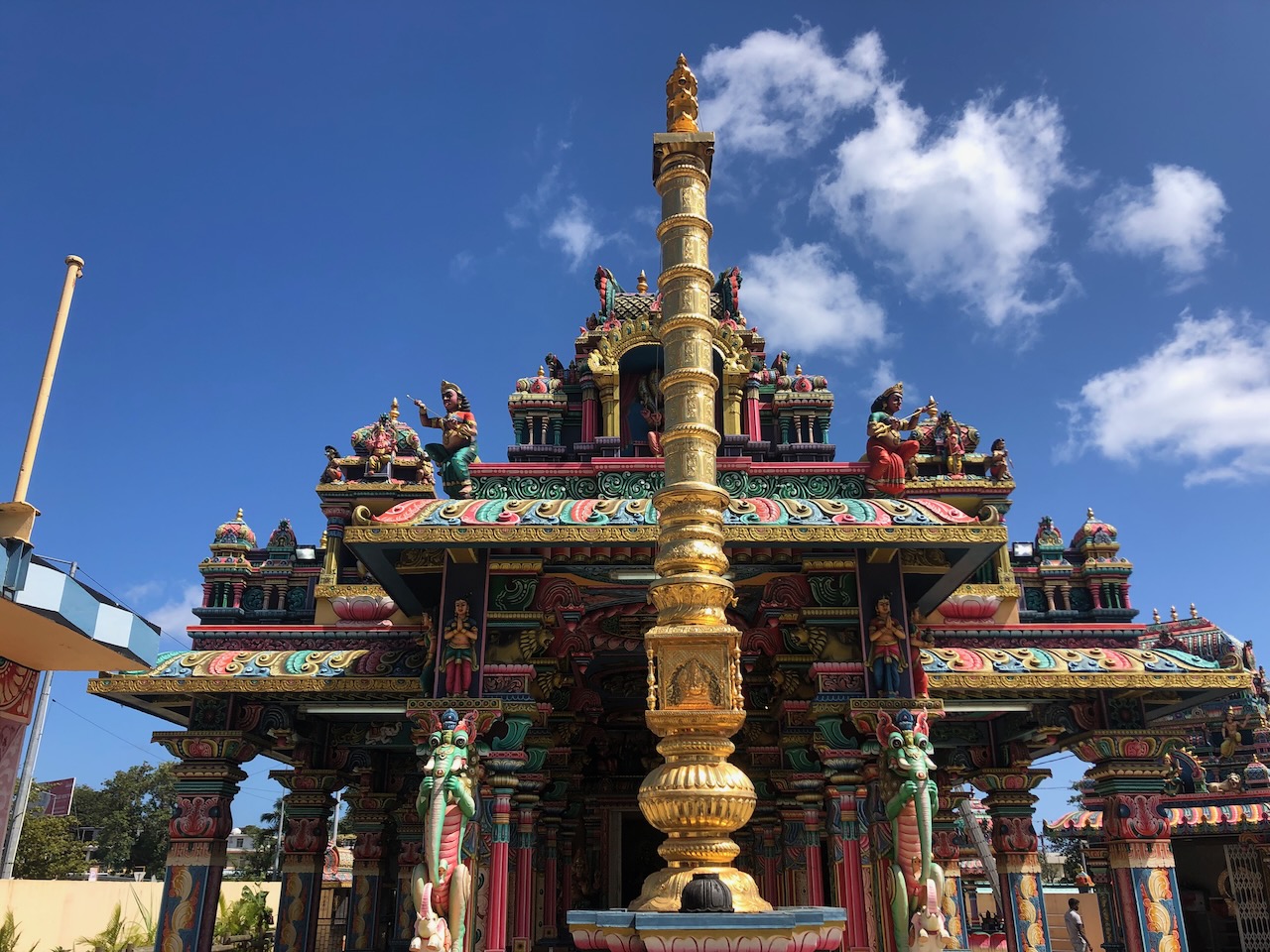
After a week of excursions, we replenish our food supply one last time and pick up the trade winds to sail further west on our crossing of the Indian Ocean. The cross-swell has calmed some, so the three-day trip to Mauritius is relatively comfortable. Soon after arriving in the bustling capital city Port Louis, we befriend Katya and Julien. Over the course of a week they take us on trips to their favourite spots, so we get a feel of the diversity of the island’s landscapes and cultures. We see people of European, African, Indian, and Chinese descent. There is even a ‘Chinatown’. We admire solemn churches, impressive mosques, and colourful Hindu temples. Despite their cultural and ethnic differences, the 1.3 million inhabitants seem to share the island amicably. “We are a rainbow country,” our new friends explain, “but the cultures don’t really mix, just like the colours of the rainbow.”
Colonial History
The great diversity has everything to do with the island’s history, rooted in exploitation. In a former camp for immigrants called Aapravasi Ghat, we learn that the Dutch admiral Van Warwyck colonized the island in 1598 and named it after his country’s leader Prince Maurits. The Dutch brought sugar cane and African prisoners to establish sugar plantations. Under the subsequent French rule and then British rule, the trade in sugar cane continued to grow, and with it the trade in people. After the abolition of slavery in 1835, the British brought many indentured labourers from Asia during the 19th century, which were financially tied to their masters and only became free after years of hard work. Today Mauritius in an independent country and all islanders live in freedom, although enormous social inequalities remain.
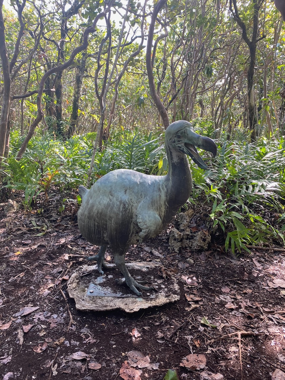
The Dodo’s Warning
The development of the sugar cane industry coupled with a growing population not only caused social misery but also meant the end of the vast majority of the native flora and fauna. Forests were cleared, ebony disappearing first as the pitch-black and very dense hardwood was popular in Europe for making furniture. These cleared areas were then use for sugar cane plantations. Like on Rodrigues, an infamous indigenous, flightless bird became extinct: the dodo.
The timespan between the dodo’s first discovery by humans to its extinction, also caused by humans, was less than a hundred years. Never before had the world seen an animal’s demise within that timeframe. The dodo therefore became representative of animal species extinction by humans and the national symbol of Mauritius. The ill-fated animal lives on to remind us, and warn us, of the consequences of human behaviour and greed.
Nature Restoration
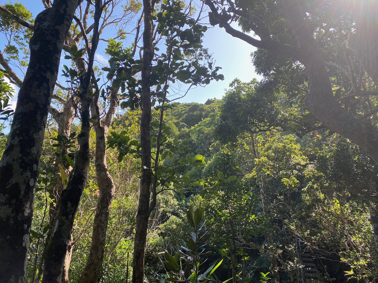
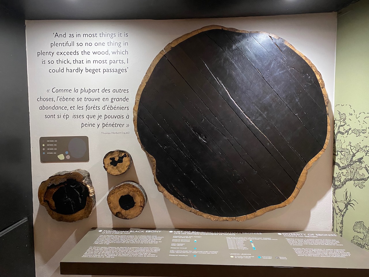
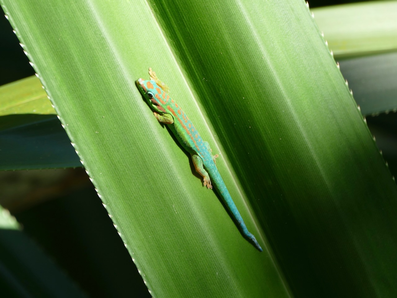
But there is hope. In the protected ebony forest, a private initiative of nature lovers, descendants of the ebony trees felled by our ancestors are thriving once again. We can admire them up close on a guided tour. As we lift a piece of ebony wood, we understand why it does not float in water but sinks. The hard wood has such an enormous density. The guide also points out other native plants and animals in the park, such as a beautifully coloured gecko. The rewilded forest gives them back their natural habitat, allowing biodiversity to expand again. We even spot some of Mauritius’s endemic birds, like the pink pigeon and the echo parakeet which have become extremely rare. Nature really shows its resilience here. It proves that if we give nature a helping hand and space, it can thrive again. The tortoises on Rodrigues and the ebony in Mauritius demonstrate what’s possible. We know how to do it, and we can do it. Now we must act accordingly, so the dodo didn’t vanish in vain.
Moored in Port Louis, Mauritius
Mauritius sugar cane
Sugar cane and settlements have largely replaced the indigenous forests on Mauritius
Multi-cultural Mauritius
Hindu temple on Mauritius
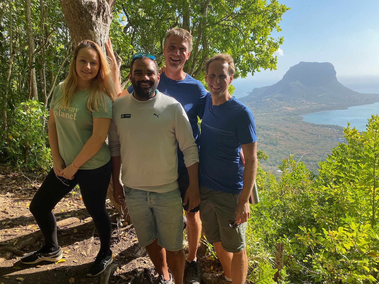
With our Mauritius friends Katya and Julien
The Dodo lives on in our imagination
Ebony trees thrive once again in the Ebony Forest
Ebony wood is black and hard
Colourful lizard in the Ebony Forest
Breathtaking protected nature on Mauritius
At Sea Again: Forces of Nature
It’s only a short trip to the neighbouring island, La Réunion, but a tiring trip, nonetheless. “I rolled the genoa away to slow us down, so we will arrive with daylight”, Ivar mutters when he hands over the watch to Floris at four in the morning. Exhausted, he disappears into the watch bunk. Floris has hardly slept and looks dazed. Clearly, 24 hours is too short a sail to get into the flow again of crossing the Indian Ocean.
We slowly sail on, until countless streetlights show us the way to our next destination. Above this unnatural glow, a menacing black silhouette emerges against the clear starry sky. The gigantic cone shape betrays the volcanic origin of this island, the highest peak of which towers no less than three thousand meters above the sea. Just a moment ago the ocean was a dizzying four kilometres deep. The huge volcano is therefore even larger under water than above it. With such extraordinary geology, we wonder – what other natural forces will we find here?
France with a Tropical Touch
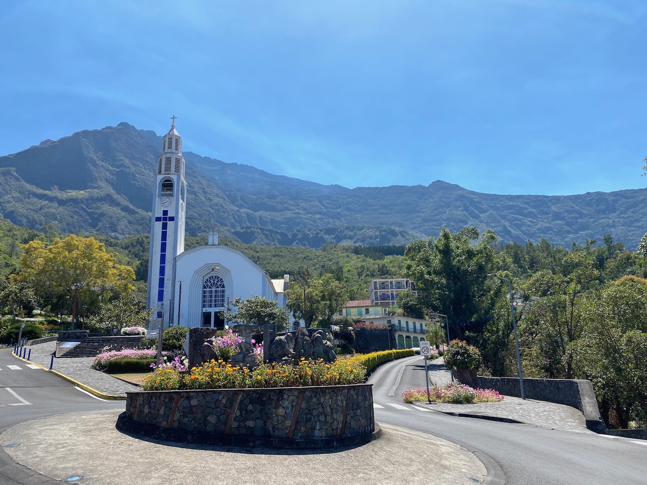
At daybreak, we’re only a few miles from the port of entry, aptly named Le Port. Suddenly, our momentum stops completely, and the mainsail begins to flap lazily in the slow rhythm of the ocean swell. We secretly hope that the wind returns but we know better: Luci floats in the wind shadow of the island. Steep, dark green mountain walls rise above the coast and give La Réunion an almost magical welcome. “A kind of primeval landscape”, Floris says. He stares at the lush scene as we calmly motor into the harbour.
The island is an overseas department of France and therefore officially French territory, so Floris calls port control in French. We receive a very friendly welcome and are allowed to moor at a quay next to the full marina. La Réunion is part of the European Union, so checking in with the authorities is easy for us. Once ashore we indeed imagine ourselves in France. The language, bakeries, cars, even the fonts and colours on the road signs are all distinctly French. And of course, yet somewhat exciting in the middle of the ocean, all prices are in euros. Unlike France, it feels exotic due to its tropical landscape, high temperatures, and mixed population. It is a colourful blend of European and local French, Indians and Creoles – who in turn are a mix of Africans, Asians and Europeans.
Crater as Shelter
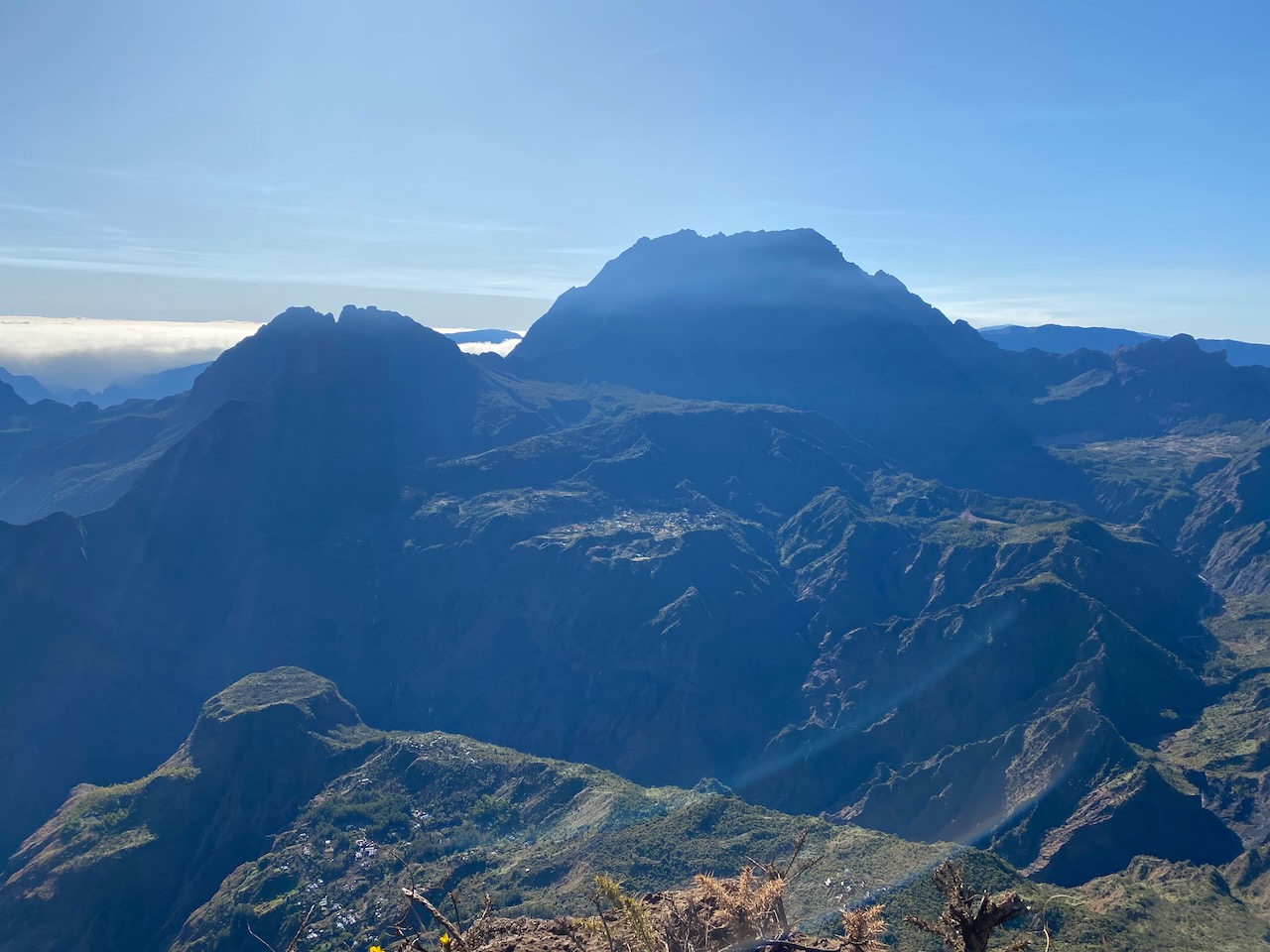
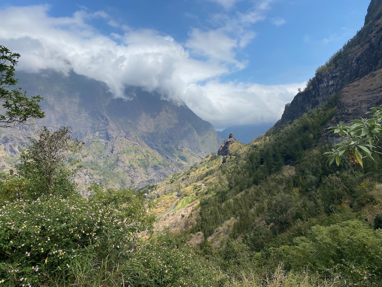
On an excursion to the interior, we learn more about the eventful history of La Réunion. We start on a highway that circles the entire island, after which we cross a valley with vertical rock walls on both sides that almost hermetically close off the interior from the rest of the island. Behind it lies one of three cirques: craters that formed after parts of the volcano collapsed. The one we visit first, the Cirque de Mafate, can only be reached after a long walk on an endless winding path.
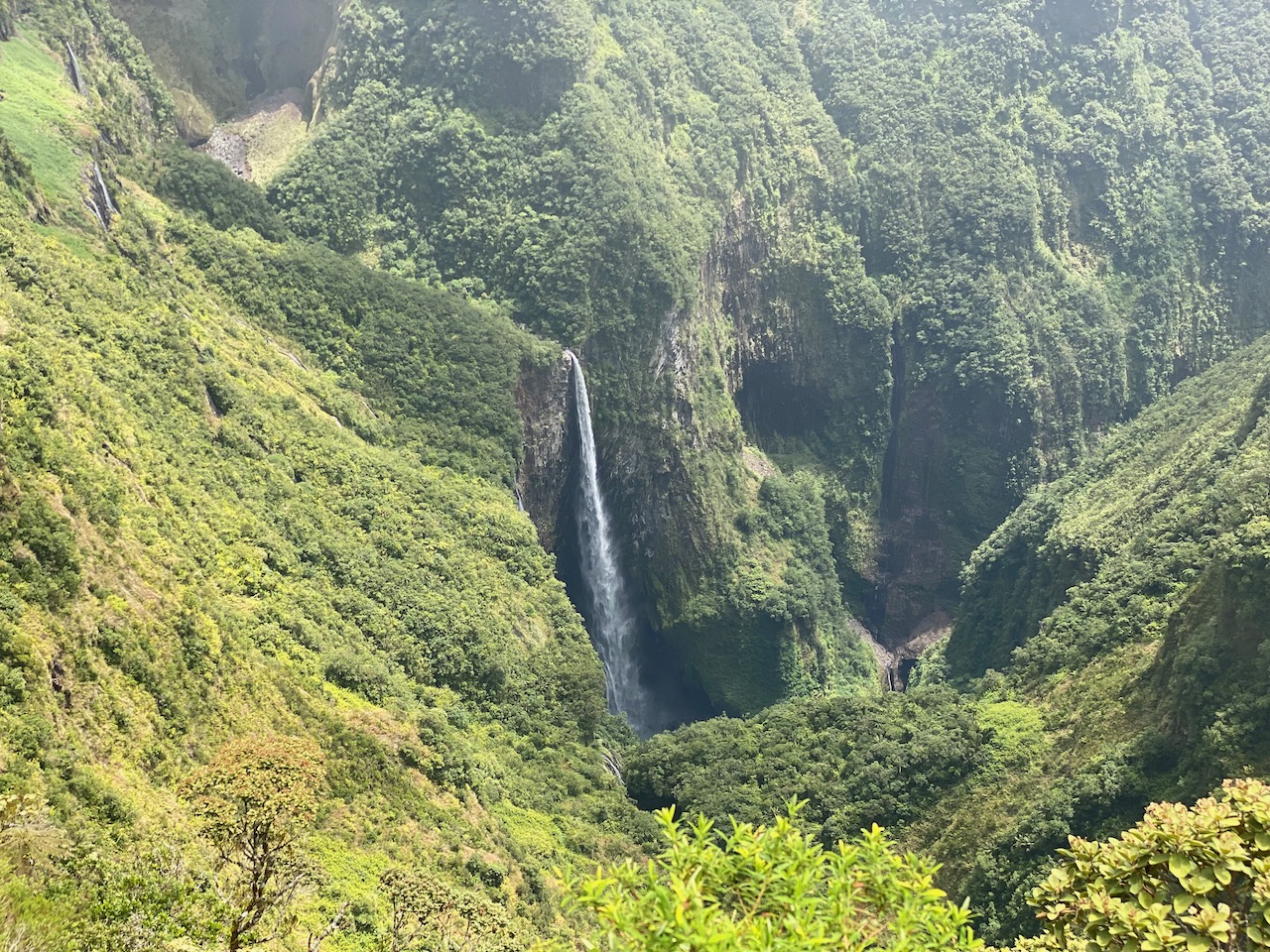
Because of the heat, we choose the lazy option to get to the viewpoint: by car. The route takes us over narrow, steep roads through small villages and past grassy meadows with cows. It gets steeper and steeper. One hairpin bend follows another. The point panoramique is on the edge of a precipice. Below us is a vertical drop, unfolding the view on a stunning, circular valley. In the distance, the walls are bright green and waterfalls plunge into the depths; all under the watchful eye of the highest mountain peak. We look around breathlessly and try to imagine the natural forces that formed this landscape.
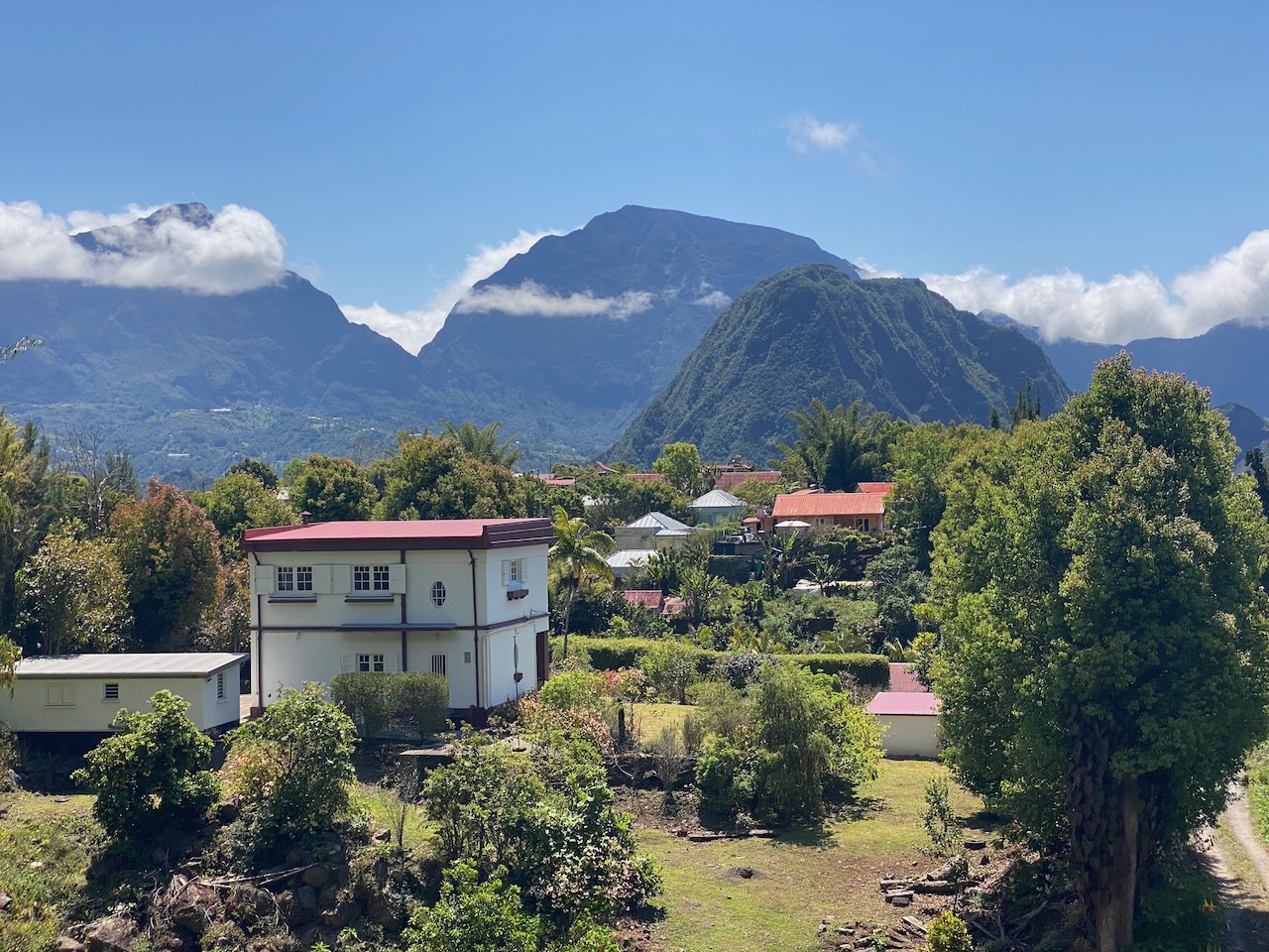
Just like in Mauritius, until the 19th century French colonists employed enslaved Africans on sugar cane plantations. Those who managed to escape this plight of existence went into hiding in this inaccessible valley. The contrast between the misery of the past and the overwhelming natural beauty could hardly be greater. After the abolition of slavery, many stayed here, safe in their valley. Between the green we see small houses with solar panels and vegetable gardens around them. The fact that the residents still must walk for hours to get to the rest of the island apparently does not outweigh the sense of freedom they still experience here to this day.
We can’t get enough of this beautiful area and visit the other two neighbouring cirques. They burst with indigenous plants, steep waterfalls, panoramic views, and picturesque villages. During our hikes we marvel at the wild and capricious landscapes formed by volcanic eruptions eons ago.
Nature’s Fireworks
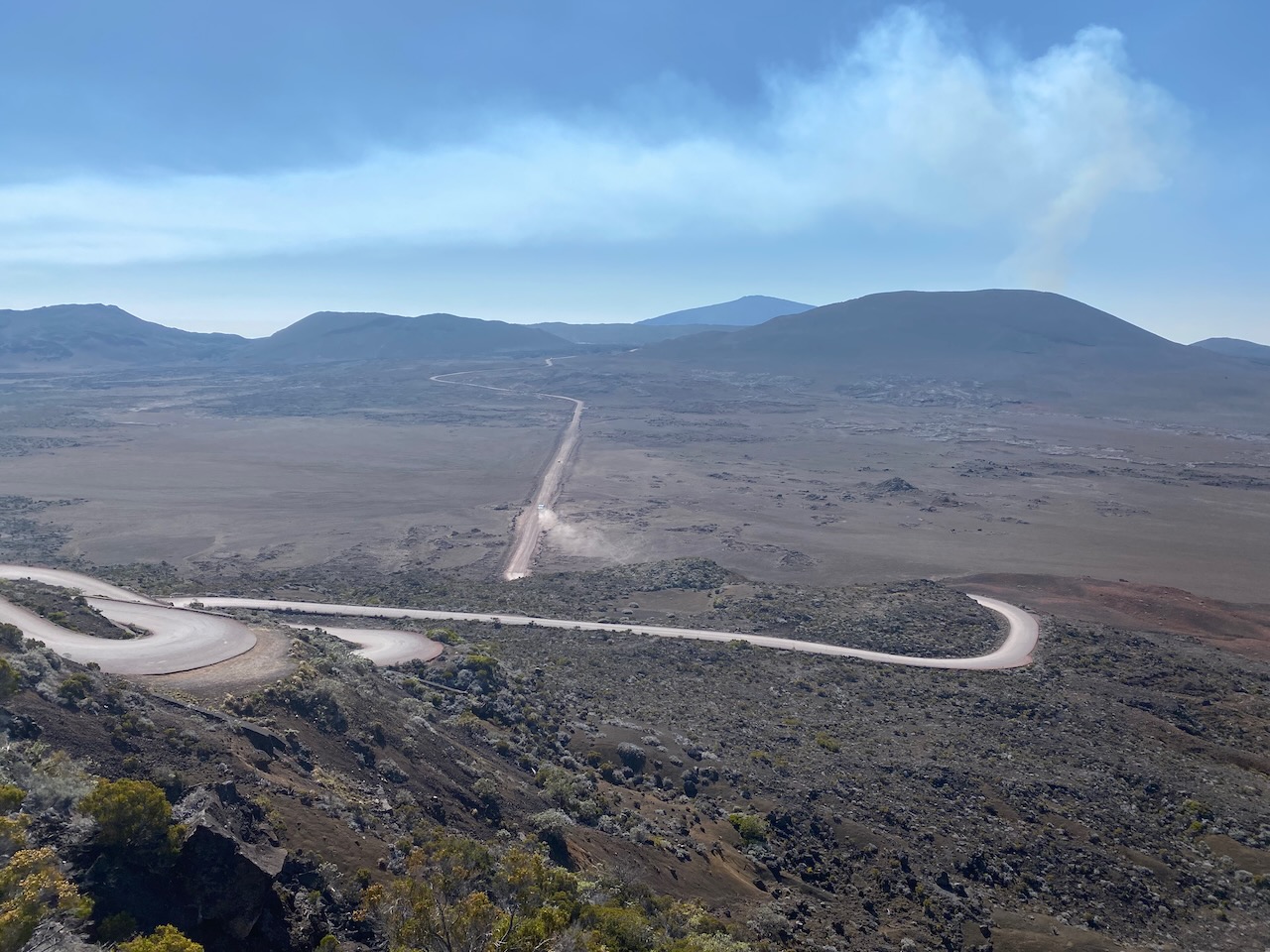
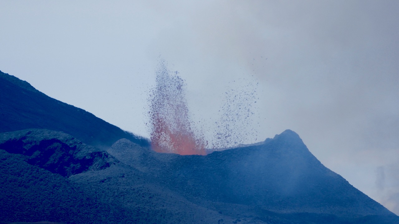
Past and present meet on the south side of the island. At the Piton de la Fournaise, the forces of nature are still active. Long before we reach the top, we see the influence of the volcano on the landscape. No trees and plants, only brown, grey and black boulders from pieces of lava, hardened over time after previous eruptions. A cloud of smoke rises in the distance; we are undeniably close.
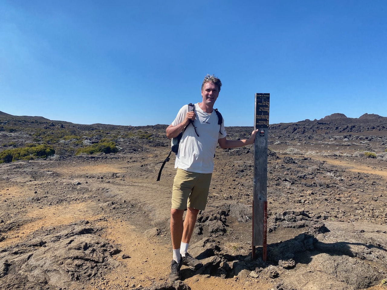
We park and hike the rest of the way through the rugged, deserted landscape. To see these natural fireworks as well as possible, we walk on until signs and ribbons make it clear that we are not allowed to continue any further. With a hellish noise, the crater continuously spews glowing pieces of lava into the air. They cool in flight and descend to earth as steaming black chunks. We watch in awe as the lava fountain rises even higher. “There is so much geothermal heat here. Surely, renewable energy could be obtained from that?”, Ivar wonders as we walk back. “In New Zealand they know how to put that heat to good use”, Floris replies, thinking of our visit to a geothermal power plant there.
La Réunion at dawn
Sun-dried laundry in La Réunion
View on Cirque de Mafate
One of the many waterfalls
Deep valleys, narrow roads
Not a bad place to live
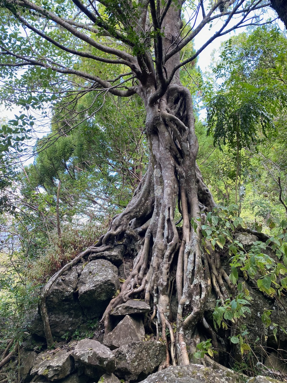
Extraordinary trees
La Réunion’s stunning interior
Another picturesque village
On our way to the active volcano
We follow the hiking trail until the end
Nature’s fireworks
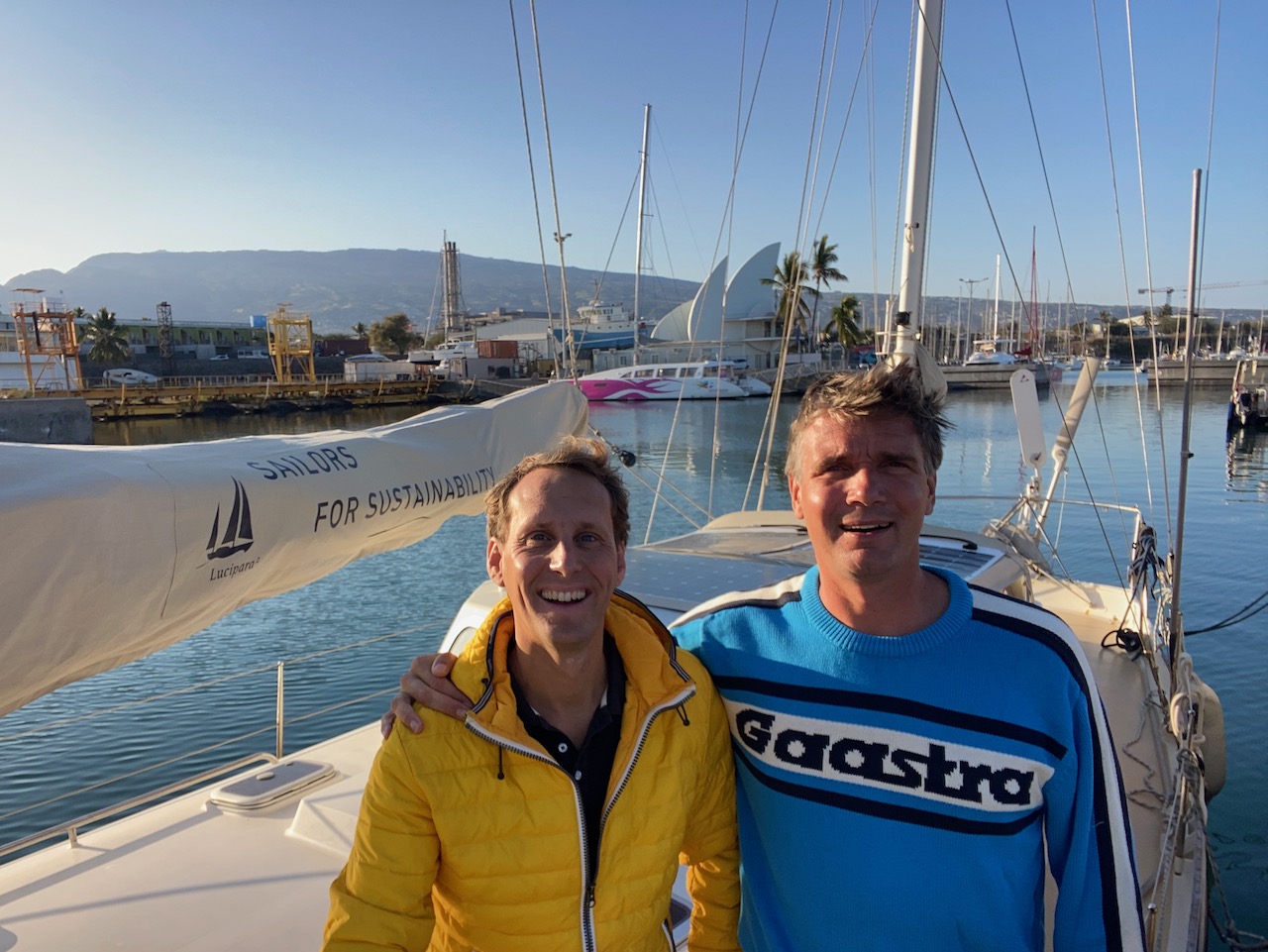
Ready for our last leg to South Africa
More Tense than Usual
Back on board we hardly have time to recover from all the impressions. A favourable weather forecast promises us a window that could get us to South Africa before the hurricane season. This section of crossing the Indian Ocean, from here to Richards Bay, is perhaps the most challenging of our journey so far.
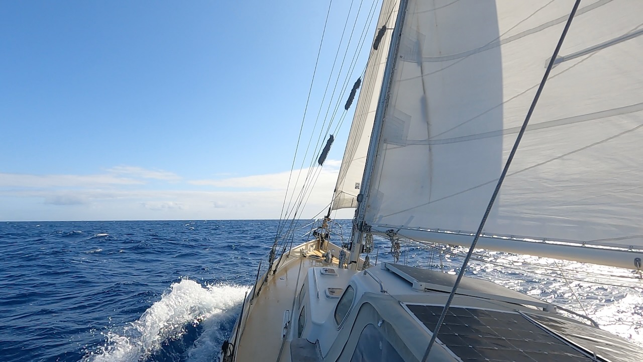
When we check out, cast off the mooring lines and hoist the sails, we notice that we are a bit more tense than usual. We put Luci on course southwest, with about 600 miles to go to the first waypoint – south of Madagascar. Will we be spared the destructive forces of nature in these infamous waters?
Notorious, More Notorious, Most Notorious
We’ve had tough sailing conditions before, Floris remembers. Like in Patagonia, where we sailed along the Argentinian coast to Staten Island with strong winds and nowhere to hide. Or during the crossing from French Polynesia to New Zealand, when a fierce storm overtook us at the start of the hurricane season. But this journey of more than 1,200 miles is of a completely different order.
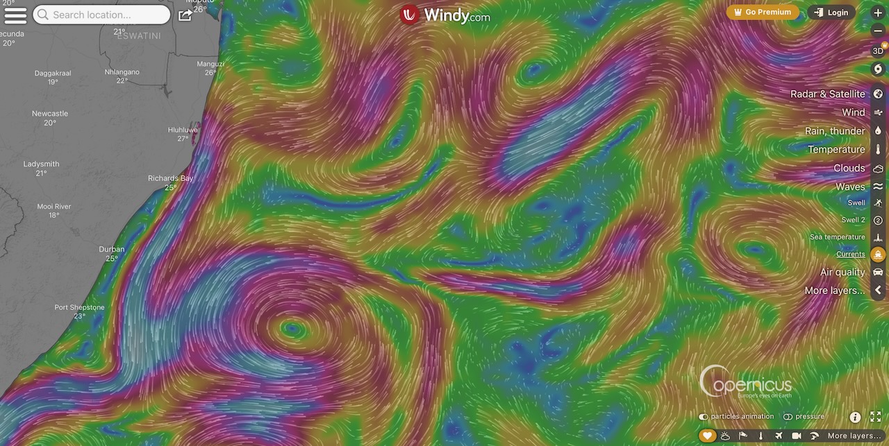
The devil is in the tail end of crossing the Indian Ocean because of the infamous Agulhas current, which pushes massive amounts of warm water southward from the Indian Ocean. Close to the South African coast it can reach up to eight knots. Moreover, depressions regularly squeeze around the Cape of Good Hope, which then make their way towards us. As a result, we could encounter gale-force winds and large waves that, as they run against the Agulhas current, steepen and break. Such monster waves can reach a height of more than ten meters and are life-threatening, for any vessel. Many large ships have been engulfed by the ocean in this kind of weather over the centuries. The sea area we are heading to is therefore Notorious with a capital N.
Weather Guru Des Cason
Experiences of other sailors do not reassure us. We hear that no one can cross the Indina Ocean and reach the South African coast without encountering at least one front or depression. Fortunately, we are not facing this challenge alone. Retired world sailor Des Cason helps us interpret the weather information and determine our tactics. From South Africa, he accompanies countless sailing yachts on their passage through the difficult Indian Ocean. Completely free, from the goodness of his heart. We send him our position, course and speed every morning. A few hours later he e-mails the weather forecast and advises us on the best route to take. It’s very useful, particularly with our slow satellite connection on board. He oversees a larger area from shore and has more sources of information.
Easterly trade winds make for an easy first part of our final leg of crossing the Indian Ocean. However, Madagascar’s high mountains influence and compress these winds, so Des advises us to give the islands’ south cape a wide berth. “The wind in the acceleration zone is expected to exceed 40 knots”, he writes. “Ok, but if we move that far South that means we will get deeper into the sea area where depressions can occur”, Ivar responds. Des has a tactic for that too: “If a depression is coming, you can turn north into the Mozambique Channel. The fronts lose strength there. I can then pinpoint exactly where the Agulhas Current is so you can avoid it if the weather conditions are too dangerous.” That reassures us. We follow his advice and sail south.
Mozambique Channel
To be on the safe side, we reef our sails even further. We certainly don’t regret it. On only a double reefed mainsail we go at full speed, with more than 30 knots of wind from behind. “We’re about 150 miles south of Madagascar! I’m glad we listened to Des and didn’t cut corners”, Ivar concludes.
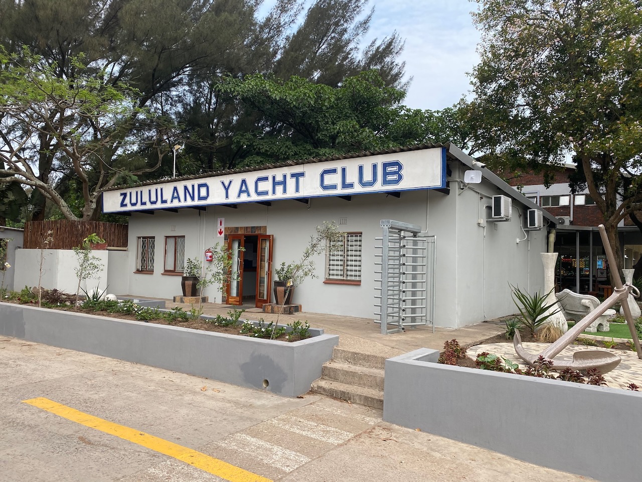
After passing our half-way point, the Mozambique Channel opens up. We sail westward, while a calm north wind gives way to a calm south wind. Twice a day we nervously check the weather forecast, but to our great relief the depressions don’t appear. Des also sees no obstacles ahead to Richards Bay. We chose this northernmost South African port because the Agulhas current is stronger further south. In addition, the local yacht club there is known to be safe and friendly.
Disturbed Weather Patterns
Des notes that the weather in this cruising area has been depression-free for almost two months now, which is highly exceptional for the time of year. We had also noticed in the Indian Ocean that the weather behaved differently than usual: we did not get the usual trade winds, but a low-pressure system instead. It developed into a tropical depression which we barely managed to avoid. At about the same time, Pakistan was experiencing catastrophic flooding. “Weather patterns are significantly disrupted in various regions. It’s just one of the many manifestations of climate breakdown”, Ivar analyses.
Whales and Wine
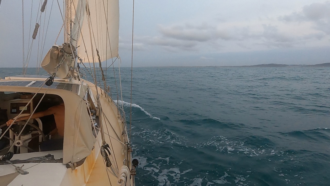
Smoothly, we sail towards the coast. The last part of crossing the Indian Ocean we keep to the north to compensate for the two-knot strong southerly current. As Richards Bay finally comes into view, a humpback whale suddenly surfaces next to the boat. The impressive creature exhales and shows us its tail, as if it’s welcoming us to South Africa.
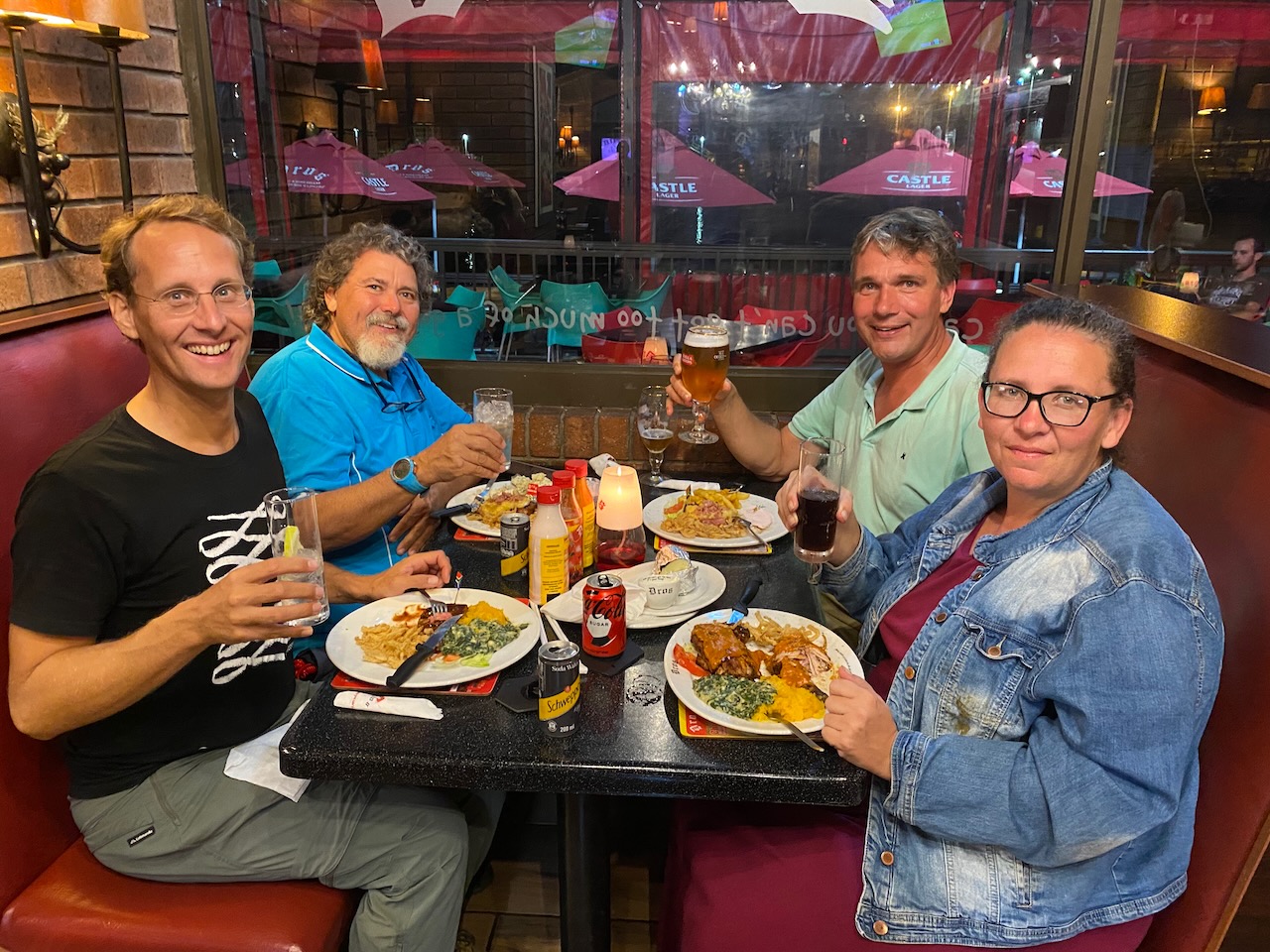
Richards Bay is an important industrial port for the export of coal and ore, so the waterway is deep and well-marked. The port control grants us permission to enter, and we make our way to the customs quay. As we moor, an energetic South African lady named Natasha hurries over to welcome us. She helps foreign sailors deal with the authorities and even offers us a ride to customs and the shopping centre for fresh groceries and a SIM card. What a heart-warming service!
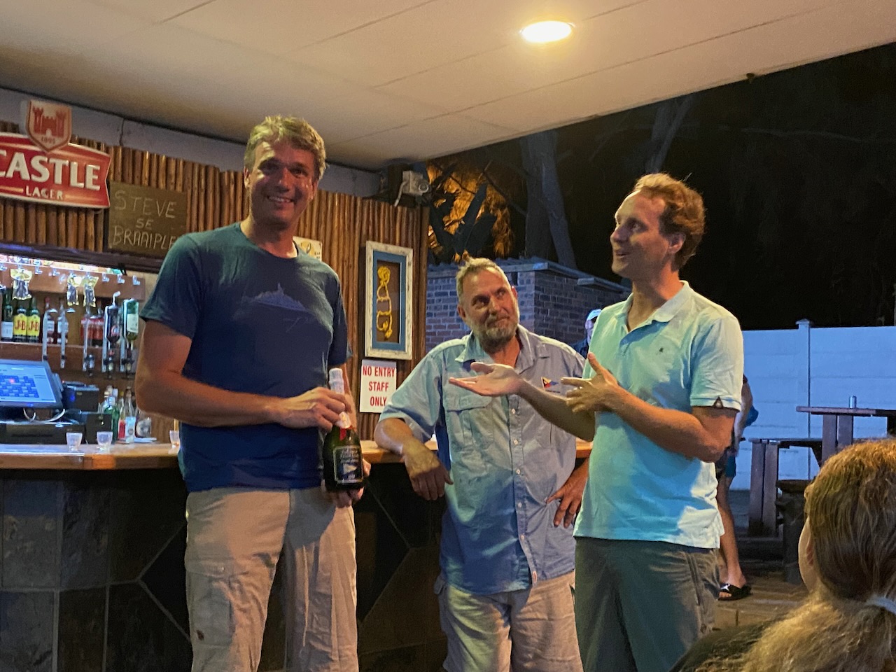
She introduces at to the town’s marina, the Zululand Yacht Club. Later that week we attend a reception party, at which the commodore welcomes all international sailors. He even hands us a bottle of sparkling wine – we’ve never experienced that before! At the braai, the South African barbecue, we toast with all the local and international sailors. The evening becomes more and more cosy as we drink and share stories. We feel euphoric.
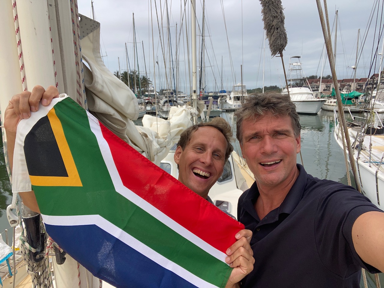
After leaving New Zealand only five months ago, we managed to achieve our goal of sailing 10,000 miles in one season, crossing the Indian Ocean to South Africa before the hurricane season, without major storms and monster waves! Now in South Africa, we marvel in the glory of our trip amongst welcoming and warm company. We can’t believe our luck!
South Africa here we come!
The Agulhas-current as forecasted by Windy
Our first view on South Africa!
We’re in South Africa!
A warm welcome with Natasha and fellow sailor Guy
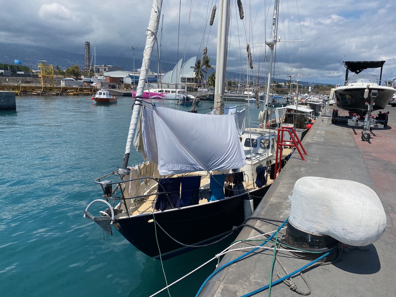
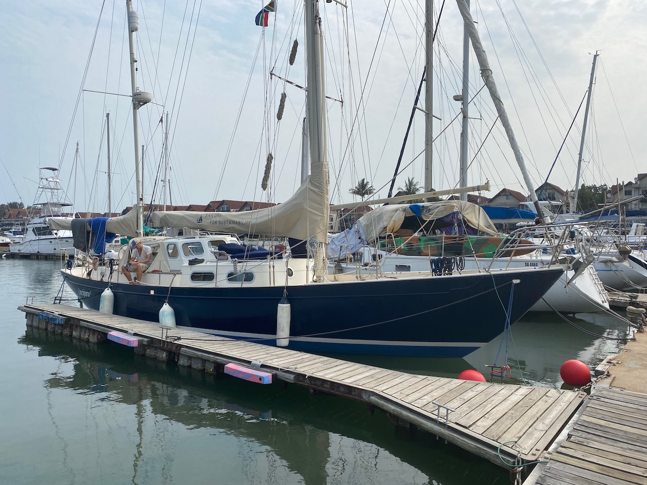
The only remaining marina in Richards Bay
Berth in the Zululand Yacht Club
Warm welcome by the Yacht Club Commodore Himself
Bestel ons boek - Order Our Book
Het boek uit over onze zeilreis van ruim acht jaar rond de wereld op zoek naar duurzame oplossingen: