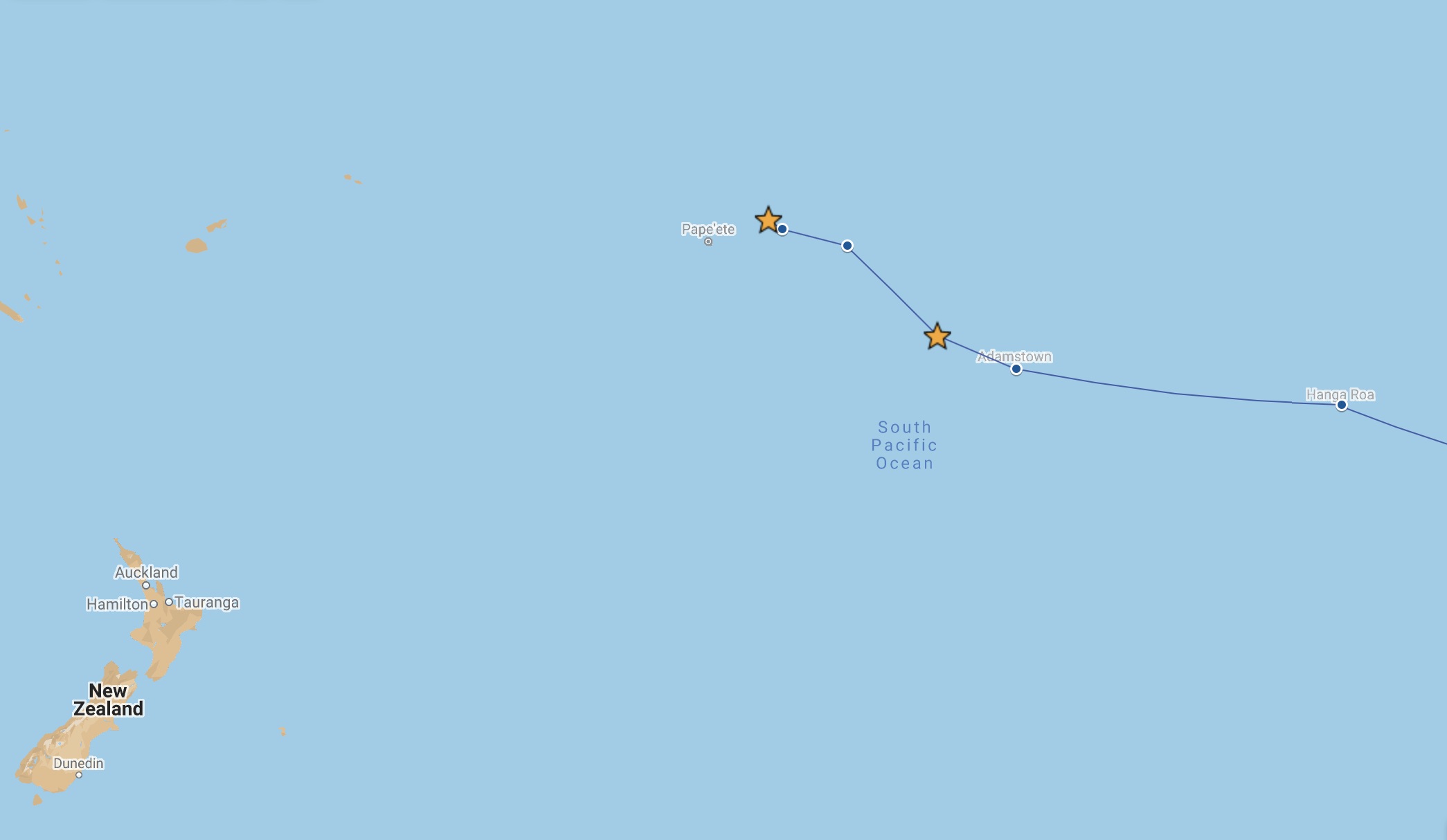
As we sail through the Tuamotus in French Polynesia, we discover large picturesque atolls that are teeming with underwater life, especially sharks! There’s a good reason for that, we learn.
Gambier – Fakarava (PYF)
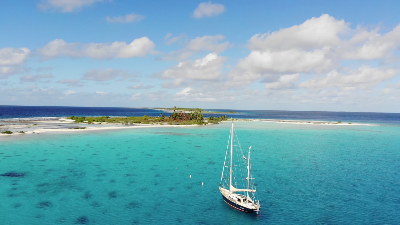
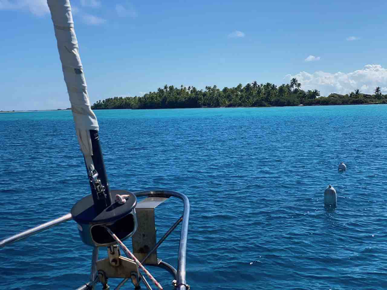
“There! I see an opening!” Floris shouts from the bow. “Keep the church to starboard!” Okay, Ivar nods. He is on high alert. Soon after leaving Gambier we entered an area in the Pacific known as the Dangerous Archipelago. The islands here are historically notorious among seafarers because they are not more than coral rings which rise about a metre above sea level. It makes them difficult to spot from a distance. Waves violently break on their shores as if to warn: stay away! Yet now we are heading straight towards the coral. Or rather the narrow gap in the coral ring, known as the pass. The waves don’t break here, but there is another challenge: strong current. As we get closer, we can see the water flowing out with great force. Underwater formations cause turbulence: eddies. Did we time our approach to coincide with slack tide accurately, we wonder?
Mixed Beginnings
When we left Gambier four days earlier, the ocean felt a bit unfamiliar. After having been sheltered by Gambier’s coral ring for more than three months, the swell of the endless Pacific Ocean was not something we looked forward to. Fortunately, the sea is calm and the wind is just strong enough to fill our sails. Ivar has no problem getting back into the rhythm, as Luci moves smoothly over the long waves on a beam-reach course. Floris needs some time to adjust. He stays outside, observing the horizon. Although he can hardly see them, the digital charts indicate that there are coral islands everywhere around us. The ancient Polynesian seafarers had noticed that too, which is why they named the archipelago Tuamotus. It means “many islands” in Polynesian.
These islands are the flattened peaks of giant undersea mountains. Their volcanic origin has caused them to steeply rise from the fathomless deep ocean floor some three thousand meters below. The craters have disappeared over eons of time, but a lagoon surrounded by coral is still there. This coral ring is largely covered with shrubs and coconut palms. “The Polynesian and European explorers would have killed to get their hands on our digital sea charts”, Ivar jokes. To avoid ship-wrecking on the coral, most seafarers would give the Tuamotus a wide berth.
Closing in on the pass at Amanu
Ecocide “Avant la Lettre”
Despite GPS and accurate charts, some of the Tuamotus are still avoided today. The reason is that the French army conducted 175 nuclear tests on the atolls of Moruroa and Fangataufa between 1966-1996. In his book “Journey into the Bomb”, skipper David McTaggart gives a thrilling account of how he and his crew sailed his yacht Vega from New Zealand to Moruroa to halt the nuclear tests. For months they sailed in international waters near Moruroa. Their protest became world news and contributed to the French government eventually becoming so internationally isolated that they stopped the nuclear testing program. McTaggart became Greenpeace International’s first chairman and led the organisation from 1979 to 1991.
The nuclear testing left deep scars in this area of the Pacific. The indigenous population suffered. Around 127,000 Polynesians worked on or were present during the nuclear tests. Elevated rates of cancer and other diseases suggest that radioactivity was the cause, although a sound scientific connection is difficult to prove because of limited information provided by the French Army. Out of 800 cases, only 11 people have received compensation. Nevertheless, since 1996 the French government has been making annual payments of €150 million to support the French Polynesian economy. The damage done to nature is debated, but the “Zone Interdite” warning on our digital chart in the area around Mururoa and Fangataufa speaks for itself. Sadly, these crimes against humanity and nature can never be undone. All we can do is learn from them and try to prevent such destruction from happening in the future. As far as we are concerned, it demonstrates once again the necessity of making ecocide a punishable crime under international law.
Treacherous Charts
For three days we pass atolls without an opening in the coral ring. We cannot stop there, as they provide no shelter from the constant ocean waves. That would make anchoring outside the ring very uncomfortable, if at all possible. The coral is typically very steep, making it challenging to find a spot suitable for anchoring. In addition, landing on the reef is difficult because of the breaking waves. Unsurprisingly, these atolls are mostly uninhabited and hardly ever visited by ships. Nature has free rein here, which we witness when we pass the uninhabited atoll of Vahanga within a mile. Boobies and other seabirds fill the sky and regularly dive into the sea close to our boat. Being able to breed undisturbed on land and with plenty of fish both inside and outside the lagoon must make it a paradise for them.
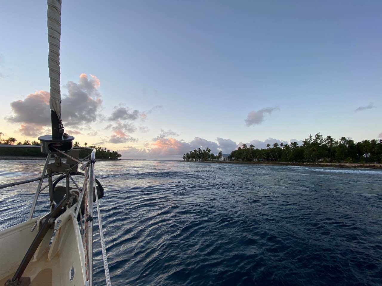
Our first Tuamotus destination is the atoll Amanu, which does have a passage through the coral ring to the sheltered lagoon. Because the oceanic tide pushes the water in and pulls it out of the lagoon here, the pass is notorious for its strong currents. When we arrive there in the middle of the night after more than 400 nautical miles and four days of sailing, we decide to heave-to until dawn. With the mainsail pushing Luci upwind while the rudder works in the opposite direction, we are more or less parked at sea. When daylight breaks, we sail towards the pass. It’s exactly high-tide according to our digital chart.
“This can’t be slack” Ivar shouts when he sees the strong current and eddies, “but we can still manage.” He carefully steers Lucipara 2 towards the middle of the channel between the palm-covered coral and Amanu’s white church. According to our charts, we are sailing over the reef, but from the bow Floris sees that it’s plenty deep. Slowly, with almost four knots of current against us, we move towards the lagoon. The tidal information of our charts is also clearly off!
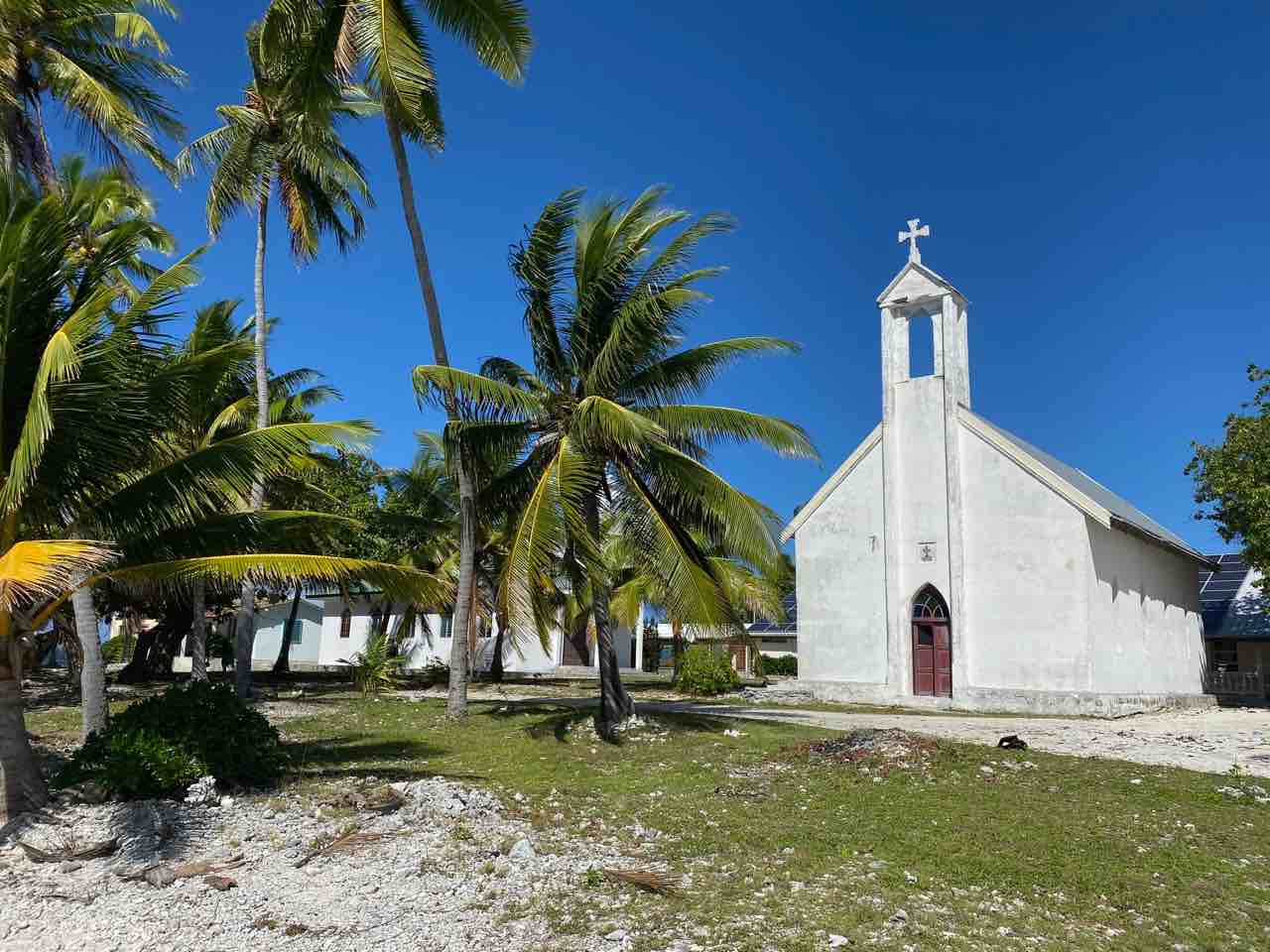
Amanu’s conspicuous white church up close
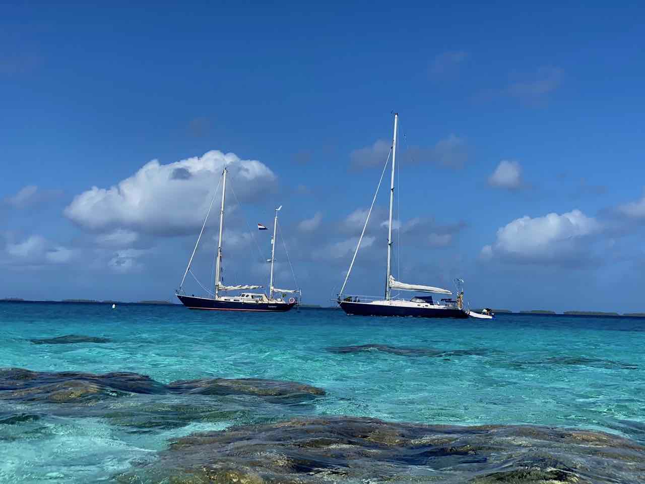
Anchored with SY Stormalong at Amanu
Relative Calm
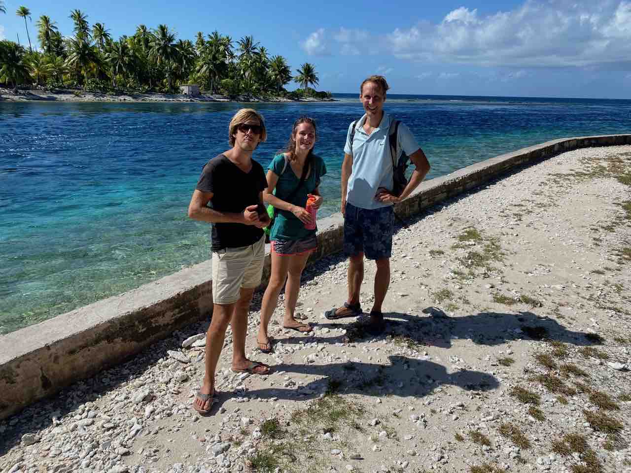
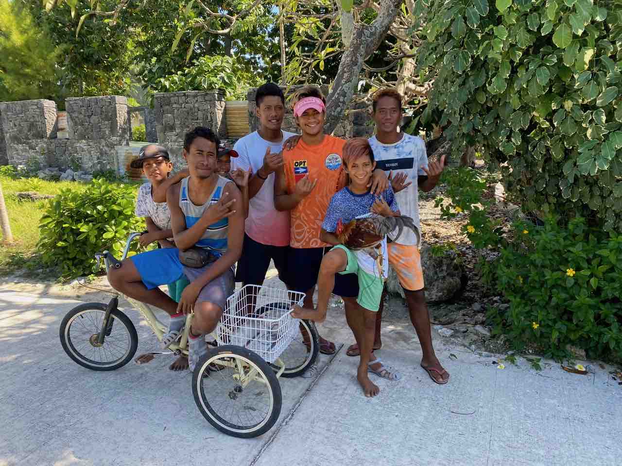
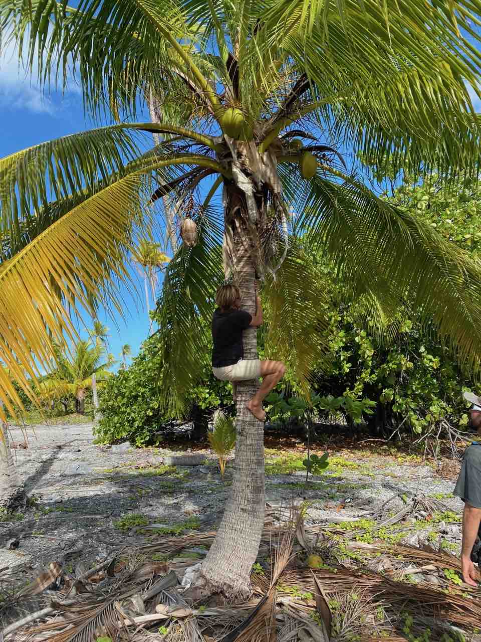
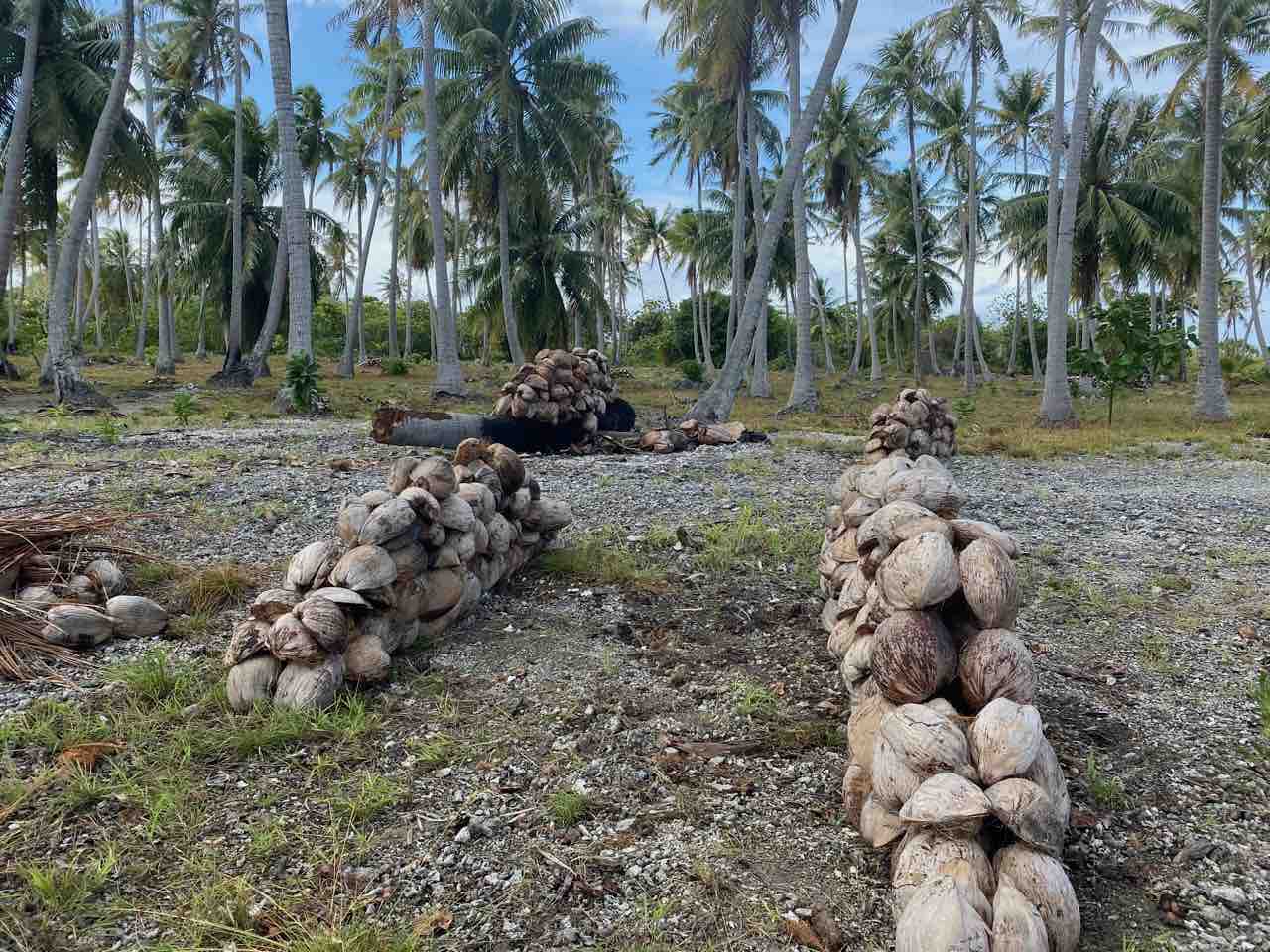
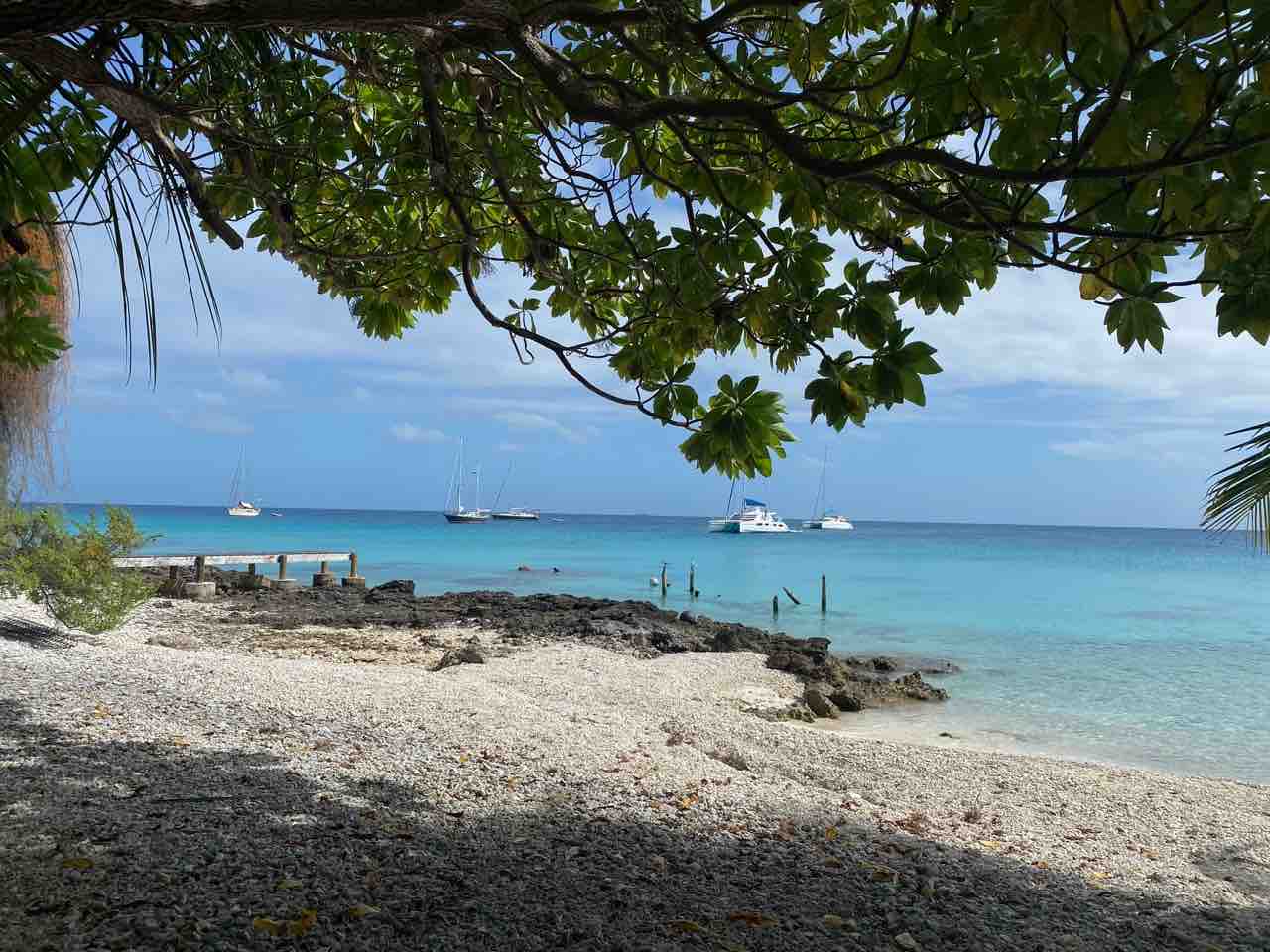
Fortunately, the pass isn’t that long and we manage to enter the lagoon safely. Once inside we gasp at how big it is! The island, or rather the lagoon, measures no less than 17 by 5 nautical miles, so we can’t even see the other side. A lagoon this big offers only relative protection. A strong breeze from the northeast causes a significant chop at our end of the lagoon. With the help of our Dutch friends Niels & Linette from SY Stormalong and Bertus & Jacqueline from SY Queen B, who arrived just before us, we manage to find a sheltered anchorage behind a reef. Not much after we have dropped the anchor, it’s time to explore! We snorkel at the nearby reefs and marvel at the beauty of the coral and the many colourful fish. Later we explore the small village near the pass and meet some friendly local people. The absence of any foreigners or tourist infrastructure is noticeable. All we see are homes, a couple of small stores, a town hall, a post-office and two churches. The people’s livelihood here seems mainly based on coconuts. We hike through large plantations with palm trees where the fresh coconut is dried in the sun. The dried coconut, or copra, is shipped in bags to Tahiti for oil extraction. We realize how very different life is here compared to Europe.
At the Amanu pass with Niels and Linette
Meeting the locals in Amanu
Niels on his way to harvest young coconuts
Drying coconuts at a copra plantation
Marine Biodiversity on Steroids
The next island we visit, Tahanea, comes highly recommended. Our pilot books and sailors who went before us cite it as a highlight of the Tuamotus. It has multiple navigable passes, is uninhabited, and its underwater biodiversity is unparalleled. How right they are. Through crystal clear water we watch our anchor set on the sandy bottom and instantly spot as many as nine curious sharks. Colourful triggerfish flock to our boat to nibble at the seaweed on our hull. And although we start to get used to picture-perfect postcard views, we still get excited when we look at the palm trees and white beaches right in front of us.
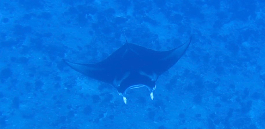
The next day we hitch a ride with our friends Chris and Fred from SY Sea Jay to reach one of the smaller passes. Fresh ocean water flows into the lagoon here, which means there is a lot of food, and thus many fish gather here. Although the waves are considerable and the current is quite strong, we feel safe in the pass with the dinghy floating close by. “Look, down there!” Floris shouts enthusiastically, having jumped in first. Majestic manta rays are feeding on plankton like big vacuum cleaners. With a wingspan of close to three meters, they effortlessly float through the water below us, as if in flight. It makes the black-tip reef sharks next to them look tiny.
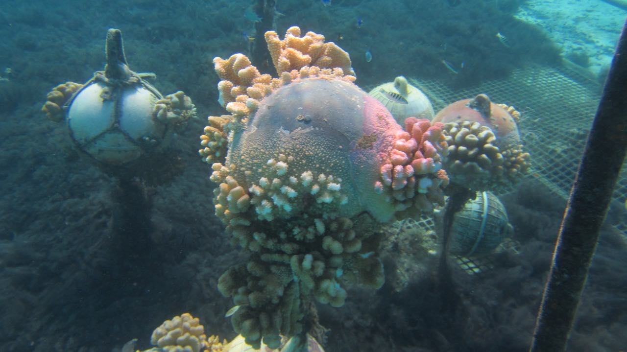
Our buoyed anchor chain prevents it from getting stuck around the coral bommies
Coral evens grows on abandoned buoys
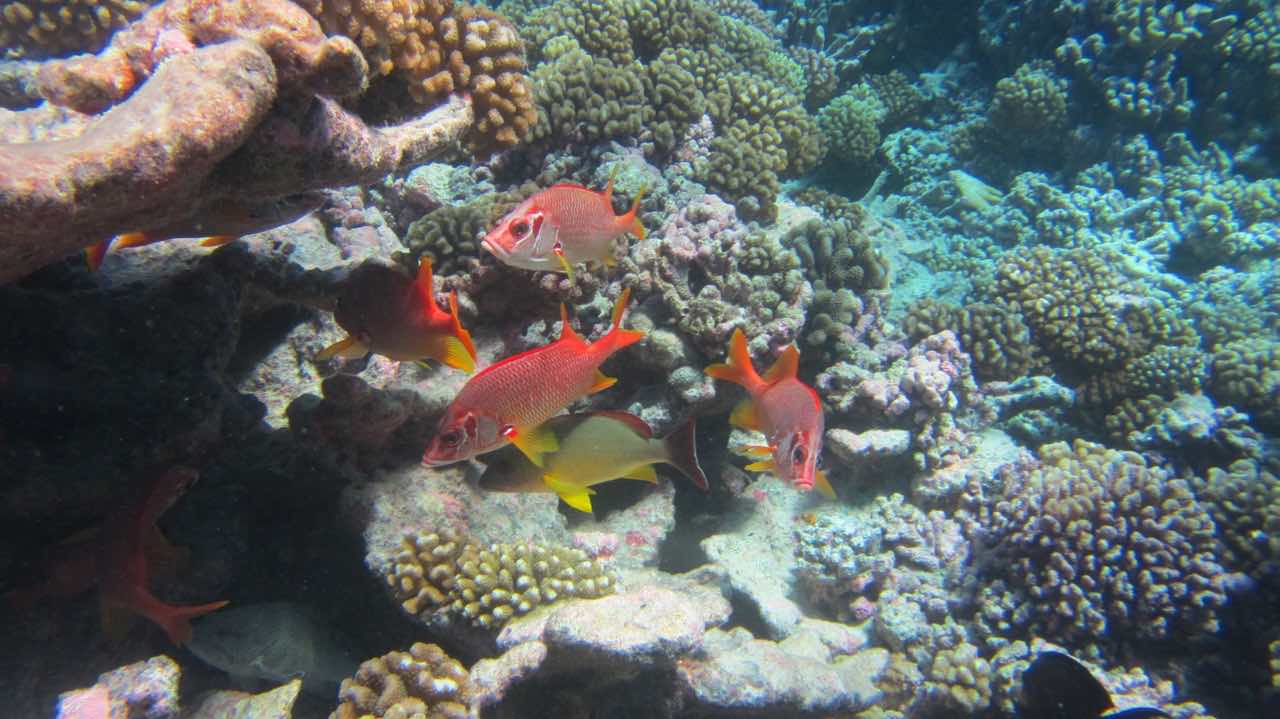
Colored fish take shelter between the corals
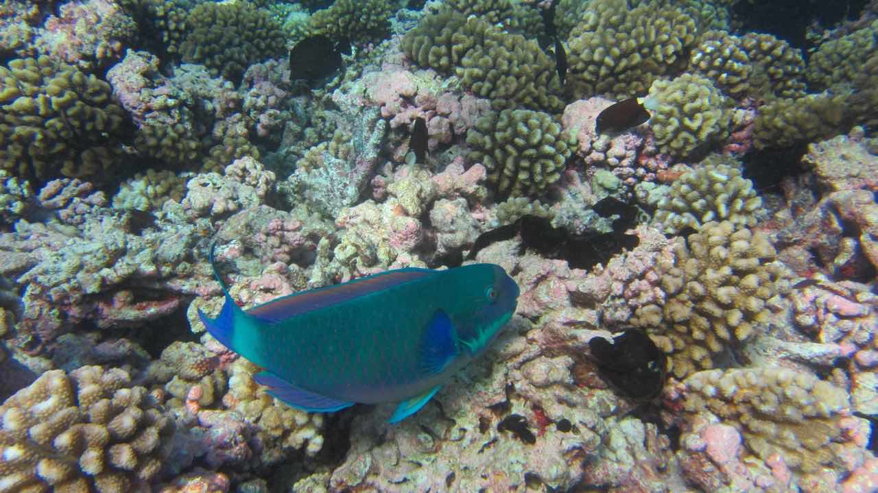
Blue parrot fish
Majestic Manta Ray
Paradise Community
Strong SE winds are forecast, which makes our anchorage next to the pass no longer comfortable. Like the other boats here, we sail some 10 nautical miles to the windward side of the coral ring. This part of the lagoon is on average about 40 meters deep, but here and there treacherous coral heads almost reach the water’s surface. Fortunately, they are well charted, and we can follow our friends’ track (thank you Christine and Matt on SV Sugar Shack). It leads to the southern end of the coral ring, where we find a good anchorage in shallow sand, in the lee of the coconut palms, and close to some 15 other boats, some of which we know from Gambier.
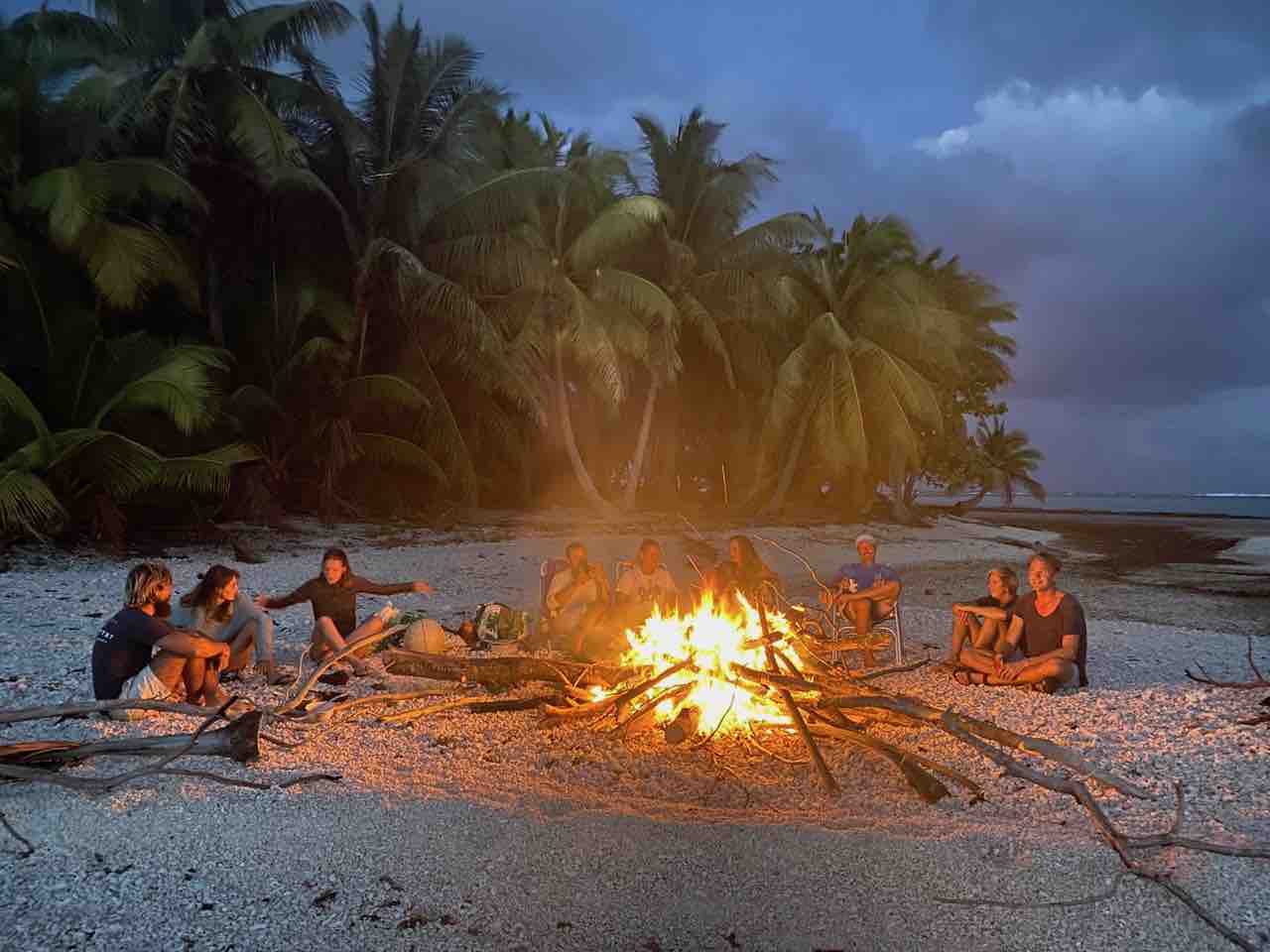
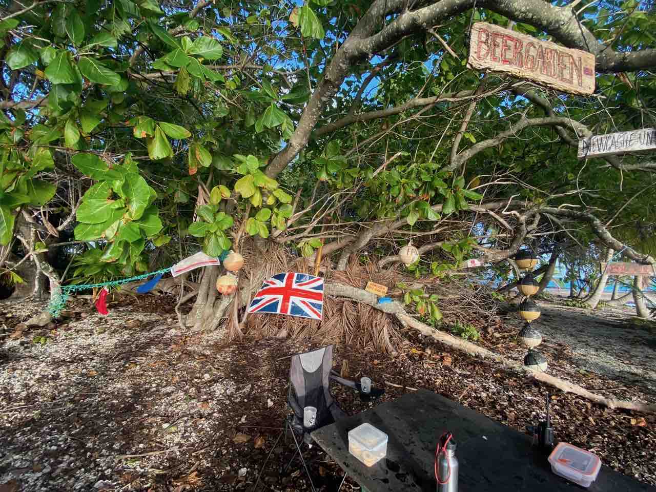
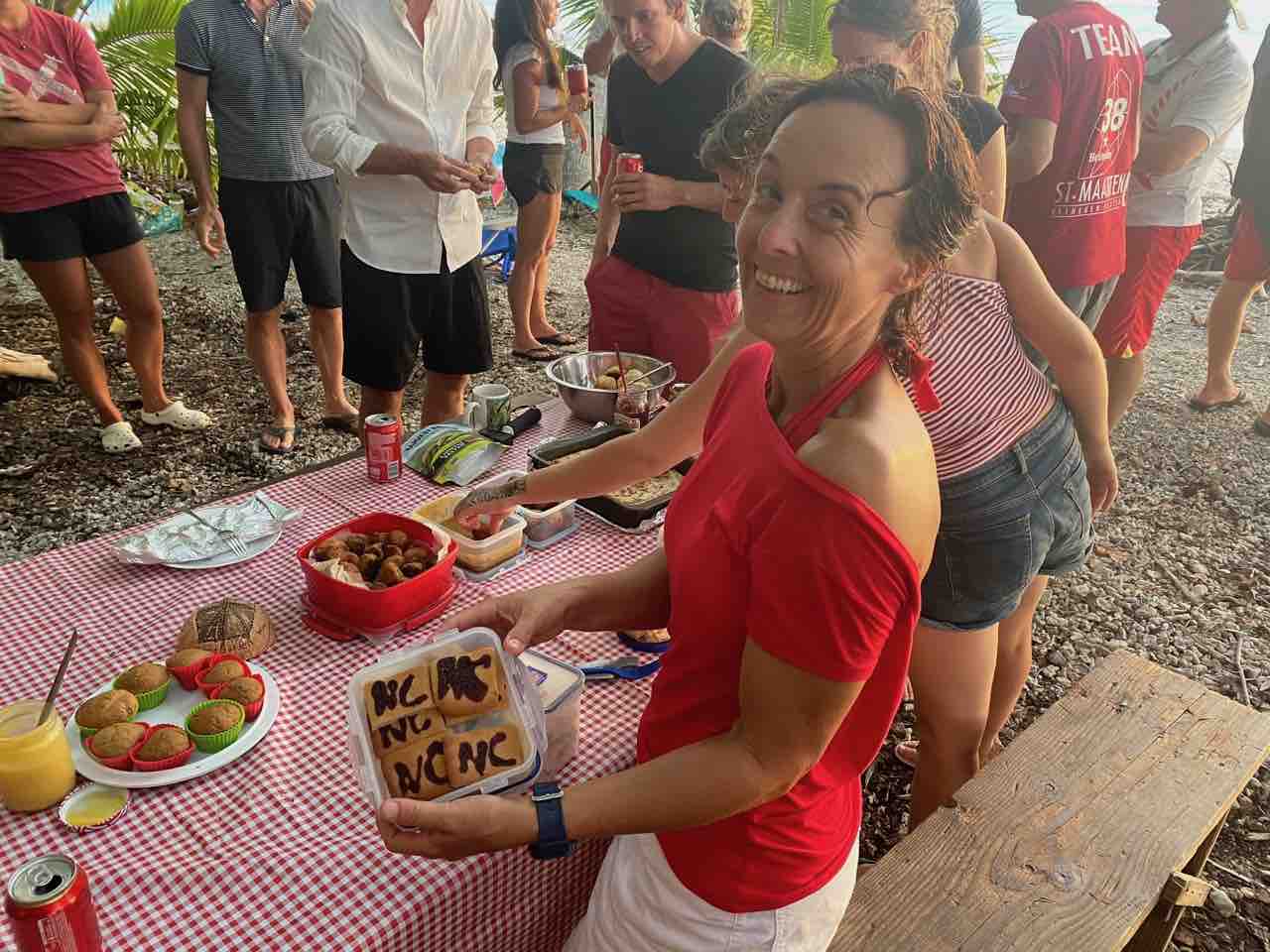
Yet more than half are strangers. It means that for the first time in months we meet “new” boats. Most of them sailed to the Pacific via the Panama Canal and spent the lockdown months in the Marquesas. It only takes one barbecue to get to know the British, Australians, Americans, and French crews of the other boats. It’s a potpourri of ages, food, and languages, which everyone seems to enjoy so much that it is soon repeated. More get-togethers follow, including a themed one. To take away a bit of the homesickness of David on SY WOW, his partner Helen turns the beach into an English pub. Hand-painted signs welcome us to The Collingwood, David’s favourite pub in Newcastle. Union Jacks hang from the trees, the sailors sport black and white (Newcastle’s colours) or red and white clothing (England’s colours), typical British food is served, and a pub quiz is held (won by the Dutch team). It’s no wonder that a true sense of community develops among the cruisers, so far from family and friends in such a remote place.
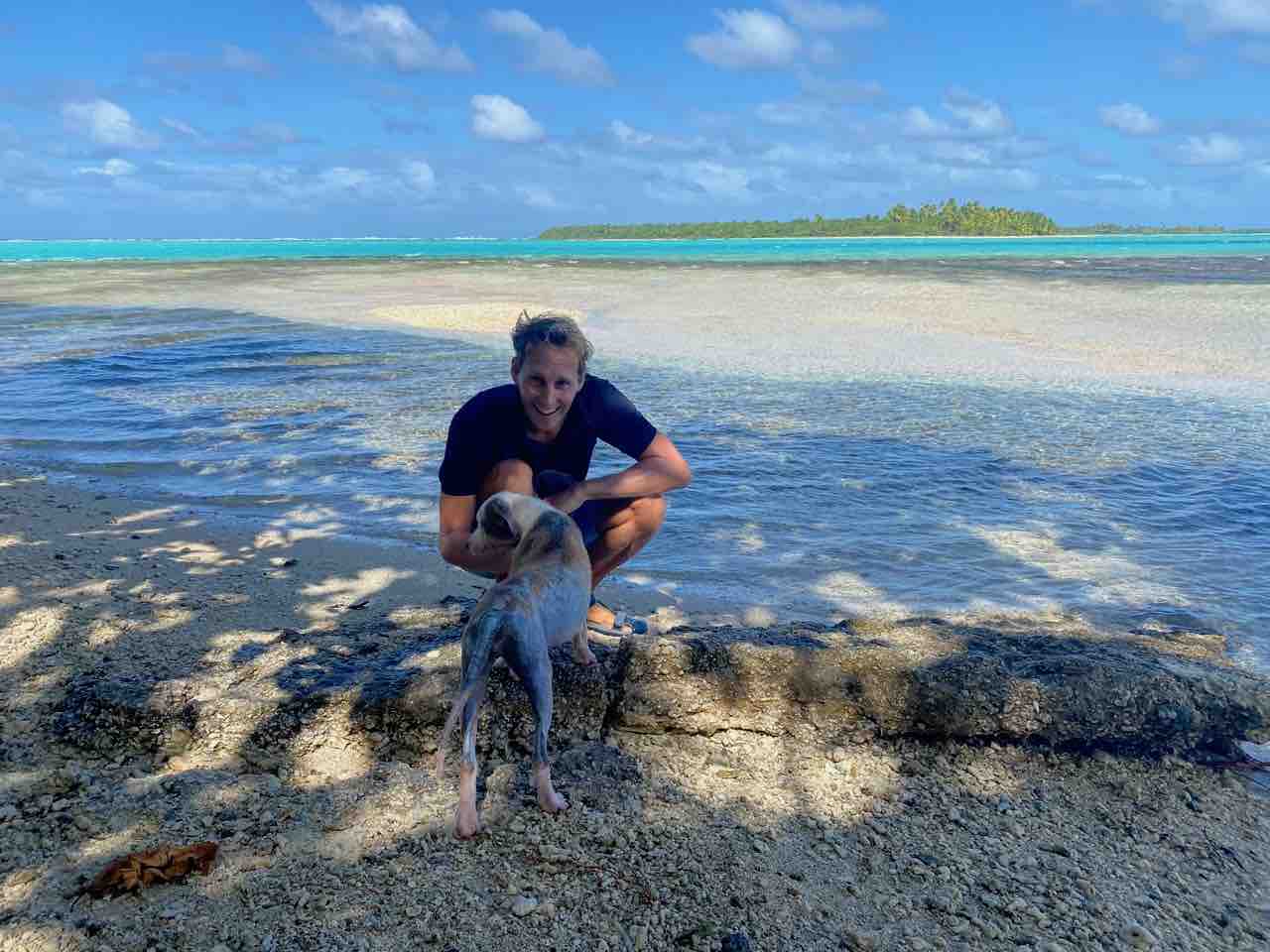
The community gets more serious and joins forces when an abandoned dog is found on the beach. Part of the island is a coconut plantation, which copra farmers from the neighbouring island periodically visit. Did they leave a young dog behind at their hut? It is emaciated and almost furless, but in high spirits. The cruisers soon take turns to feed Lassie and oil her sun-exposed skin. She gets healthier each day. Mike (SV Easy) is the last sailor of the group to leave Tahanea, so he takes her to Fakarava to be adopted by a local family. Kudos to Mike!
Meeting new crews on the beach
Newcastle’s pop-up pub
Helen shares homemade Newcastle biscuits
Walking Lassie
Baby coconut palm trees
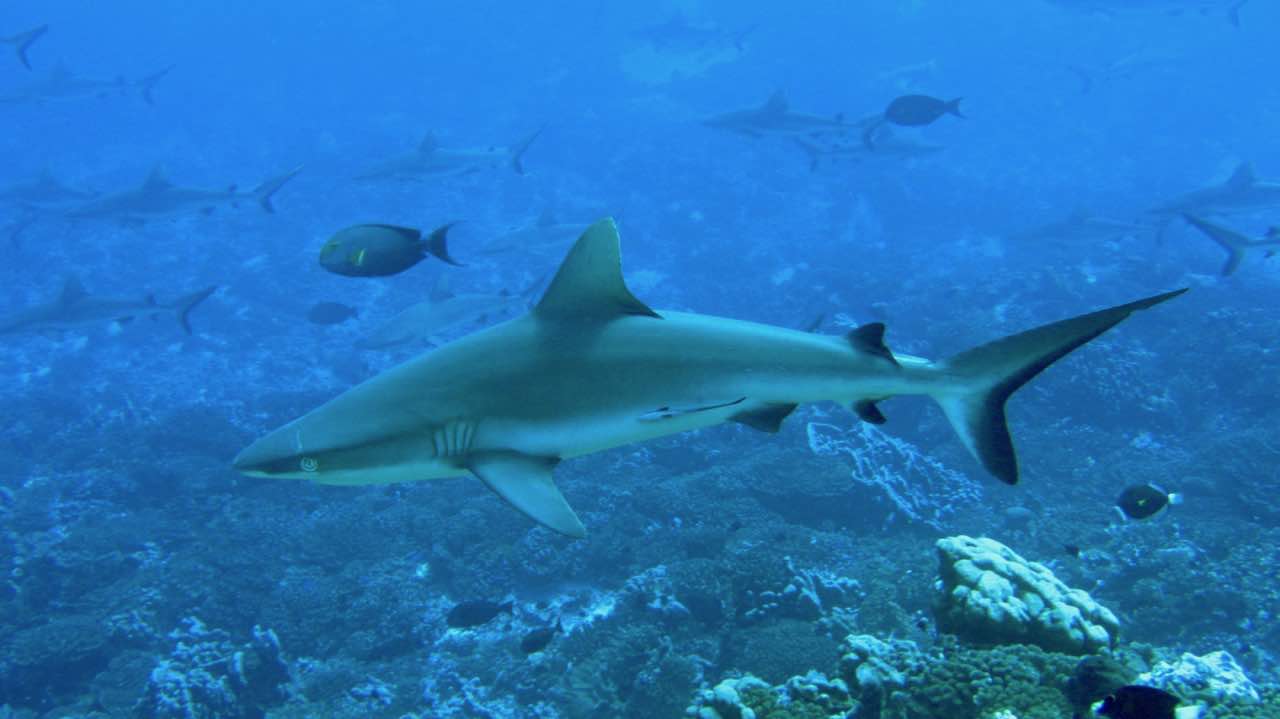
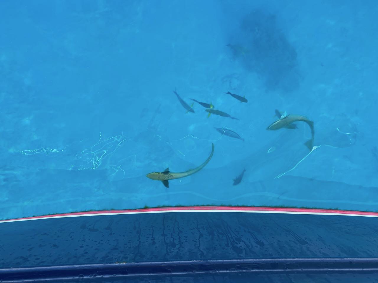
Swimming with Sharks
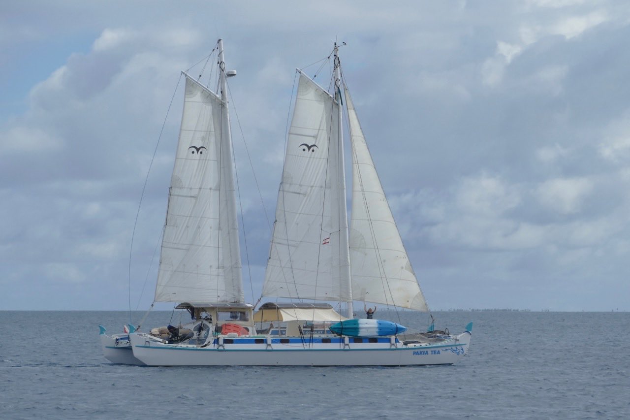
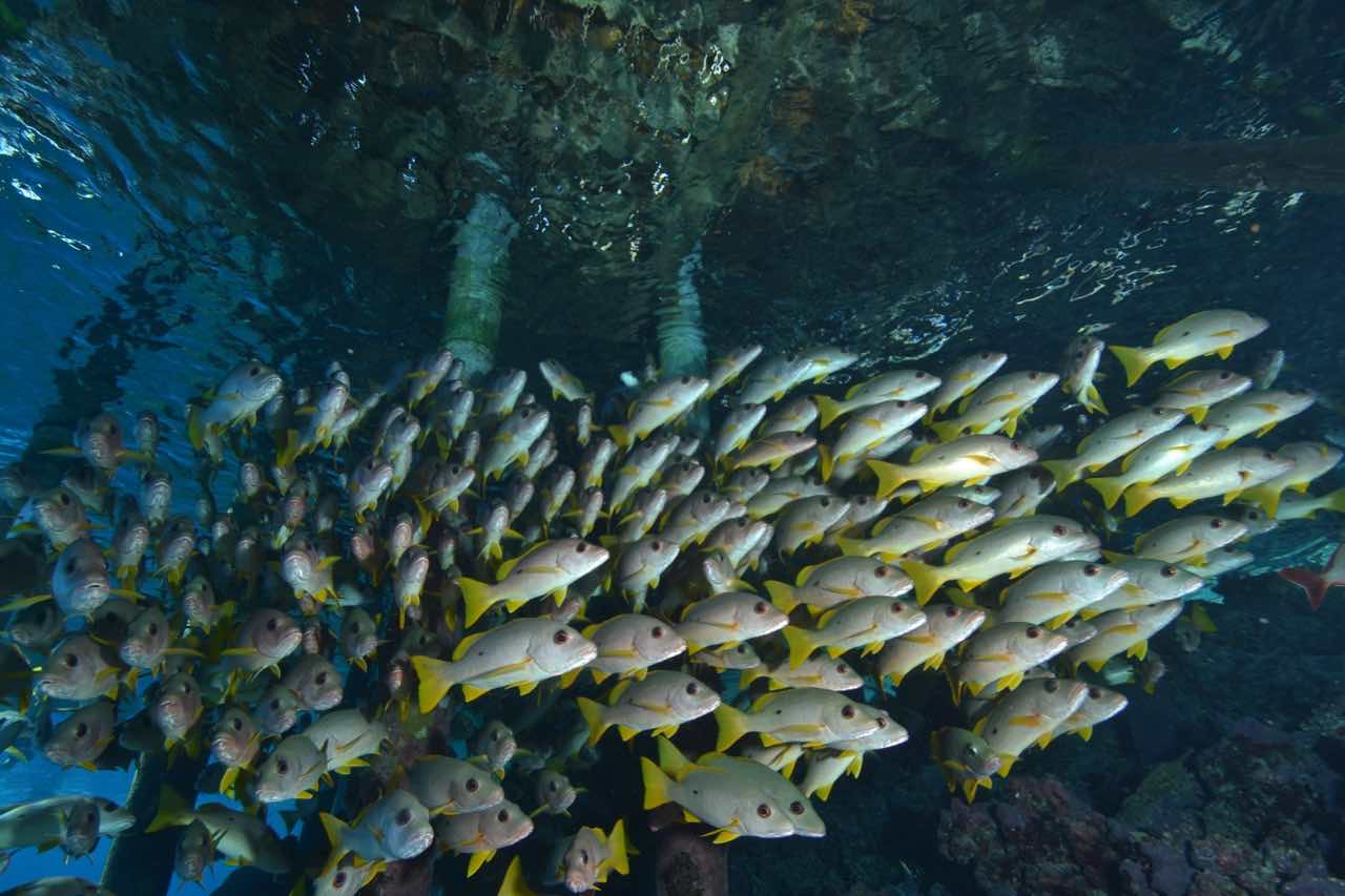
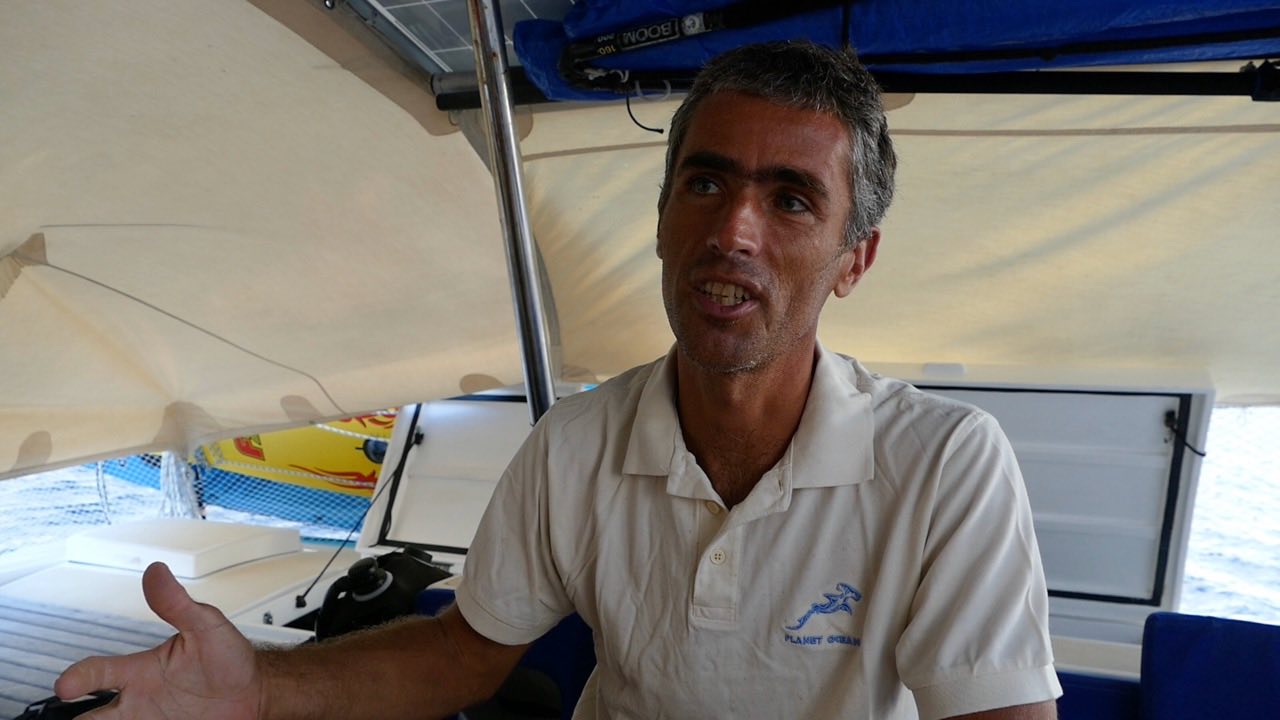
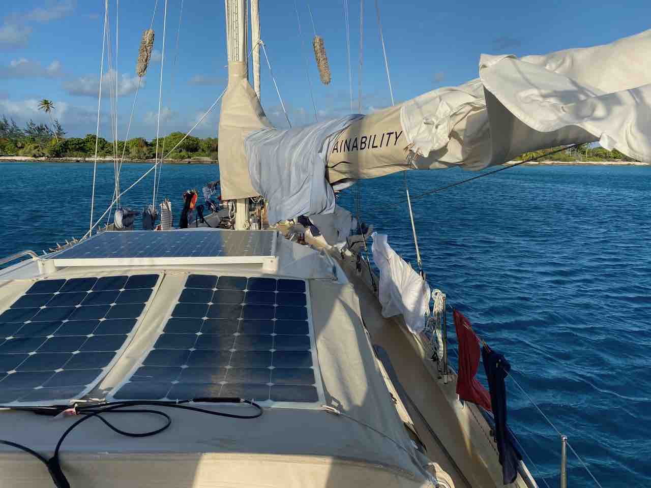
We, too, move to Fakarava, which we reach after a long day trip. Measuring 30 by 10 nautical miles, it’s one of the largest atolls of the Tuamotus with a lagoon as large as the entire Dutch IJsselmeer. Much of the atoll has been designated a UNESCO World Heritage Site to protect its impressive biodiversity. It makes the island popular with tourists, who mainly come here to dive. We probably pass some of them above their submerged heads when we navigate through the atoll’s southern pass, this time with a favourable current. A mile away from the pass we anchor close to SY Pakia Tea with Sonja, Tom, and their son Keanu on board. Sonja and Tom are marine biologists, passionate about underwater life, and keen scuba divers. They give us a tour of Pakia Tea, which they explain means White Shark. “It is a Polynesian double canoe equipped with two masts, countless solar panels and an electric motor”, Tom explains. “We enjoy showing guests the beauty, but also the vulnerability of the underwater world. That’s why we promote nature protection via our Planet Ocean website.” Clearly, we have come to the right people to show us something very special underwater.
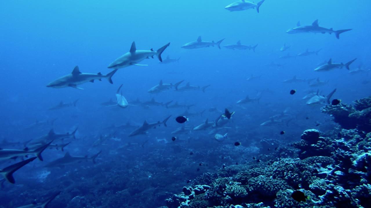
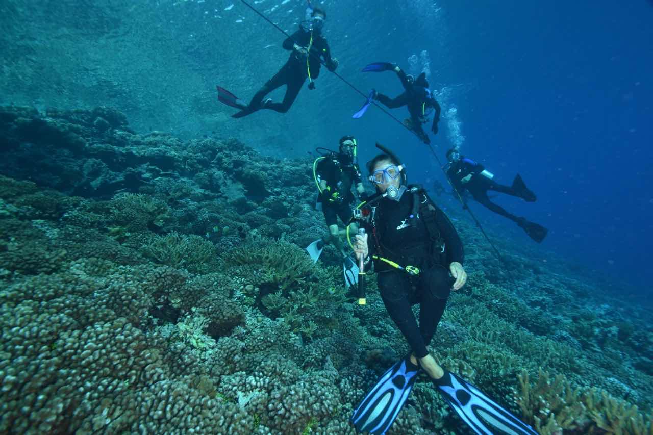
French Polynesia is one of the few places in the world where sharks are protected. Its entire exclusive economic zone, larger than the EU, is a shark sanctuary. It explains why we almost always see reef sharks whenever we go snorkelling. By now we know from experience that these types of sharks are harmless to people, just like our guidebook says. But now we are in for a treat. The south pass of Fakarava is known for the many sharks that live there. “Their bellies are full from feeding on groupers”, Sonja explains, just before we deflate our BCDs and dive down to 22m. As soon as we reach that depth, hundreds of them appear out of the blue, literally. We stick to the side of the pass and cling to dead pieces of coral to avoid being carried away by the current. Slowly they swim by, undisturbed by our presence. They are grey reef sharks, which hunt at night and rest during the day. Even then, they need to keep moving to take up oxygen. The current in the pass is perfect for them, as they can stay almost motionless while the incoming water slips through their gills. It’s a spectacular sight, and feels as if we are in an underwater theatre with a live shark performance.
Back on board at Pakia Tea, Tom explains that only a few shark species are dangerous to humans. Millions of sharks – some estimates put the number at 100 million! – are killed each year worldwide, mainly for shark fin soup in Asia. “Sharks are essential for a healthy reef and ecosystem”, Tom continues. “As top predators, they not only keep the fish population in check, but also keep them healthy by eating the weak, sick fish first. Indirectly, they are also essential for healthy coral reefs, as a healthy and balanced fish population is needed for that.” To learn more about the important role of sharks in the marine ecosystem and what you can do to help protect them, go to our Sustainable Solution article and video.
Pakia Tea sailing
Hundreds of Grey Reef Sharks
Beautiful creatures, undisturbed by us
Diving the spectacular pass of Fakarava (by Tom Puchner)
Marine biodiversity on steroids (by Tom Puchner)
Marine Biologist Tom Puchner explains the importance of sharks
Getting Closer to Civilization
Fakarava is not only popular with tourists, but also with other sailors. As a result, there are facilities for sailors here, unlike what we have encountered until now. We sail halfway towards the northern end of the island and pick up a free mooring buoy in front of a small lodge. It is where Mathieu runs Pakokota Yacht Service, which caters to all of our needs. There is reasonably fast internet, a large washing machine tackles our mountain of laundry, and Mathieu drives us to the village for groceries. After the shopping spree, we enjoy fresh fruits and vegetables again, the first since leaving Gambier. The setting also comes with a curse. We spend hours behind our computers to put blogs and vlogs online, order spare parts for delivery in Tahiti, and send out a newsletter. Fortunately, the sea is always there for a quick dive in some of the clearest water we have ever seen. Sharks, rays, and small tuna regularly swim below us. It’s a perfect combination of nature and sailors’ luxuries.
When we leave Fakarava through the northern pass a week later and set course for Tahiti, we wave at several boats with diving tourists. “The unique ecosystem attracts divers, bringing business to the local population”, Floris contemplates. “In this way, protection works for nature and the local economy.” “I had no idea that the atolls of the Tuamotus would be so big and so rich in coral, fish and other marine life,” Ivar adds. “I’m glad we didn’t circumvent this Dangerous Archipelogo!” At the same time, we realise that there are many serious threats to the atolls and their marine life, such as sea level rise and warmer seawater due to climate breakdown, plastic pollution, and illegal fishing. Yet there is still a lot of nature left. Fortunately, we still have time to preserve it for future generations.