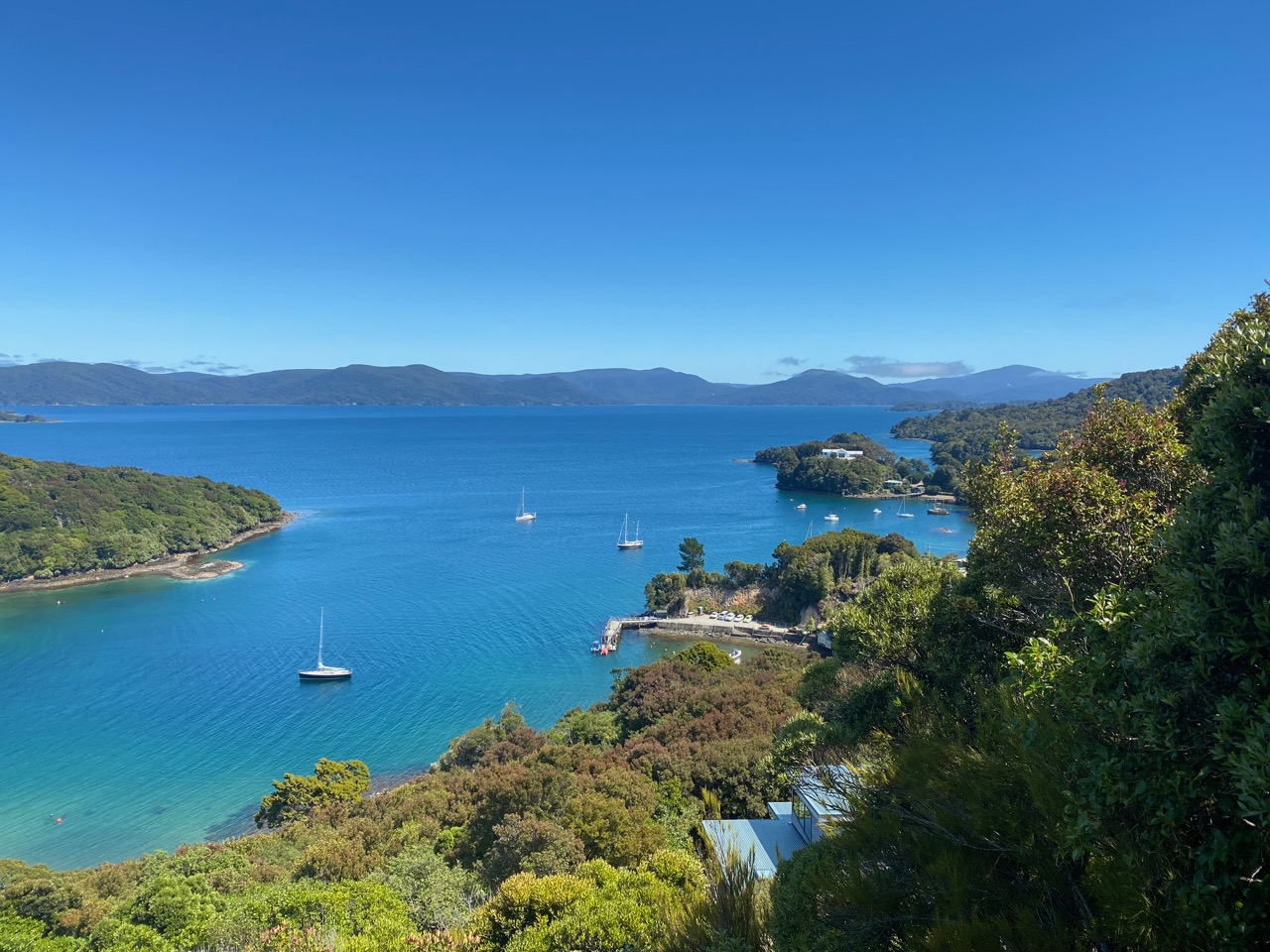
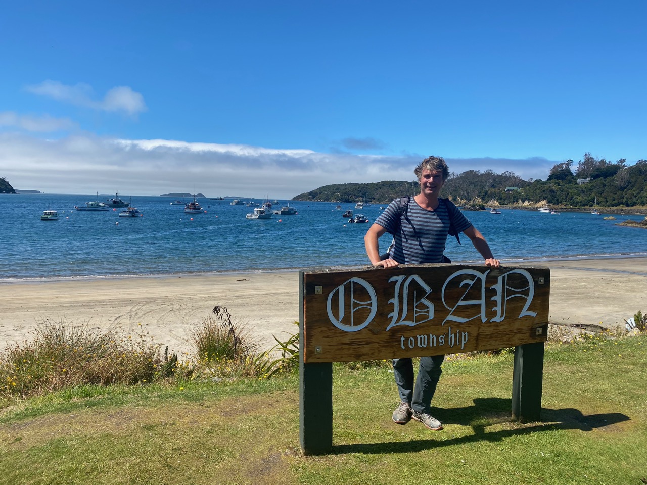
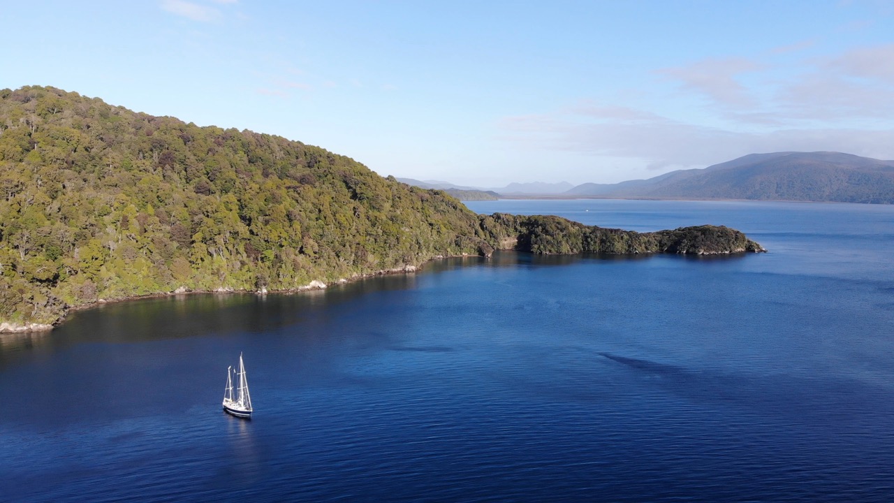
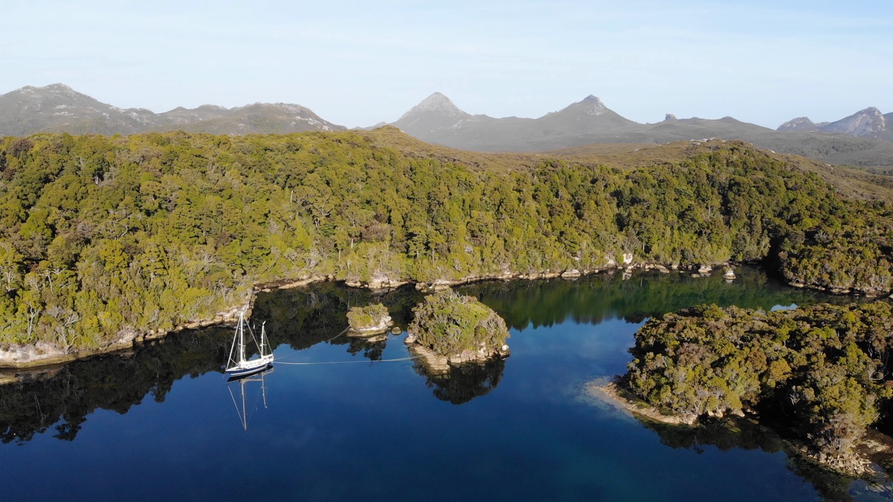
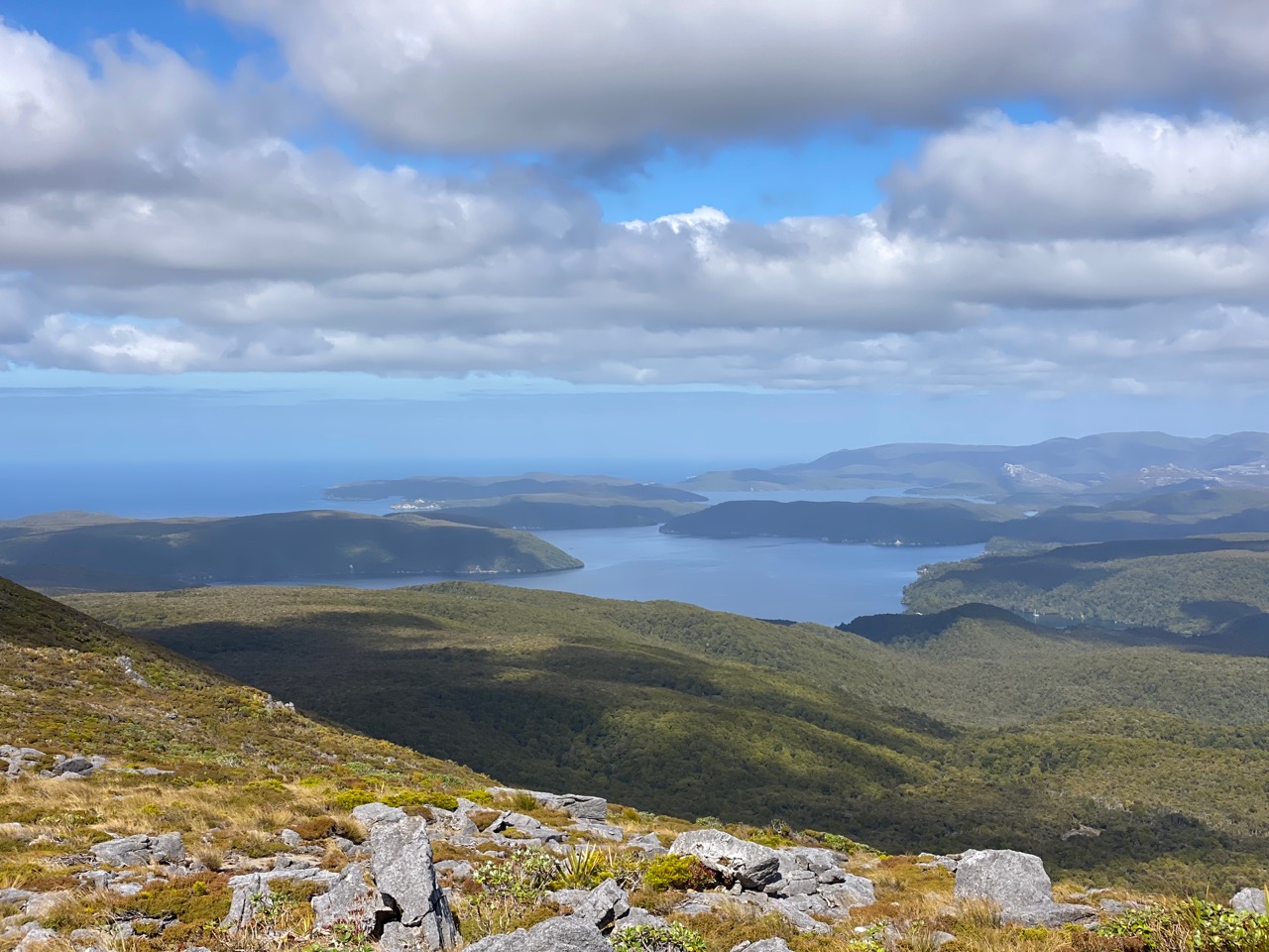
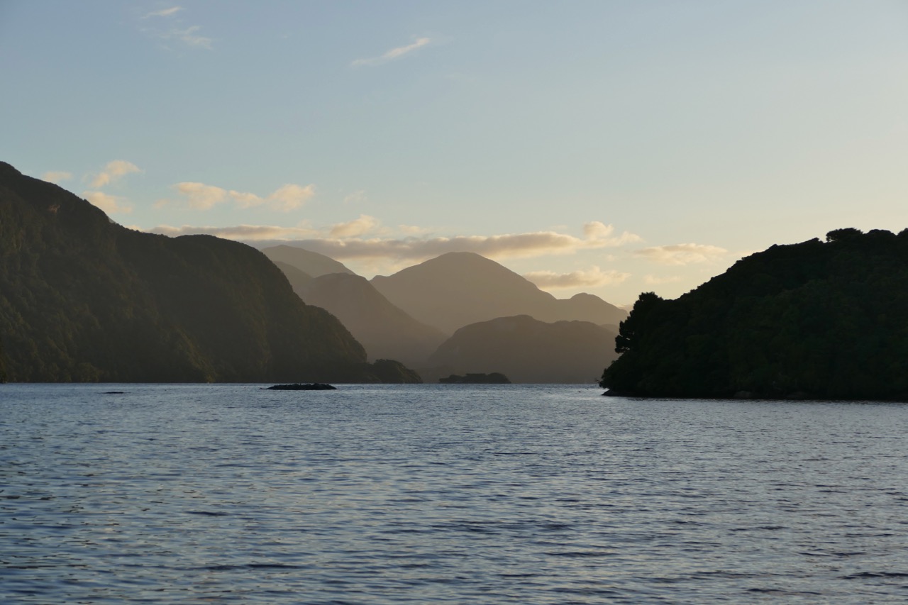
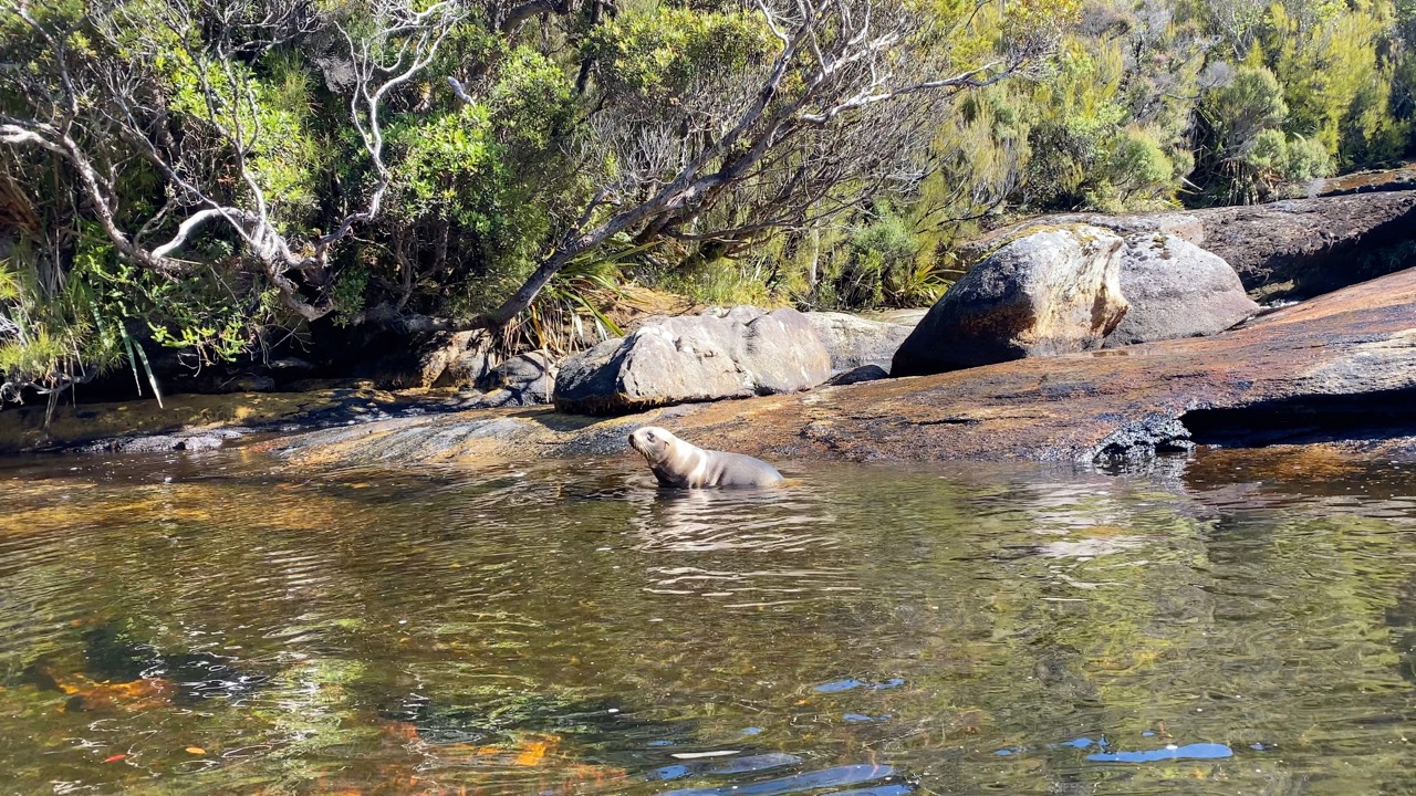
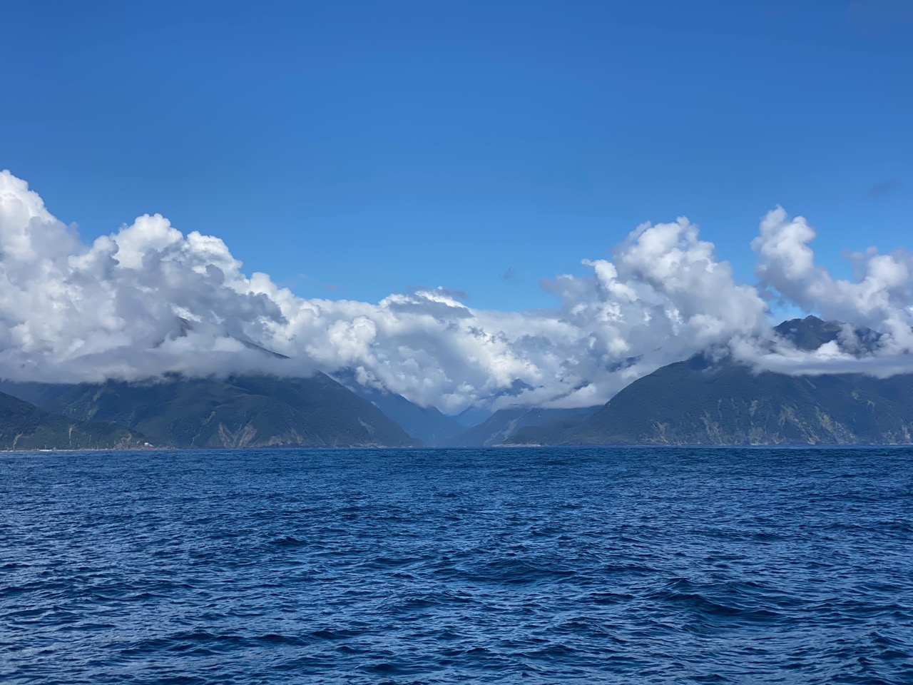
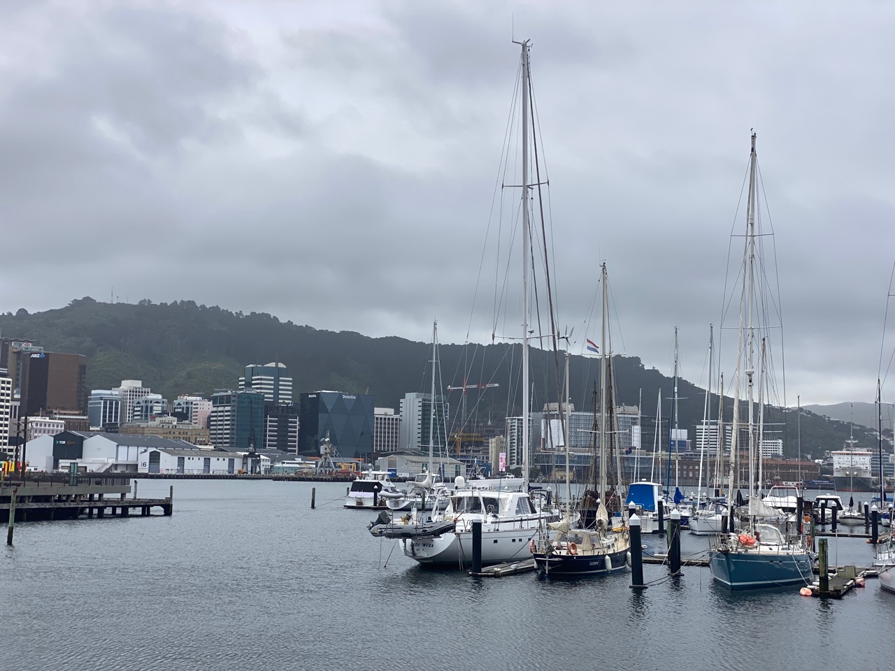
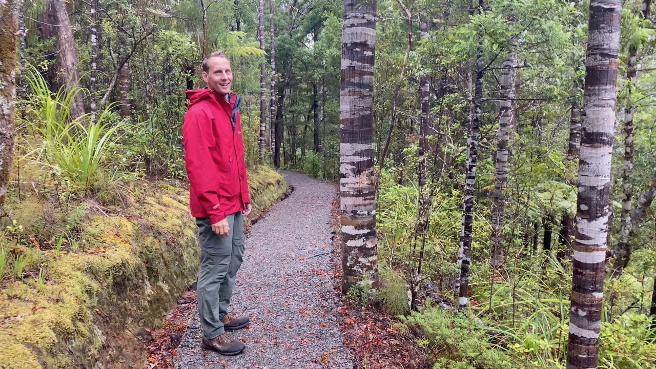
We fight strong currents and winds to explore Stewart Island and wild Fiordland before completing our circumnavigation of New Zealand.

Nelson –Whangarei (NZL)

“The current is six knots”, Ivar shouts while he’s trying to keep Luci clear of the rocks on either side of the narrow channel known as the French Pass. We timed our passage of this gap between two islands carefully and according to the tables it’s slack high water. Yet the pass is also subject to weather influences, as the pilot book warns, which makes the currents here difficult to predict. That proves to be quite the understatement. Luckily, the current is behind us, so we race through the pass and make it to the other side unscathed. We wouldn’t want to be here in less settled conditions! In our preparations for sailing around the South Island we read about challenges like these. Sailors who heard about our plan to circumnavigate Aotearoa New Zealand were, without exception, always quick to warn us about strong currents and winds around the South Island. How will we fare on the rest of this journey that few sailors dare to take?

Blown through Cook Strait

The challenging conditions in the French Pass are the price we pay for a shortcut on our way from Nelson around the top of the South Island to its east coast. They also serve as an introduction to the Cook Strait, our next challenge. This relatively narrow body of water, a little over 10 nautical miles wide, separates the North Island from the South Island. It is notorious for strong winds and currents, as the tides on either side of the Strait – the Tasman Sea to the west and the Pacific Ocean to the east – are opposites of each other. Low tide on one side means high tide on the other. As a consequence, enormous masses of water squeeze through this bottleneck at ferocious speeds. To add to this, the prevailing winds are funnelled between the mountain ranges on both islands. Once again, timing is of the essence. We don’t have to wait long for a passage with both wind and current behind us. As a result, we fly through the Strait, then turn south and seek shelter in Port Underwood, a large natural bay. The anchor drops in calm surroundings, perfect to wait for a good weather window to sail further south. Our friends Bonnie and Maarten live nearby, so they join us for drink and dinner. We try to persuade them to sail the next stage with us, which they politely (and wisely?) decline, but they do stay for a sleepover.

Escorts to Christchurch and Akaroa

In the early morning, after ferrying Bonnie and Maarten to shore, we set sail for our trip down the east coast. It’s a two-day trip, marked by strong winds and choppy seas, courtesy of the seabed rising sharply in this area. The upwelling currents bring nutrient-rich water to the surface, which in turn attracts sea birds. For hours on end we are surrounded by albatrosses. They regularly glide next to our boat, leaving us in awe of their size. We like to think that these amazing birds escort us.

The entire coast has only a few natural bays that provide shelter from the ocean. Unsurprisingly, settlements were established around these natural ports, such as Christchurch, the South Island’s largest city. The city’s port is Lyttelton, which has a marina next to the industrial port. Our buddy boat SV Pazzo arrives at the same time and moors next to us. After enjoying a warm shower, we meet up with our friends Saskia and John from Whangarei. They are holidaying on the South Island and have come to meet us here. It’s a joy to catch up and explore the city with them. We also find a dentist to fix Ivar’s filling and a chandlery to get a new spinnaker block. Those city facilities do come in handy sometimes!

As soon as a favourable north wind develops, we continue our trip south. Heavyhearted, we leave our friends Cindy and Willy of SV Pazzo behind, as Willy has doctor’s orders to take it easy. We spend the day sailing around Banks Peninsula to Akaroa. While we tack our way into the natural harbour, a pod of Hector’s dolphins welcomes us to their habitat. They can easily be recognised because of their small size and rounded dorsal fin. Sadly, these dolphins, endemic to New Zealand, are endangered. We hope conservation efforts will help these beautiful cetaceans survive.

They accompany us again the next day when we leave the harbour. The weather is too good to stay at anchor. Besides, we had visited Akaroa on our road trip, so don’t feel bad about the short stopover. Off to Dunedin!

Going for Gold(en Bay)

“Shall we sail on?” Ivar suggests twenty-four hours later. “The wind is super favourable to continue to Oban!” Floris hesitates for a moment. We were planning to go Dunedin and meet friends there, but the stable wind we have now is quite rare at these latitudes. “Ok let’s do it. It’s a shame we will not see our friends, but who knows how long we’ll have to wait for another nice weather window like this”, Floris finally replies. Our next destination: Rakiura Stewart Island, New Zealand’s third largest island.

We don’t regret our decision. Without sail changes and shipping traffic, the nights shifts are very comfortable. We sleep well, so when we approach Stewart Island the next day we actually feel rested. Ivar steers Luci into Paterson Inlet, a large, sheltered bay on the north side of the island. We drop the anchor in Golden Bay, from where we can easily reach Oban, the island’s only town. Around us are colourful boathouses on a golden beach against a background of green mountains. We realize where we are: in the middle of large nature reserve. “There are about 20,000 kiwis here,” Floris reads. And he’s not talking about New Zealanders, but about the famous birds that have become rare in the rest of the country. Will we finally see New Zealand’s national icon in the wild? And even photograph one?

In Broad Daylight

Kiwis, only found in New Zealand, have been on our wish list for a long time. We did see some at the Zealandia eco-sanctuary in Wellington but that was not in the wild: there is a high fence around the sanctuary to keep predators out. We learned there that kiwis sleep during the day and are active at night. We searched for them in the dark on various islands in the Bay of Islands, but each time without success.

We try our luck at the far end of Paterson Inlet, away from the hustle and bustle of Oban. This place can only be reached by boat or after a few days of hiking. The scenery is stunning. Nothing but calm water and lush vegetation. On shore, we follow a track through the forest when suddenly Ivar spots it: a kiwi! Right there on the trail! The bird seems just as surprised as we are and quickly disappears into the ferns, before Floris can take a decent photo: “I got its leg” he sighs.

“It is half past nine in the morning. What is that kiwi doing here in broad daylight?” Ivar wonders. Floris has done his research: “This is one of the few places where kiwis also roam around in the evening and morning” he explains. “They are also the largest of the four types of kiwis.” “The night is probably too short to feed their large bodies” Ivar jokes.

Wild and Empty

A few days later the wind is perfect, though strong, to sail to the far south of Stewart Island. In the sheltered Port Pegasus, another large natural bay, we find a cove which fits our boat like a glove. “It’s time to grab the Patagonia lines”, Ivar commands. As Floris ties the long floating lines to trees and shrubs around our cove, he gets flashbacks from our time in South America. Like in the Chilean caletas, the lines and anchor keep Luci free from the rocks on all sides. We soon realize that this is not an unnecessary luxury. The next day is very windy. While the north of the island is somewhat sheltered by the high mountains of the South Island, we get the full brunt here. The wind pulls at the rigging and now and then Luci lists considerably, so we spend the day indoors behind our computer screens and postpone the next kiwi hunt.

When the weather improves, we sport our hiking boots again. Inspired by our earlier morning kiwi encounter, we keep our eyes peeled and camera ready. Hiking here is not easy, however. The unrelenting weather has shaped the landscape. The vegetation is tough. There are no hiking trails, so we regularly wade through swamps and fight against thick bushes. Showers further delay our progress, and the thought of the long way back almost makes us give up. Pure will power leads us to the top of Mount Gog, the sight of which kept us going for hours. Expansive views of the rugged landscape and the Southern Ocean make all the effort worthwhile, even the arduous way back. We don’t meet any kiwis along the way, neither the human nor the feathered version.

Gone Fishing

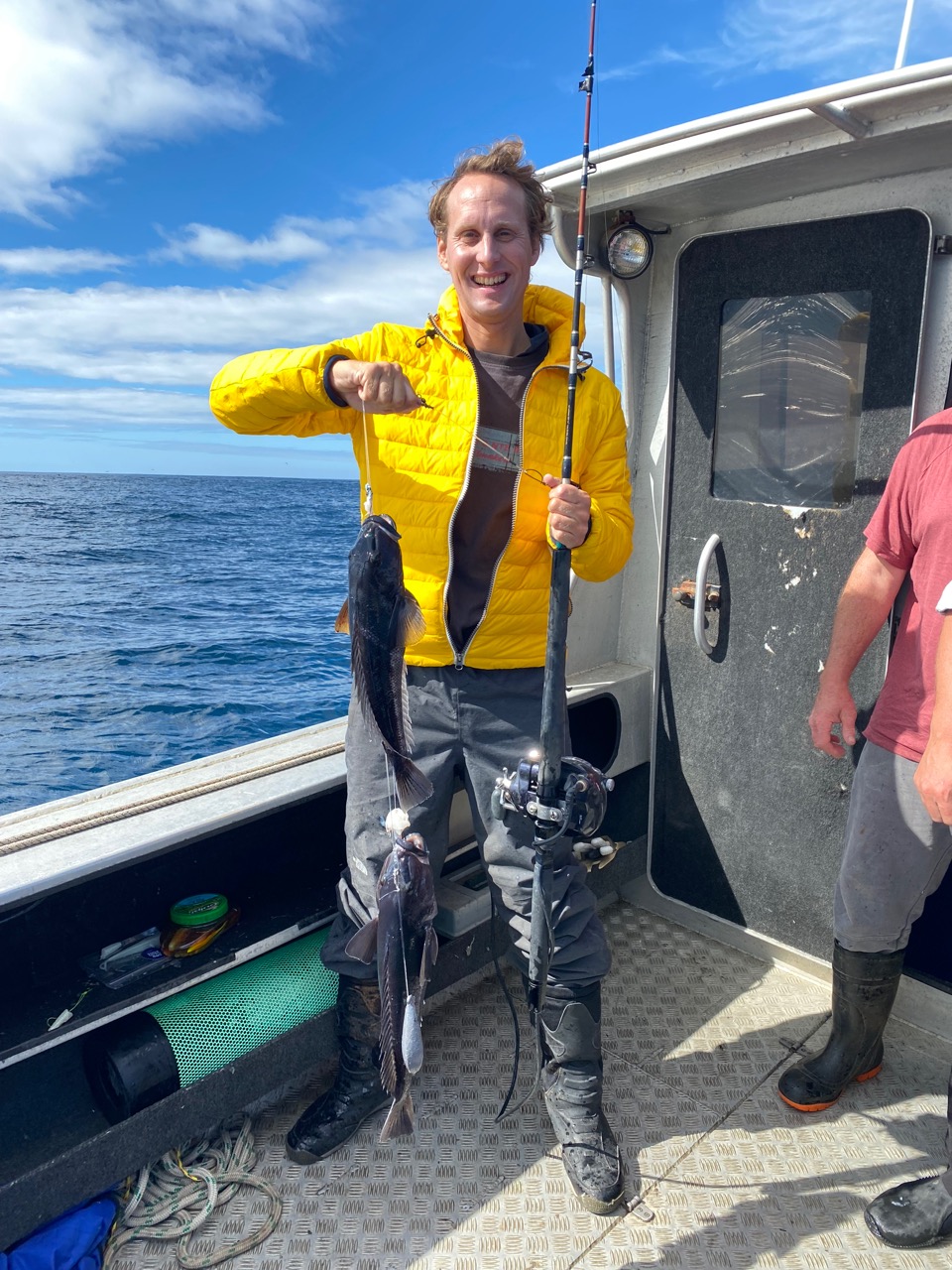
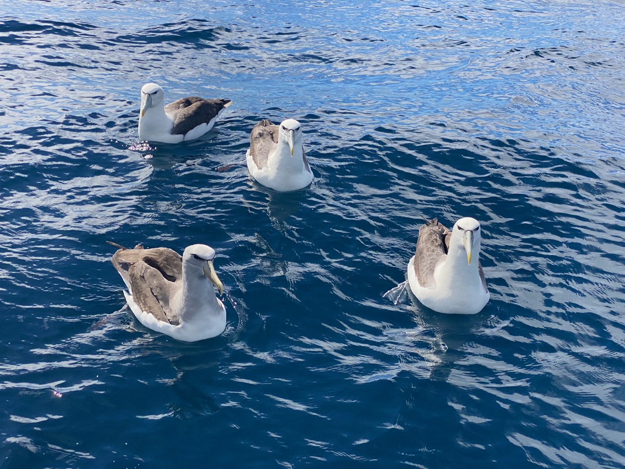
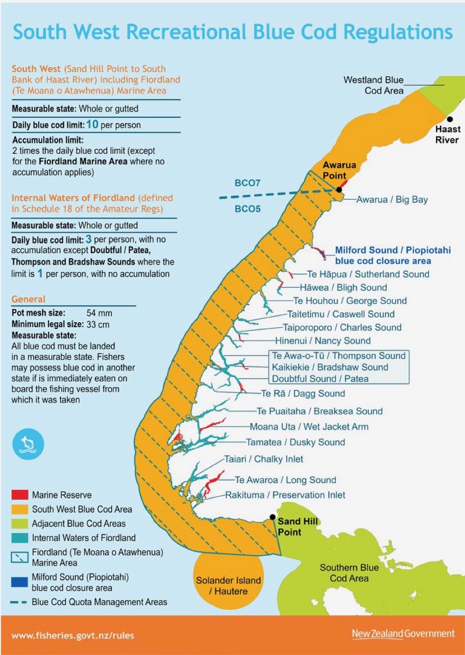
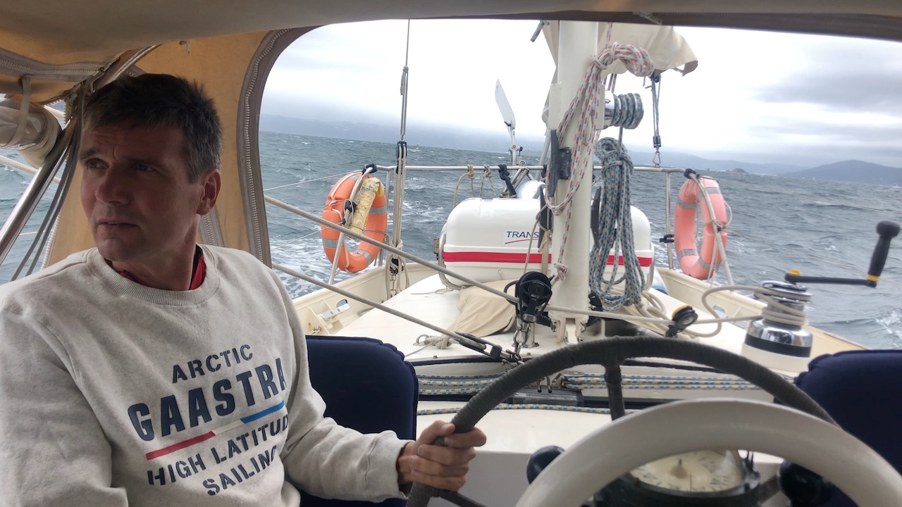
The next day the fishermen return. All five of them, without their evacuated friend. “Thanks so much for your help yesterday. Do you want to join us for fishing?” they ask. We don’t hesitate for a second and jump onto their boat. At 25 knots we race to a shallow stretch of ocean. There, they stop the boat and hand us fishing rods to hold. After some instructions, we soon catch one blue cod after another. This local cod species is indeed a bit blueish. We catch large specimens, without bycatch. Also, our new friends adhere to the minimum size and maximum quota, as blue cod populations are managed by the authorities.

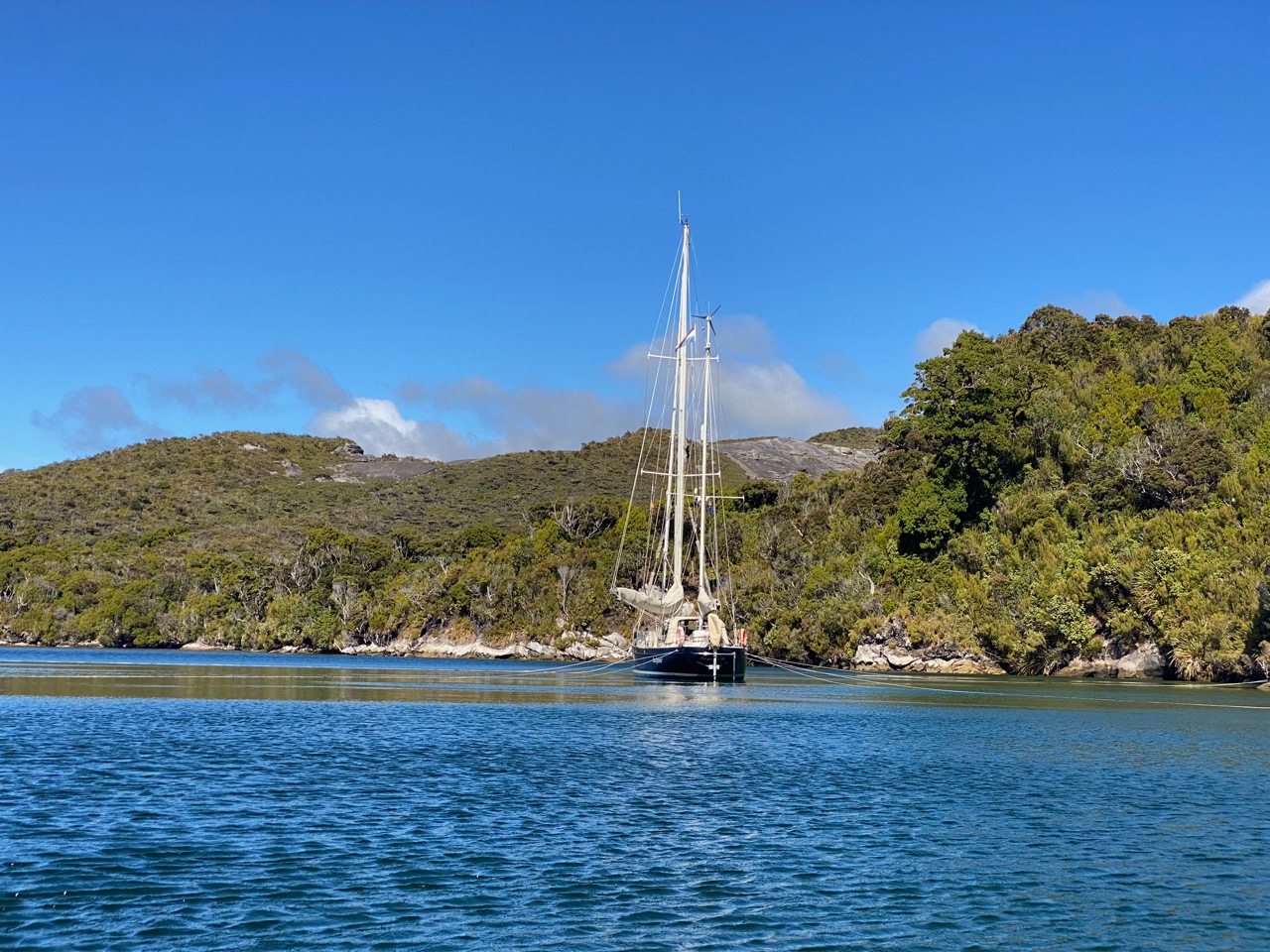
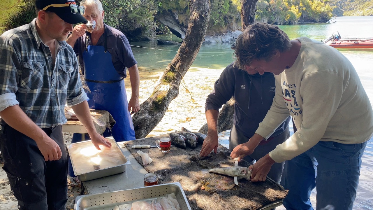
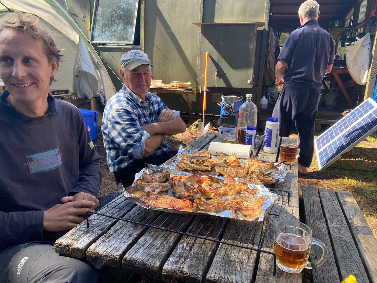
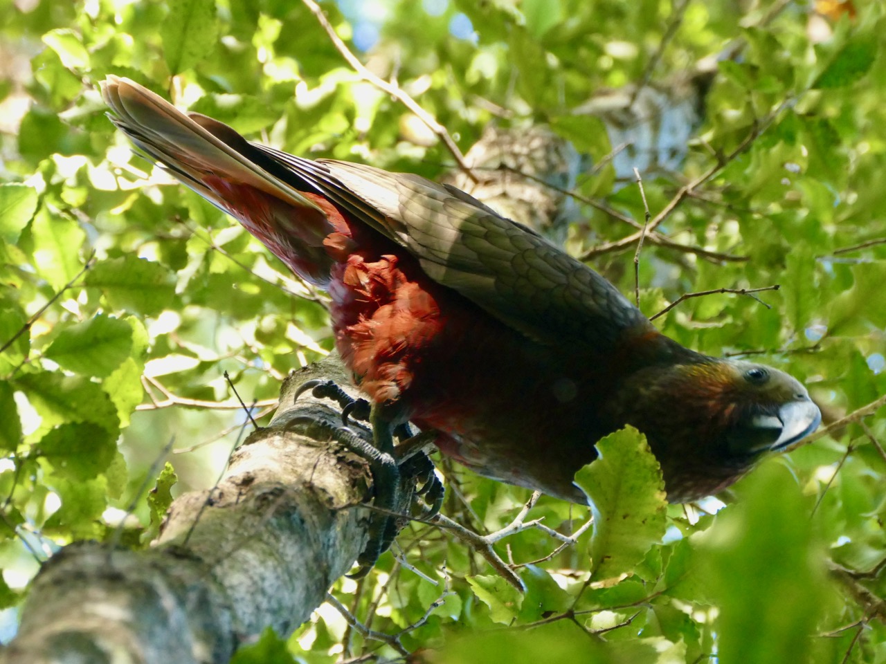
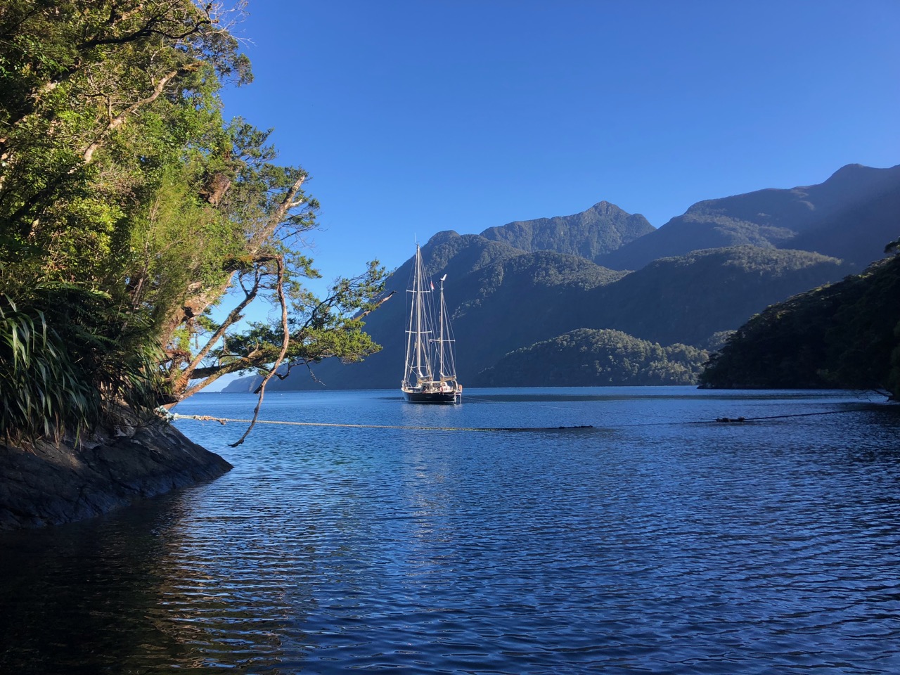
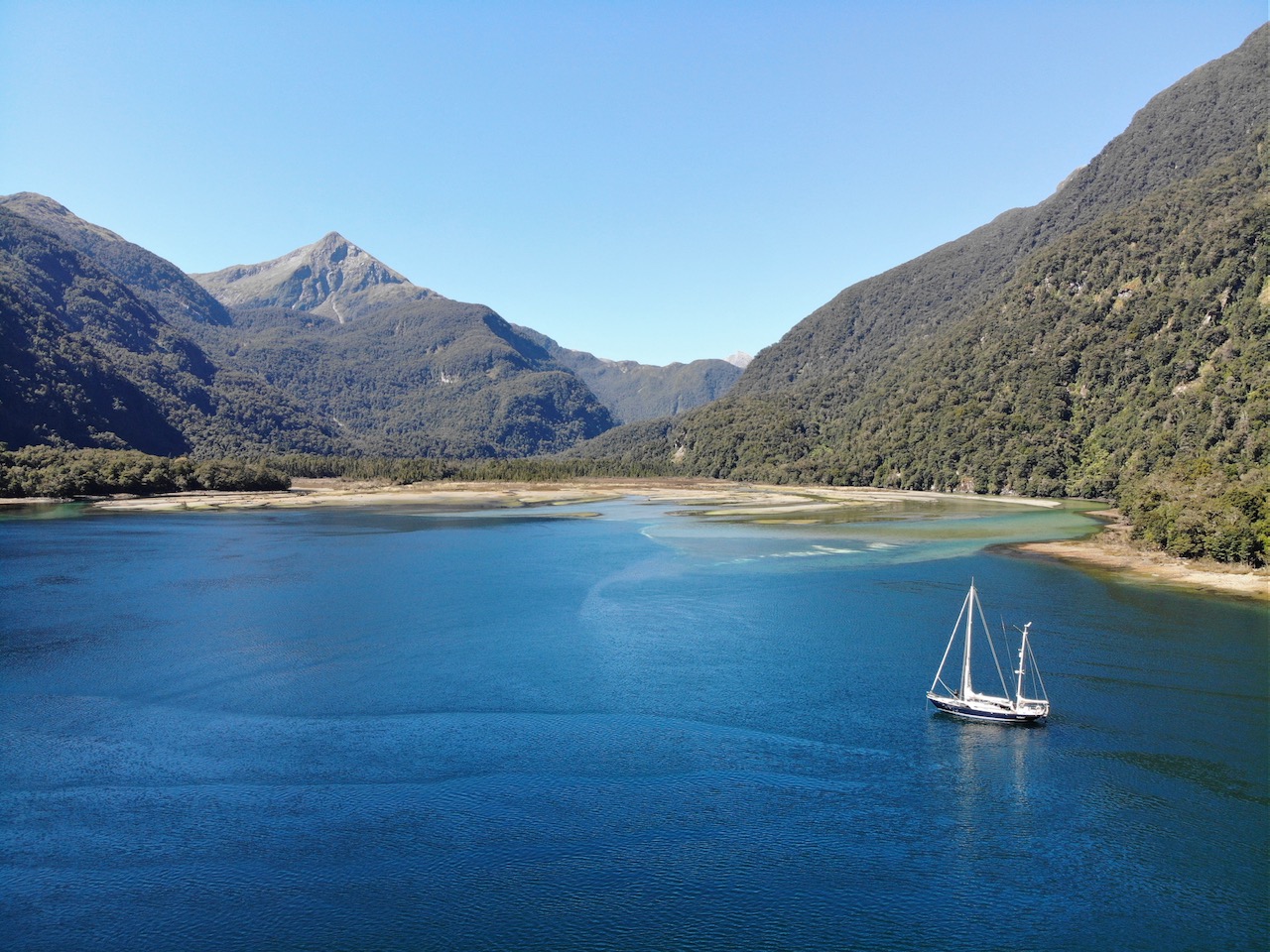
The fishermen know each other well and have been doing this for many years, they tell us. Back at their cabin it turns out that they are exceptionally well equipped: we see heaps of gas bottles, jerry cans, and freezers, powered by solar panels they brought with them. Ivar gets a lesson in filleting cod on a table on the beach. Using cookware that rivals a restaurant’s, the fish is then smoked, baked, or deep-fried to make fresh fish & chips. We have never eaten such tasty fish in all its preparations. The fishermen’s hospitality overwhelms us, too. At the end of an unforgettable day, they take us back to Luci. “Well, we saw a lot of fish today, and a lot of beer, too”, Ivar smiles when we are back on board. “But still no kiwis.”

Traces of Tin

After another depression has passed, we stretch our legs again. This time we can follow a track, one that was created over a century ago. It was cleared for train tracks to transport tin ore from the mountains to the shore. While we consider ourselves lucky that there is an easy-to-follow trail here, we realize how much work it must have been to build six kilometres of rails and so much other mining infrastructure like dams, pipes, and buildings in this remote wilderness. At the same time, we’re impressed with nature, since it has mostly rewilded the place. From the top of the tin range, we enjoy marvellous views down to Luci and Pegasus Bay.

Protected Species

“A nice easterly wind is forecast in a few days. That’s exactly what we need to continue our journey around the South Island,” Ivar concludes after studying the weather forecast. We decide to go back to Oban, where we can do some provisioning before exploring another wilderness, Fiordland. We drop anchor again in Golden Bay, paddle to shore, and visit the information centre of the Department of Conservation (DOC).

“They just walk around Oban,” the ranger says indifferently when we ask him about the best places to see kiwis. “It is a protected species in New Zealand. Because they can’t fly, their eggs and young are vulnerable to introduced pests like rats and stoats. Here on Stewart Island, we try to eradicate those pests with traps so the kiwis have a chance to survive”, he continues. Floris knows enough: “Then we will also look for them right here!”

Under a Car

That evening we walk for hours with red headlamps along the rugby field, through the forest, and around the church. This time, we’re not alone. Cindy and Willy from SV Pazzo have caught up with us and join the search. Unfortunately, we see nothing at all. Could it be a joke from the locals, who are now having a laugh at all the wandering tourists? When we are almost back at Golden Bay, Floris tries his secret weapon one more time: he plays kiwi sounds on his bird app. Immediately, three kiwis answer with loud screeches! We follow the sounds and see one crawling under a parked car. As we get closer, it slowly walks to the side of the road, seemingly undisturbed. Between the leaves, it searches for insects with its long bill. It’s really a unique creature. While Ivar shines his red light on the bird, Floris finally manages to photograph this New Zealand icon in the wild. We hope that one day soon they will roam the forests in many parts of the country again.

Seeing the Sounds

“Yes, it worked! Thank you easterly wind!” Ivar exclaims as we sail past the lighthouse of Cape Puysegur, some 18 hours after leaving Golden Bay. Easterly wind is rare here in southern New Zealand. Storms from the west are much more common, often because depressions from the Tasman Sea batter this rugged coast. The coastal district of Puysegur gets storm warnings no less than 300 days a year! We feel enormously privileged that we can sail these infamous waters so easily thanks to modern means of communication and reliable weather reports.

From here on, fantastic sailing grounds open up for us. It is marked by fjords – also known as sounds – and their many branches. We can hardly wait to explore them, but don’t want to arrive in the dark. We therefore sail past the two southernmost sounds in order to approach Dusky Sound at first daylight. Steep, green mountains on either side of the estuary glow magically in the morning light. “We first have to pass these rocks and then make a sharp turn to port,” Floris instructs. A group of seals watches us curiously from their rocks as we sail right past them. Not much later, we anchor in Luncheon Cove, a well-protected bay off Anchor Island. We hear and see dozens of kakas, native parrots that have become rare elsewhere in Aotearoa New Zealand. Has this area always been this pristine, we wonder?

Remote Wilderness

In the pilot book we read about the history of this remote wilderness in the extreme southwest of the South Island. Gigantic glaciers have shaped the landscape in bygone ice ages. The steep walls of the high mountains continue under water for many hundreds of meters. We are not the first to think that the landscape resembles Norway, as the name of this area proves. Fiordland is overwhelmingly green, which is not strange considering it gets seven meters of rainwater a year.

Although the area is remote and quite inaccessible, Māori – New Zealand’s first inhabitants –lived here for about seven hundred years. They fished and hunted birds and seals for their own use, so on a small scale. That changed after James Cook explored these waters in 1793. In his logbook he wrote not only about friendly encounters with some Māori families. He also mentioned the many fish his crew caught and numerous seals and whales they saw.

Borderless Plunder Culture

As soon as the outside world got wind of this, sealers went to Fiordland. In just 30 years, they killed over a million seals for their skins. After the population was virtually wiped out, the industry was forced to move on. Cynical detail: the number of seals killed is known quite accurately thanks to the meticulous bookkeeping of the hunters and traders.

The whalers also plundered the waters around Fiordland. The growing demand for lamp oil and lubricants for machines made whale hunting a profitable industry. Records indicate that the land for the first whaling station was purchased from the Māori’s for “60 rifles, 1 cannon and 1,000 pounds of ammunition.” By 1850 there were so few whales left that commercial fishing was no longer profitable. Not much later, the industry would be decimated worldwide by the discovery and extraction of oil.

Commercial fishing for other species reached its peak in the second half of the last century. New victims: the local cod (blue cod), abalone (paua) and crayfish. Guess how that ended…

These are all examples of western plunder culture. Under the motto ‘there is demand’, trade is created, driven by short-term profits and without taking the limits of nature into account. Time and again, much more is harvested than nature can regenerate. As a result, there is nothing left for anyone. Apparently, natural boundaries must first be crossed before humans are forced to adapt their behaviour. However short-sighted and tragic, it is not the whole story.

A Different Mindset

In previous blogs we wrote about possible solutions to better protect nature areas, such as the introduction of ecocide law and granting rights to nature. Before it’s too late, laws could set clear limits to the assault on non-human life. Fiordland never had that chance, but history shows something else here. As soon as the commercial looters disappeared after an initial boom and inevitable bust, something changed. Animal populations were able to recover, albeit slowly. At the same time, a different mindset arose: that of nature conservation and sustainable fishing.

Today, all of Fiordland is a national park, with over 12,000 km2 the largest in New Zealand. Laws prohibit large-scale industries such as commercial fishing, forestry and mining. In search of a new balance, human activity has not been completely eliminated. Although whales and seals are protected species and hunting them is taboo, other animals can be fished with moderation. A special platform was established in 1995, under the auspices of the Ministry of Fisheries, to regulate catches of popular fish: The Guardians of Fiordland’s Fisheries.

It unites representatives of the Māori, small-scale commercial fishermen, charter operators, sport fishermen, and scientists. Their starting point: respecting natural boundaries. This means that if the total catch does not exceed the natural increase, fishing can continue to be a source of nutrition and entertainment for future generations. The population size of various fish species is monitored. Seasonal limits on catch, both in number and minimum size, have been established and are enforced seriously. It turns out to be a recipe for success.

Elusive Encounter

From our anchorage in Luncheon Cove we paddle to the shore of Anchor Island, famously pest-free. It means that there are no rats, stoats, possums and other introduces species that have caused havoc on the native bird population in almost all of New Zealand. While we carry the kayak to shore, a curious robin observes our every move and boldly approaches us to within a few centimetres. It poses for our photographs and leaves us wondering what else we would find on this bird sanctuary island. Yet never did we expect that a bird of another league in terms of rarity would cross our path.

“I think I just saw one”, Ivar mentions non-chalantly as we make our way through the forest to the other side of the island. “You mean a kaka?” Floris asks, as we were just talking about parrots. “No, the other one. The flightless one.” “Whaaaat? A kakapo? Impossible!” Floris exclaims. “They are nocturnal!” “I know, but it was much bigger than a kaka and looked just like the stuffed one we saw at the DOC centre in Oban”, Ivar counters. Kakapos are the rarest bird of New Zealand, and perhaps the rarest parrot in the world. We know that they’re on this island, as they were brought here and other pest-free islands after their re-discovery in the 1950’s. Here on Anchor Island is a research station that studies and monitors their behaviour. We find it an hour later and the rangers there confirm that they can indeed be active during the day as well. “You’re one of the few people on earth who saw a kakapo!” Floris tells Ivar, slightly jealous. It’s a good sign they are doing well here, but lots of work needs to be done still to eradicate pests elsewhere.

Harmonious Balance

We make our way to the very end of Dusky Sound and anchor where a river meets the fjord. Along a hiking trail we pass beautiful waterfalls and again see countless birds. Even in this remote corner of the world there is a Department of Conservation (DOC) hut where hikers can spend the night. “I think it’s a great way to get tourists to appreciate the beautiful nature here”, Ivar assesses.

With a light southerly breeze we sail on to Doubtful Sound. On the way, a group of playful dolphins visits us. It’s the southernmost population of bottlenose dolphins in the world. Encounters with them never get old. Every now and then we come across a sports fisherman and regularly a seal appears next to us. Those are signals that the fish stock is in good shape.

The spectacular views continue to amaze us. We follow the Gaer Arm, a branch of the Doubtful Sound, all the way to the end and anchor in twenty meters of water. In our kayak we paddle up the river that ends here. We leave the tall, rocky walls of the fjord and get immersed in a lush vegetation on both sides of the river. The sounds and vegetation change and the river gets narrower, until we can’t paddle any further. Huge boulders block our way and make for a picturesque scenery.

Guardians of Nature

At our next anchorage, we see a striking, red-painted image on the shore. It’s a Te Poupou o Rua o Te Moko, a carved wooden statue from the Māori culture. It symbolizes the kaitiaki: guardians of nature. In the Māori worldview, we humans cannot appropriate nature, but are responsible for protecting it. We are pleased to see that this element of the Māori way of life is becoming established among all New Zealanders. We realize that there is still a lot of beautiful nature. The Kiwis have found a model in Fiordland to respect natural boundaries and preserve the area with its unique flora and fauna for future generations. It’s an example that, as far as we are concerned, could and should also be applied elsewhere!

No Safe Places

“We won’t get such a favourable weather window anytime soon” Ivar predicts after downloading the weather forecast while we sit out a passing front in well-sheltered Deas Cove. A moderate breeze from the south is forecast to last a few days. “It’s ideal for our next leg to the north”, Ivar concludes. Between here and the northern tip of the South Island are a few more sounds. After that we will have to cover about 350 miles non-stop, because there are no more safe places to hide. “I would have liked to explore some more sounds”, Floris sighs. “But I agree that we can’t let this opportunity pass. Who knows how long we would have to wait for the next favourable weather window?!”

Favourable Winds

Fortunately, the weather sticks to the forecast. The gennaker, our treasured light weather sail, is working overtime as the days pass. The sun is shining brightly and the sky is so clear that even from the sea we can admire the snow-capped peak of majestic Aoraki / Mount Cook, the highest mountain in Aotearoa New Zealand.

After leaving the west coast of the South Island behind us, a new challenge presents itself for the second time: the Cook Strait. Fortunately, the weather gods are still kind to us. A westerly wind picks up just as we sail into the strait. We can’t believe our luck and decide use this pleasant tailwind to proceed to Wellington.

Speed Record

“I see a warning here on the digital nautical chart,” Floris remarks. “The currents beyond Cape Terawhiti can reach five knots, resulting in heavy overfalls. The area even has a name: Karori rips,” he continues. “I think we’ll be fine. They usually mention the most extreme situations. And we have both the wind and current with us”, Ivar replies drily.

Not much later, the wind strength doubles to about 40 knots. The current is also getting stronger. “What? More than 13 knots of speed over ground!” Floris shouts in amazement when he checks the electronics. Never before have we gone so fast. Fortunately, Luci is handling it very well. We reef the genua between gusts from the mountain ranges and within no-time reach the entrance to Wellington Harbour. With the wind now on the nose, a narrow channel ahead, and ferries coming from both sides, we decide to motor the last bit.

Windy Wellington

Just before the sun sets, we find a reasonably sheltered anchorage near the airport. Yet the next morning the wind direction is predicted to change, so we call the marina. “You first need to send pictures to prove that you cleaned the hull”, the harbourmaster orders. Floris quickly jumps into the kayak, cleans some spots, and shoots a few blurry photos. He sends them by email and asks if we’re clear to come into the marina. “We are already on our way, because the wind has just shifted,” he adds.

“All good, please come in”, is the redeeming answer two minutes later. “But you are not allowed to sleep on board because of the strict COVID rules.” There’s no point in protesting, so we call our friend Kerry. Fortunately, he is happy to have us stay at his wonderful apartment. It’s a treat to see him again. A week flies by. We visit museums, blog and vlog, have dinner with old and new friends, do the laundry, and pay a much-needed visit to the hairdresser.

A new challenge presents itself for the continuation of our journey: Cape Palliser. It forms the south-easternmost tip of the North Island. We’ll have to get around it to sail further north. We time our departure so that we can sail to the cape with the last bit of northerly wind. There is still a strong breeze when we leave, so we race out of the harbour. We follow the coast eastwards for about 30 miles until the wind dies down completely. As we drift towards the cape, a south-westerly wind picks us up. Our plan worked! The new wind increases quickly, as does our speed.

Taking a Beating

For two days we whiz north along the east coast of the North Island with the wind in our back. We check the weather forecast for the East Cape that lies ahead of us. The map with gribs turns red around the cape, a high landmass that extends well into the sea. “About 30 knots of wind. From behind, so that should be doable”, Ivar estimates optimistically.

We decide to sail on and pass potential stopovers Napier and Gisborne. Yet when we get close to the cape, the wind is much stronger. The meter regularly clocks above 40 knots, while we’re flying with eight knots boat speed. Water gets blown off the tops of ever-increasing waves. The howling of the wind is deafening. It is no longer possible to turn around. How bad is this going to get? Should we have stopped sooner?

Uncertainty takes hold of us, but Luci does her best to take it away. Despite the forces of nature, she is holding up fine. With only a reefed mainsail we go only slightly slower than the waves. She calmly lifts her stern as another breaking wave passes below us. There isn’t a splash of water that reaches her well-protected centre cockpit, and the autopilot keeps us nicely on course. Rounding the cape seems to take forever, as we are giving it a wide berth. After a few hours we finally get out of this washing machine. Soon after we are to the north of the cape and have the landmass to port, we get into its lee. The wind abates and later even dies down completely. That’s how much of an influence the East Cape’s landmass has on the local weather. We are relieved that we survived this beating unscathed.

Young Kauris

From here we sail in the lee of the land, which makes for comfortable cruising. The swell is almost gone and there are plenty of islands and anchorages to rest. After an excursion on the Coromandel, we set course to Great Barrier Island. It’s sparsely populated and off-grid. Today it is known as a natural paradise, but that used to be different. When we hike through the forest, we see traces of the ecocide that took place here.

At the ruins of a dam, for example, we read about a father and his sons who built huge dams in rivers. Large kauri trees were felled and assembled in the reservoirs that the dams created. By knocking the dam away, the body of water – including kauri tree trunks – plunged down violently. The logs flowed to the sawmills downriver. As a result of this efficient operation, almost all old kauri trees disappeared.

Today, the forest is protected and we are delighted to see many young kauri trees along the well-maintained hiking trails. The island now attracts hikers and tourists seeking tranquillity. This provides the islanders with an income and hopefully gives the kauri forest a chance to recover.

Long Live Length

A strong autumn storm is forecast, reminding us of that summer is ending. We head to a protected cove for shelter but are not the only ones. Shallow spots close to the shore are occupied, so we drop anchor in a depth of no less than twenty meters and release all of our one-hundred-meter-long chain. When we put the engine in full reverse, we remain firmly in place. Content to have a spot with good holding and sufficient swinging room, we anxiously await what comes next.

A few hours later the storm starts. In gusts it pushes Luci to one side. Because of the lashing rain and the splashing spray we can hardly see the other boats. But no matter how hard the gusts try to move Luci, our long chain absorbs all the shocks. While the storm roars day and night, the anchor doesn’t move one bit. We are thrilled that our new long chain has helped us weather the storm so well. Later we hear that the storm caused a fishing boat to sink off the Northland coast. Unfortunately, four people on board did not survive.

Back at Base

A day after the storm has passed, we sail back to Whangarei. We moor again at our base, Riverside Drive Marina. It means that after five months our circumnavigation of New Zealand is complete. Our friends here give us a warm welcome, and are curious to learn all about our adventures. We are still a bit overwhelmed from seeing so much natural beauty. At the same time, we are relieved that we had mostly good weather and when we didn’t, Luci kept us save and everything on board remained intact.

Still, Luci always demands maintenance. So, now it’s time for some TLC and preparing her (and ourselves) for the next stage of our world-circumnavigation: leaving New Zealand…

Close Menu